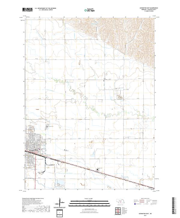
2021 Map of Lexington East
USGS Topo · Published 2021About this map
Lexington serves as the focal point of this Platte River valley landscape, where the town’s grid meets a complex network of agricultural irrigation and drainage. The Dawson County Courthouse marks the local seat of government, surrounded by several long-established burial grounds including Greenwood Cem and Saint Anns Cem. The presence of Dawson County Drain Number 1, Lateral Number 2, and the Sherman Reservoir in the northern uplands highlights the intensive water management required for farming in the region. Outside the main settlement, the rail stop of Josselyn and multiple rural cemeteries like Evergreen Cem and Mount Hope Cem provide specific points of interest for genealogical research. The terrain transitions from the low-lying valley floor near Spring Cr to the more dissected hills in the north, where Crooked Cr winds through the sections.
Find a feature on this map
56 named features on this map. Tap any name to fly to it.
Don’t see what you’re looking for? This feature index may not catch every label — zoom into the map to look around manually.
Map Details
Editions of this 2021 Lexington East Map
This is the sole edition of this map. No revisions or reprints were ever made.
Other maps of this area

1896 · Lexington
USGS Topo · 1:125,000

1899 · Lexington
USGS Topo · 1:125,000

1955 · Grand Island
USGS Topo · 1:250,000

1957 · Grand Island
USGS Topo · 1:250,000

1958 · Grand Island
USGS Topo · 1:250,000

1962 · Lexington West
USGS Topo · 1:24,000

1962 · Lexington SE
USGS Topo · 1:24,000
1962 · Buffalo
USGS Topo · 1:24,000
1962 · Sumner
USGS Topo · 1:24,000

1962 · Lexington East
USGS Topo · 1:24,000