
1962 Map of Lexington East
USGS Topo · Published 1964About this map
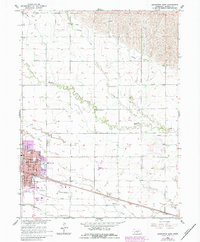
Lexington serves as the focal point of this Platte River valley landscape, appearing during a period of established agricultural and civic growth in central Nebraska. The town is densely detailed, highlighting the Courthouse, the Po, and several local campuses including High Sch and St Anns Sch. The surrounding rural landscape in Dawson County is defined by a complex irrigation network, featuring the Beatty Ditch, Berquist Ditch, and Dawson County Drain No 1, which supported the region's fertile farmland. Meandering watercourses like Buffalo Creek and Crooked Creek cut across the gridded section lines, while the Union Pacific railroad corridor provides the primary industrial artery through the valley. This survey also documents numerous rural educational landmarks, such as School No 17 North and the uniquely named Horseshoe Bend Sch, alongside several family and community burial sites like St Anns Cem.
Find a feature on this map
42 named features on this map. Tap any name to fly to it.
Don’t see what you’re looking for? This feature index may not catch every label — zoom into the map to look around manually.
Map Details
Editions of this 1962 Lexington East Map
2 editions found
Other maps of this area

1896 · Lexington
USGS Topo · 1:125,000

1899 · Lexington
USGS Topo · 1:125,000

1955 · Grand Island
USGS Topo · 1:250,000

1957 · Grand Island
USGS Topo · 1:250,000

1958 · Grand Island
USGS Topo · 1:250,000

1962 · Lexington West
USGS Topo · 1:24,000

1962 · Lexington SE
USGS Topo · 1:24,000
1962 · Buffalo
USGS Topo · 1:24,000
1962 · Sumner
USGS Topo · 1:24,000
1962 · Overton
USGS Topo · 1:24,000