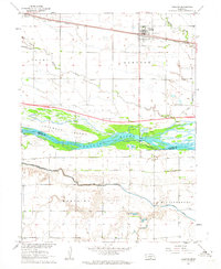
1962 Map of Overton
USGS Topo · Published 1964About this map
The braided channels of the Platte River dominate this Central Nebraska landscape, bifurcating around the large Jeffreys Island as it flows through the Platte Valley. In the early 1960s, this area served as a critical transportation corridor, with the Union Pacific railroad and the burgeoning Interstate 80 corridor—shown here under construction—running parallel to the river. The town of Overton serves as the local hub, supported by a network of rural schoolhouses and cemeteries such as Overton Cem and Platte Valley Cem. The map reveals the intricate water management system required for prairie agriculture, featuring the Beasty Ditch, Berquist Lateral, and several canals. Local spiritual life is anchored by Adullam Ch in the southern portion of the quadrangle, while the presence of numerous Gravel Pits along the river banks points to the area's industrial activity.
Find a feature on this map
33 named features on this map. Tap any name to fly to it.
Don’t see what you’re looking for? This feature index may not catch every label — zoom into the map to look around manually.
Map Details
Editions of this 1962 Overton Map
2 editions found
Other maps of this area

1896 · Lexington
USGS Topo · 1:125,000

1896 · Kearney
USGS Topo · 1:125,000

1899 · Lexington
USGS Topo · 1:125,000

1955 · Grand Island
USGS Topo · 1:250,000

1957 · Grand Island
USGS Topo · 1:250,000

1958 · Grand Island
USGS Topo · 1:250,000

1961 · Elm Creek West
USGS Topo · 1:24,000

1961 · Miller SW
USGS Topo · 1:24,000

1962 · Lexington SE
USGS Topo · 1:24,000

1962 · Lexington East
USGS Topo · 1:24,000
Featured Places
- Overton, NE
- Josselyn, NE
- Northside Village Mobile Home Park, Overton
- Dawson County, NE
- Phelps County, NE