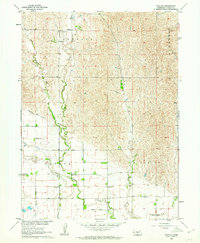
1962 Map of Buffalo
USGS Topo · Published 1964About this map
Buffalo and the surrounding rural townships in Dawson County appear during a period of established agricultural development and water management. The landscape is defined by the winding course of Buffalo Creek and the critical infrastructure of the Gothenburg Canal and Dawson County Canal, which trace the base of the loess hills. These waterways, supported by features like the Gaging Station and a local Flume, speak to the region's reliance on irrigation to sustain its plains economy.
Find a feature on this map
22 named features on this map. Tap any name to fly to it.
Don’t see what you’re looking for? This feature index may not catch every label — zoom into the map to look around manually.
Map Details
Editions of this 1962 Buffalo Map
This is the sole edition of this map. No revisions or reprints were ever made.
Other maps of this area

1896 · Lexington
USGS Topo · 1:125,000

1899 · Lexington
USGS Topo · 1:125,000

1951 · Oconto SW
USGS Topo · 1:24,000

1951 · Oconto SE
USGS Topo · 1:24,000

1951 · Eddyville SW
USGS Topo · 1:24,000

1955 · Broken Bow
USGS Topo · 1:250,000

1955 · Grand Island
USGS Topo · 1:250,000

1956 · Broken Bow
USGS Topo · 1:250,000

1957 · Grand Island
USGS Topo · 1:250,000

1958 · Grand Island
USGS Topo · 1:250,000