
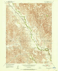
1951 Map of Eddyville SW
USGS Topo · Published 1953About this map
Wood River meanders across this rural Nebraska landscape, cutting a wide valley through the Wood River, Loup, and Kennebec regions. The Union Pacific railroad tracks run parallel to the riverbed, serving as the primary transportation artery for the sparse agricultural community in the early 1950s. The village of Eddyville sits at the southeastern corner of the survey, where the rail line and river converge near the Custer Co and Dawson Co border. This survey records the distribution of local educational infrastructure before rural school consolidation, preserving the locations of Happy Hollow Sch, School No 245, and School No 65. The terrain is characterized by a dense network of draws and ridges that feed into the central river valley, illustrating the complex drainage patterns of the central Nebraska plains.
Find a feature on this map
10 named features on this map. Tap any name to fly to it.
Don’t see what you’re looking for? This feature index may not catch every label — zoom into the map to look around manually.
Map Details
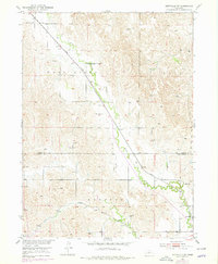
Editions of this 1951 Eddyville SW Map
3 editions found
Other maps of this area

1896 · Lexington
USGS Topo · 1:125,000

1899 · Lexington
USGS Topo · 1:125,000

1951 · Eddyville NE
USGS Topo · 1:24,000

1951 · Eddyville NW
USGS Topo · 1:24,000

1951 · Oconto SE
USGS Topo · 1:24,000

1951 · Eddyville
USGS Topo · 1:24,000

1951 · Oconto
USGS Topo · 1:24,000

1955 · Broken Bow
USGS Topo · 1:250,000

1955 · Grand Island
USGS Topo · 1:250,000

1956 · Broken Bow
USGS Topo · 1:250,000