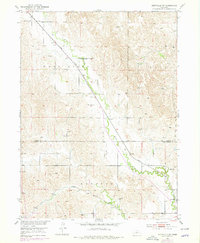
1951 Map of Eddyville SW
USGS Topo · Published 1978About this map
Wood River meanders diagonally across this Nebraska landscape, creating a fertile corridor that defined the area's development through the mid-20th century. Parallel to the water, the Union Pacific railroad tracks bisect the terrain, anchoring the small community of Eddyville in the southeastern corner. This intersection of rail and river provided the essential infrastructure for the region's agricultural economy, supporting a network of rural schoolhouses and distinct townships like Kennebec and Loup.
Find a feature on this map
9 named features on this map. Tap any name to fly to it.
Don’t see what you’re looking for? This feature index may not catch every label — zoom into the map to look around manually.
Map Details
Editions of this 1951 Eddyville SW Map
3 editions found
Other maps of this area

1896 · Lexington
USGS Topo · 1:125,000

1899 · Lexington
USGS Topo · 1:125,000

1951 · Eddyville NE
USGS Topo · 1:24,000

1951 · Eddyville NW
USGS Topo · 1:24,000

1951 · Oconto SE
USGS Topo · 1:24,000

1951 · Eddyville
USGS Topo · 1:24,000

1951 · Eddyville SW
USGS Topo · 1:24,000

1951 · Oconto
USGS Topo · 1:24,000

1955 · Broken Bow
USGS Topo · 1:250,000

1955 · Grand Island
USGS Topo · 1:250,000