
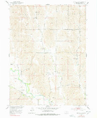
1951 Map of Eddyville NE
USGS Topo · Published 1953About this map
The South Loup River meanders across the southern portion of this mid-century Custer County survey, defining a landscape of agricultural valleys and dissected uplands. This area, mapped for the development of the Missouri River Basin, reveals a high density of rural schoolhouses that served the dispersed farming community. Notable education landmarks include New Hope Sch, Fairview Sch, and Round Hill Sch, indicating the social structure of these Nebraska townships before school consolidation shifted. The small settlement of Burr Oak sits near the riverbanks, supported by the nearby Burr Oak Ch and Burr Oak Sch. Further north, Buckeye serves as a secondary focal point amidst a network of creeks including Deer Creek and West Box Elder Creek, which drain the intricate topography of East Custer and Berwyn townships.
Find a feature on this map
17 named features on this map. Tap any name to fly to it.
Don’t see what you’re looking for? This feature index may not catch every label — zoom into the map to look around manually.
Map Details
Editions of this 1951 Eddyville NE Map
3 editions found

Other maps of this area

1951 · Broken Bow SW
USGS Topo · 1:24,000

1951 · Ansley
USGS Topo · 1:24,000

1951 · Broken Bow SE
USGS Topo · 1:24,000

1951 · Mason City SW
USGS Topo · 1:24,000

1951 · Eddyville NW
USGS Topo · 1:24,000

1951 · Eddyville
USGS Topo · 1:24,000

1951 · Mason City NW
USGS Topo · 1:24,000

1951 · Eddyville SW
USGS Topo · 1:24,000

1955 · Broken Bow
USGS Topo · 1:250,000

1956 · Broken Bow
USGS Topo · 1:250,000