
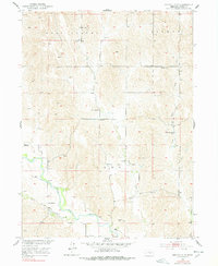
1951 Map of Eddyville NE
USGS Topo · Published 1953About this map
The South Loup River winds through the southern landscape of this mid-century survey, defining the agricultural character of central Nebraska. This area of Custer County is characterized by a dense network of one-room schoolhouses and rural community centers, indicating a high point in local settlement before later consolidation. Key educational landmarks include New Hope Sch, Fairview Sch, and Round Hill Sch, located near the distinctive Round Hill elevation. Small settlements like Buckeye and Burr Oak serve as focal points for the surrounding farmsteads, while the Burr Oak Ch stands as a central spiritual and social hub. The drainage patterns of Deer Creek and West Box Elder Creek weave through the township boundaries of East Custer and Loup, illustrating the vital relationship between the river system and the regional cattle and farming economy.
Find a feature on this map
17 named features on this map. Tap any name to fly to it.
Don’t see what you’re looking for? This feature index may not catch every label — zoom into the map to look around manually.
Map Details
Editions of this 1951 Eddyville NE Map
3 editions found
Other maps of this area

1951 · Broken Bow SW
USGS Topo · 1:24,000

1951 · Ansley
USGS Topo · 1:24,000

1951 · Broken Bow SE
USGS Topo · 1:24,000

1951 · Eddyville NE
USGS Topo · 1:24,000

1951 · Mason City SW
USGS Topo · 1:24,000

1951 · Eddyville NW
USGS Topo · 1:24,000

1951 · Eddyville
USGS Topo · 1:24,000

1951 · Mason City NW
USGS Topo · 1:24,000

1951 · Eddyville SW
USGS Topo · 1:24,000

1955 · Broken Bow
USGS Topo · 1:250,000