1900s (20th Century) Maps of Frontier County, Nebraska
Explore 42 historic maps of Frontier County from the 1900s (20th Century). These maps offer a rare glimpse into what life looked like during the 1900s — showing old roads, neighborhoods, homes, and landmarks that have changed or disappeared over time.
Whether you're researching your family's past, planning a metal detecting trip, or studying how Frontier County's landscape evolved across the 1900s, these high-resolution maps are a powerful tool for exploring the history of this region.
- Focus on a specific era: All maps on this page are from the 1900s, giving you a focused view of this time period.
- See what’s changed: Compare century-old streets, trails, and buildings to today's modern landscape using overlays and satellite layers.
- Research with precision: Use these maps for genealogy, historical research, land use analysis, or educational projects.
- View, download, or print: Maps are fully viewable online in high resolution, and can be downloaded or printed for your own records.
Start exploring Frontier County's history through authentic maps from the 1900s. This is your window into the past.
Frontier County, NE maps
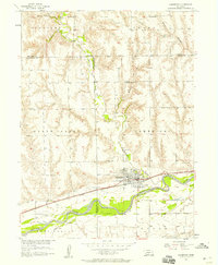
(42)- 1902 Map of Gothenburg
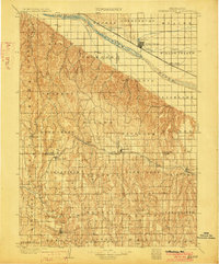 1902 Gothenburg1902 Print · USGSThe Platte River valley in the early twentieth century was a landscape defined by new railroads and irrigation. Genealogists and historians can trace the early rail stops at Gothenburg and Cozad or locate remote frontier outposts like Stockville and Moorefield.3 unique versions available
 - 1954 Map of McCook, 1966 Print
 1954 McCook1966 Print · USGSSouthwest Nebraska in the mid-fifties reveals a landscape shaped by major water projects and the Chicago Burlington and Quincy RR. Trace ancestral roots and defunct rail stops in McCook, Wauneta, and along the shores of Swanson Lake.2 unique versions available
 - 1955 Map of Grand Island, 1967 Print
 1955 Grand Island1967 Print · USGSCentral Nebraska is seen here during a period of industrial and agricultural growth, centered on the vital Platte River corridor. Researchers can trace the mid-century footprints of the U S Naval Ammunition Depot and the Cornhusker Ordnance Plant.3 unique versions available
 - 1956 Map of White NE, 1957 Print
 1956 White NE1957 Print · USGSThe rural intersection of Hayes, Lincoln, and Frontier counties is documented here in the mid-fifties, capturing a landscape of remote farmsteads and prairie creeks. Genealogists can locate family landmarks like Ash Grove Cem, Ash Grove Sch, and Valley Sch.2 unique versions available
 - 1956 Map of Freedom, 1957 Print
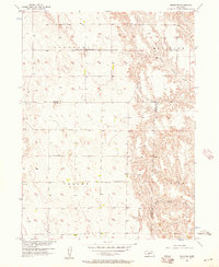
 1956 Freedom1957 Print · USGSFrontier County at the mid-century shows a landscape of traditional prairie schools and the rising waters of a new reservoir. Genealogists and local historians can locate Freedom, the Prairie Land Cem, and long-standing rural hubs like Champion Sch and Cottonwood Sch.2 unique versions available
 - 1956 Map of Stockville NE, 1957 Print
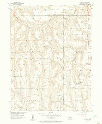
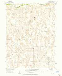
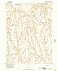
 1956 Stockville NE1957 Print · USGSThe Frontier County backcountry in the mid-1950s shows a landscape of deep canyons and evolving rural districts. Genealogists and historians can trace the transition of local schoolhouses like Ingham Sch and the now-silent Mount Hope Sch along the Chicago Burlington and Quincy railroad line.2 unique versions available
 - 1956 Map of Curtis SW, 1957 Print
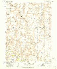
 1956 Curtis SW1957 Print · USGSFrontier County, Nebraska, is captured in the mid-fifties during a period of Missouri River Basin development. Genealogists and local historians can locate rural landmarks such as the Prairie Bell Sch and trace the paths of Elkhorn Canyon and Frazier Creek.2 unique versions available
 - 1956 Map of Cambridge, 1957 Print
 1956 Cambridge1957 Print · USGSMid-century Furnas County comes alive in this survey of the river valley near the Red Willow and Frontier county lines. Genealogists can locate family-named landmarks like Mousel Sch and Harding Sch No 70 or trace the Republican River past Cambridge.3 unique versions available
 - 1956 Map of Moorefield, 1957 Print
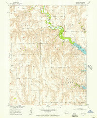
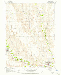
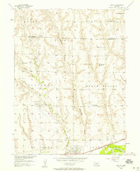
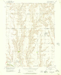 1956 Moorefield1957 Print · USGSThe Nebraska plains of Frontier County are shown here in the mid-fifties as a thriving network of small settlements and rural school districts. Researchers can trace the Chicago Burlington and Quincy rail line or locate ancestral sites like Moorefield Cemetery and Bethel Sch.2 unique versions available
 - 1956 Map of Medicine Creek Dam, 1957 Print
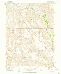
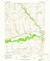
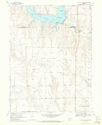
 1956 Medicine Creek Dam1957 Print · USGSFrontier County was undergoing a major transformation in the 1950s following the completion of the Medicine Creek Dam. Researchers can trace the mid-century community of Orafino and find family-named landmarks like Denny Cem and the Afton Sch.
 - 1956 Map of Curtis NW, 1957 Print
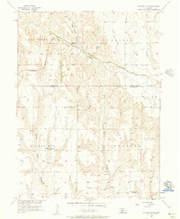
 1956 Curtis NW1957 Print · USGSThe Nebraska high plains at the Frontier and Lincoln county line were defined by the deep canyons and rail-side settlements of the mid-fifties. Researchers can trace the Chicago Burlington and Quincy line as it connects Wellfleet and Maywood along the banks of Medicine Creek.3 unique versions available
 - 1956 Map of Quick NE, 1957 Print
 1956 Quick NE1957 Print · USGSThe Frontier County tablelands are seen here in the mid-1950s, showing a rural landscape defined by township boundaries and canyon topography. Researchers can trace family roots at Schoonover Cem or locate local landmarks like Zion Hill Sch and Ash Grove Sch.2 unique versions available
 - 1956 Map of Curtis, 1957 Print
 1956 Curtis1957 Print · USGSFrontier County life centered on the fertile valleys of the loess hills during the mid-fifties. Researchers can trace the rail corridor of the Chicago Burlington and Quincy and locate landmarks like the Lutheran Ch and Curtis Cem.2 unique versions available
 - 1956 Map of Curtis SE, 1957 Print
 1956 Curtis SE1957 Print · USGSFrontier County's dissected prairie and deep canyons are captured here in the mid-fifties, showing the rural landscape as the Missouri River Basin development era began. Genealogists and local historians can locate Lone Tree Cem and several namesake sites like Fischer and School No 75.3 unique versions available
 - 1956 Map of Stockville, 1957 Print
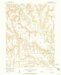 1956 Stockville1957 Print · USGSFrontier County was still a landscape of deep canyons and rural school districts in the mid-fifties. Researchers can locate family landmarks like Arbor Cem and the sites of the Liberty Sch or the County Fairground near Stockville.3 unique versions available
 - 1956 Map of Bartley NW, 1957 Print
 1956 Bartley NW1957 Print · USGSFrontier County rural life is captured here in the mid-fifties as the Missouri River Basin development was underway. Genealogists can locate family landmarks and a series of rural schoolhouses, including Hanthorn Sch and the shuttered Walnut Hill Sch.
 - 1956 Map of Bartley, 1958 Print
 1956 Bartley1958 Print · USGSThe Republican River valley of southwest Nebraska is captured here during the mid-fifties, centered on the rail-side community of Bartley. Researchers can trace the era's changing rural landscape through several closed country schools and sites like Mt Zion Ch and Dry Creek Cem.3 unique versions available
 - 1956 Map of Stockville SE, 1958 Print
 1956 Stockville SE1958 Print · USGSFrontier County rural life is captured in the mid-1950s, showing a network of small schools and creek-side land divisions. Genealogists can trace family footprints near Boston Ridge Sch, Fairview Sch, and the winding banks of Medicine Creek.
 - 1957 Map of McCook
 1957 McCook1957 Print · USGSSouthwestern Nebraska in the mid-fifties is captured here during a period of significant water development and rail-based commerce. Researchers can trace the path of the Chicago Burlington and Quincy through Indianola and Bartley, or locate rural settlements like Chase Village and Ough near the Sand Hills.
 - 1957 Map of Grand Island
 1957 Grand Island1957 Print · USGSCentral Nebraska and Northern Kansas are shown here during a period of massive hydraulic and military expansion in the mid-fifties. Researchers can trace the development of the Harlan County Reservoir and the massive wartime legacy of the Cornhusker Ordnance Plant.
 - 1958 Map of McCook
 1958 McCook1958 Print · USGSSouthwest Nebraska during the late fifties reveals a landscape of massive new reservoirs and established rail hubs like McCook. Genealogists can trace family footprints through rural centers like St Johns Church and the many grain elevators along the Union Pacific RR.2 unique versions available
 - 1958 Map of Grand Island
 1958 Grand Island1958 Print · USGSSouth-central Nebraska thrived as a rail and industrial hub during the late fifties, shaped by the braided Platte River. Genealogists and historians can trace rail lines like the Union Pacific RR through towns such as Kearney or locate the sprawling Cornhusker Ordnance Plant.
 - 1958 Map of Holbrook, 1960 Print
 1958 Holbrook1960 Print · USGSThe Republican River valley in the late fifties shows a landscape reshaped by irrigation and rail. You can trace family plots at Miller Cem, locate the Lutheran Ch, or follow the Chicago Burlington and Quincy rail line through Holbrook.2 unique versions available
 - 1970 Map of Red Willow Dam, 1972 Print
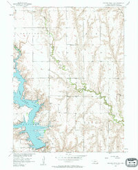
 1970 Red Willow Dam1972 Print · USGSThe Frontier and Red Willow county line area was undergoing significant change in the 1970s following the creation of Hugh Butler Lake. Researchers can trace the massive Mc Cook State Airport (Abandoned) and rural landmarks like Zion Hill Cem and School No 41.
 - 1970 Map of Quick, 1972 Print
 1970 Quick1972 Print · USGSFrontier County during the early 1970s shows a landscape of rural schoolhouses and the expansion of Hugh Butler Lake. Local historians can trace the community around Quick, Garden Prairie Ch, and School No 101.
Showing maps 1-25 of 42
Top cities of Frontier County
- Curtis historical maps
- Eustis historical maps
- Maywood historical maps
- Moorefield historical maps
- Stockville historical maps
Frequently asked questions
- What are the different types of historical maps available for Frontier County?
- What is the oldest map of Frontier County?
- Where can I purchase historical maps of Frontier County for my home or office?
- Where can I download high-res historical maps of Frontier County?
- Are there historical topographic maps available for Frontier County?
- Is there historical aerial imagery available for Frontier County?
- Where are historical maps of Frontier County sourced from?