1970s Maps of Frontier County, Nebraska
Explore 17 historic maps of Frontier County from the 1970s. These maps offer a rare glimpse into what life looked like during the 1970s — showing old roads, neighborhoods, homes, and landmarks that have changed or disappeared over time.
Whether you're researching your family's past, planning a metal detecting trip, or studying how Frontier County's landscape evolved across the 1970s, these high-resolution maps are a powerful tool for exploring the history of this region.
- Focus on a specific era: All maps on this page are from the 1970s, giving you a focused view of this time period.
- See what’s changed: Compare century-old streets, trails, and buildings to today's modern landscape using overlays and satellite layers.
- Research with precision: Use these maps for genealogy, historical research, land use analysis, or educational projects.
- View, download, or print: Maps are fully viewable online in high resolution, and can be downloaded or printed for your own records.
Start exploring Frontier County's history through authentic maps from the 1970s. This is your window into the past.
Frontier County, NE maps
(17)- 1970 Map of Red Willow Dam, 1972 Print
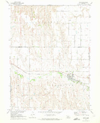
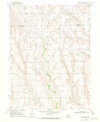
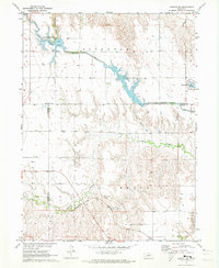
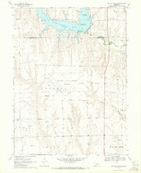 1970 Red Willow Dam1972 Print · USGSThe Frontier and Red Willow county line area was undergoing significant change in the 1970s following the creation of Hugh Butler Lake. Researchers can trace the massive Mc Cook State Airport (Abandoned) and rural landmarks like Zion Hill Cem and School No 41.
 - 1970 Map of Quick, 1972 Print
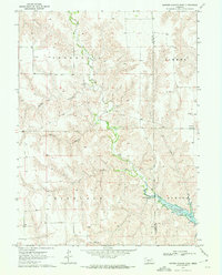
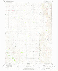
 1970 Quick1972 Print · USGSFrontier County during the early 1970s shows a landscape of rural schoolhouses and the expansion of Hugh Butler Lake. Local historians can trace the community around Quick, Garden Prairie Ch, and School No 101.
 - 1970 Map of Burger Canyon SE, 1972 Print
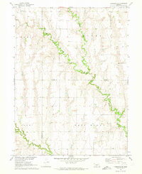
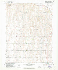
 1970 Burger Canyon SE1972 Print · USGSSouthwestern Nebraska in the early 1970s was defined by the intersection of four counties and the intricate engineering of the Blackwood Creek valley. Researchers can trace the sophisticated irrigation network of the Culbertson Siphon Extension Canal and locate rural landmarks like the Beebe Landing Strip.
 - 1970 Map of Quick SE, 1972 Print
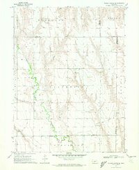
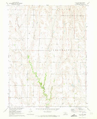
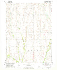
 1970 Quick SE1972 Print · USGSRed Willow County agricultural life in the early seventies centered on the vital waters and canyons of the Nebraska plains. Genealogists and researchers can trace local landmarks like the Box Elder Cem and the complex irrigation network of the Red Willow Creek Diversion Dam.
 - 1970 Map of Eustis SW, 1973 Print
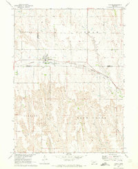
 1970 Eustis SW1973 Print · USGSFrontier County at the start of the 1970s reveals a rural landscape defined by prairie draws and remote homesteads. Researchers can pinpoint historic community sites like Independence Cem, Orafino Cem, and the Earl Sch.
 - 1970 Map of Eustis, 1973 Print
 1970 Eustis1973 Print · USGSThe high plains of Nebraska near the Dawson and Frontier county line are captured here as they appeared in the early seventies. Genealogists and local historians can trace the tracks of the Burlington Northern, locate the Holmes Sch, and find the Silica Mine south of Eustis.
 - 1970 Map of Cambridge NE, 1973 Print
 1970 Cambridge NE1973 Print · USGSThe borderlands of Frontier and Gosper counties are captured here in the early seventies, dominated by the drainage of Muddy Creek. Local historians can trace the rural topography of West Muddy and find landmarks like Stowe Cem and Deer Creek.
 - 1970 Map of Eustis SE, 1973 Print
 1970 Eustis SE1973 Print · USGSFrontier County, Nebraska, is documented here in the early 1970s, showing a rural landscape defined by deep canyons and prairie creeks. Genealogists and local historians can locate Wilkins Cem and trace the paths of Muddy Creek or Horseshoe Canyon.
 - 1970 Map of Farnam, 1973 Print
 1970 Farnam1973 Print · USGSFarnam sat at the intersection of Lincoln, Dawson, and Frontier counties in the 1970s, where the prairie gives way to deep creek breaks. Researchers can trace the Burlington Northern rail corridor and find local landmarks like the Farnam Cem and Plum Creek.
 - 1970 Map of Bartley SW, 1973 Print
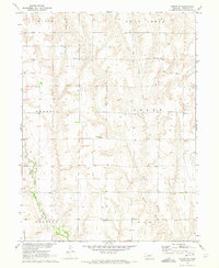
 1970 Bartley SW1973 Print · USGSRed Willow County ranchlands are documented here in the early seventies, showing a landscape shaped by deep draws and cattle country. Researchers can trace rural infrastructure from School No 42 to numerous Wells and a specific Oil Well.
 - 1970 Map of Burger Canyon East, 1975 Print
 1970 Burger Canyon East1975 Print · USGSThe Hayes and Frontier county line in the early 1970s shows a changing Nebraska landscape following the creation of Hugh Butler Lake. Researchers can trace old rural centers like St Ann Ch, School No 116, and the remote Beebe Landing Strip.
 - 1971 Map of Elwood SW, 1973 Print
 1971 Elwood SW1973 Print · USGSGosper County was characterized by its rail-linked northern border and extensive drainage networks in the early 1970s. Genealogists can locate family land near the Burlington Northern line or trace water sources along East Branch Muddy Creek and Elk Creek.
 - 1971 Map of Arapahoe NW, 1973 Print
 1971 Arapahoe NW1973 Print · USGSThe rural border of Frontier and Gosper counties comes alive in the early 1970s through this detailed look at its creek-fed ranchlands. Genealogists can trace family roots at Salem West Cem, East Muddy Cem, or the remote Pleasant Grove Cem overlooking the valley.
 - 1971 Map of Elwood NW, 1973 Print
 1971 Elwood NW1973 Print · USGSGosper County and Dawson County landscapes are defined by water management and rail travel in the early seventies. Genealogists and historians can trace the Burlington Northern line through Brace or explore the shores of Gallagher Lake and Plum Creek.2 unique versions available
 - 1973 Map of Camp Hayes Lake SE, 1977 Print
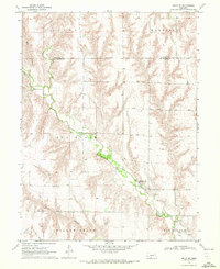
 1973 Camp Hayes Lake SE1977 Print · USGSSouthwestern Nebraska's rural plains are captured here in the early seventies, detailing the sparse agricultural settlement along the Hayes and Frontier County line. Researchers can trace local landmarks like St John Ch, Evergreen Union Ch, and the course of Red Willow Creek.
 - 1979 Map of Gothenburg
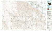 1979 Gothenburg1979 Print · USGSThe Nebraska Loess Hills and the Platte River valley are captured here in the late seventies, showing a landscape defined by irrigation and rail. Researchers can trace the Union Pacific line through Gothenburg, locate family sites near Eustis, or explore the canyon country around Stockville.
 - 1979 Map of McCook
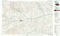 1979 McCook1979 Print · USGSThe Republican River valley of southwest Nebraska is seen here in the late seventies, a region of rail-connected river towns and extensive irrigation. Genealogists and local historians can trace family ties through McCook, the Burlington Northern line, and water landmarks like Medicine Creek.
End of results
Showing maps 1-17 of 17
Top cities of Frontier County
- Curtis historical maps
- Eustis historical maps
- Maywood historical maps
- Moorefield historical maps
- Stockville historical maps
Frequently asked questions
- What are the different types of historical maps available for Frontier County?
- What is the oldest map of Frontier County?
- Where can I purchase historical maps of Frontier County for my home or office?
- Where can I download high-res historical maps of Frontier County?
- Are there historical topographic maps available for Frontier County?
- Is there historical aerial imagery available for Frontier County?
- Where are historical maps of Frontier County sourced from?