Old Maps of Knox County, Nebraska for Genealogy
Trace your family roots with 185 historic maps of Knox County. These high-res maps reveal old neighborhoods, homesites, landmarks, and streets — helping you uncover where your ancestors lived and how the area evolved over time.
- Explore historic neighborhoods: Identify where your relatives may have lived in the 1800s or 1900s.
- Compare maps over time: Trace the changes in streets, buildings, and landmarks for multi-generational research.
- Perfect for genealogy & ancestry research: Used by family historians and researchers to map out lineage and migration.
These maps are an incredible resource for exploring your personal connection to Knox County's past.
Knox County, NE maps
(185)- 1950 Map of Niobrara, 1952 Print
 1950 Niobrara1952 Print · USGSThe Missouri and Niobrara rivers converge here in the mid-twentieth century, just as the town of Niobrara prepared for major changes. Genealogists can locate many rural landmarks including Norwegian Cem, Wagner Sch, and the Chicago and North Western rail line.2 unique versions available
 - 1950 Map of Verdel, 1952 Print
 1950 Verdel1952 Print · USGSThe Missouri River borderlands of Knox County come to life in this mid-century survey of the Verdel area. Local historians can trace the paths of the Chicago and North Western railroad and locate rural landmarks like Clay Hill Sch or Cedar Hill Cem.4 unique versions available
 - 1950 Map of Verdigre NE, 1952 Print
 1950 Verdigre NE1952 Print · USGSKnox County was a land of valley farms and rural school districts during the early post-war years. Researchers can trace the Chicago and North Western rail line and locate community landmarks like St Johns Cem and Ponca Sch.3 unique versions available
 - 1950 Map of Pishelville, 1952 Print
 1950 Pishelville1952 Print · USGSKnox County, Nebraska, is seen here in the mid-twentieth century as the Missouri River Basin development program was underway. Local historians can trace the rural infrastructure of the day through several country schools like Stony Butte Sch and settlements including Pishelville and Dukeville.2 unique versions available
 - 1950 Map of Monowi, 1973 Print
 1950 Monowi1973 Print · USGSNortheastern Nebraska is captured in the mid-1950s at the meeting of the Missouri River and Niobrara River. Genealogists and local historians can locate family sites among numerous rural landmarks like Alford Cem, Monowi, and Masdon Sch.
 - 1952 Map of Monowi
 1952 Monowi1952 Print · USGSThe village of Monowi and the surrounding Nebraska-South Dakota borderlands are captured here in the early 1950s. Genealogists can trace family roots through numerous rural landmarks like Beulah Cem, Pleasant Hill Sch, and the Verdel Sch.2 unique versions available
 - 1952 Map of Dorsey
 1952 Dorsey1952 Print · USGSThe border of Holt and Knox counties in the early fifties shows a landscape of creek-fed valleys and rural schoolhouses. Genealogists and local historians can locate early burial sites like Star Cemetery or trace the locations of the Old Mill School and the village of Dorsey.2 unique versions available
 - 1954 Map of Walnut, 1956 Print
 1954 Walnut1956 Print · USGSKnox County, Nebraska, is shown in the mid-1950s as a landscape of rural schoolhouses and prairie creek branches. Genealogists and historians can trace family roots at the Jelen Cem or locate former school sites like Oak Valley Sch and Cottonwood Grove Sch.2 unique versions available
 - 1954 Map of Verdigre, 1956 Print
 1954 Verdigre1956 Print · USGSKnox County settlement centers on the rail-and-river hub of Verdigre in the mid-1950s. Genealogists and researchers can trace local family landmarks and rural education sites such as St Wenceslaus Cem, Oak Valley Sch, and the Chicago and North Western rail line.2 unique versions available
 - 1954 Map of Star, 1956 Print
 1954 Star1956 Print · USGSThe Holt and Knox county border comes alive in the mid-1950s, showing a landscape of remote ranching and rural education. Genealogists can trace family footprints at Grimton Cemetery and local schools like Cedar Corner Sch or Grimton Sch.2 unique versions available
 - 1955 Map of Sioux City, 1959 Print
 1955 Sioux City1959 Print · USGSThe Missouri River valley in the mid-fifties is captured here during a time of major engineering and social transition. Genealogists and historians can trace the foundations of Gavins Point Dam, tribal boundaries on the Santee Sioux Indian Reservation, and local landmarks like the Norfolk State Hospital.4 unique versions available
 - 1955 Map of O'Neill, 1974 Print
 1955 O'Neill1974 Print · USGSNorth-central Nebraska in the 1950s reveals a vast cattle-ranching landscape transitioning from the Missouri River breaks to the iconic Sand Hills. Researchers can trace the path of the Chicago and North Western rail line and locate rural landmarks like the Dustin Post Office and St Johns Lake Ch.2 unique versions available
 - 1958 Map of Sioux City
 1958 Sioux City1958 Print · USGSThe Missouri River valley in the late fifties was a bustling intersection of tribal lands, rail corridors, and river towns. Genealogists can trace family roots through specific rural sites like Daisy Valley School, St Johns Church and School, and Yankton State Hospital.
 - 1959 Map of O'Neill
 1959 O'Neill1959 Print · USGSNorth-central Nebraska in the late fifties is defined by the vast Sand Hills and the vital Chicago and North Western rail line. Genealogists and researchers can trace family roots through settlements like Atkinson, Bassett, and Stuart or follow the waters of the Niobrara River.2 unique versions available
 - 1959 Map of Sioux City
 1959 Sioux City1959 Print · USGSThe tri-state region surrounding the Missouri River is captured here in the late fifties, showing the convergence of Nebraska, South Dakota, and Iowa. Researchers can trace rural lineages through numerous country schoolhouses like Cemetery School and the many numbered Washington School districts.
 - 1963 Map of Orchard NE, 1964 Print
 1963 Orchard NE1964 Print · USGSThe rural border of Knox and Antelope counties is captured here in the early sixties, showing a landscape of townships and winding creek beds. Researchers can locate legacy schoolhouses like School No 77 and family landmarks such as Alcott Cem or Grove Lake.2 unique versions available
 - 1963 Map of Venus, 1964 Print
 1963 Venus1964 Print · USGSNortheastern Nebraska ranchland is captured here in the early sixties at the meeting point of Holt, Knox, and Antelope counties. Genealogists can trace rural family life through features like Venus, Lambert Cem, and country schools like Cream Ridge Sch.2 unique versions available
 - 1963 Map of Orchard NW, 1964 Print
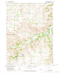 1963 Orchard NW1964 Print · USGSKnox and Antelope counties in the early sixties reveal a rural landscape of scattered schools and family cemeteries. Genealogists and historians can trace the locations of Enterprise Cem, the Pleasant Hill Sch, and the local Fish Hatchery.2 unique versions available
 - 1964 Map of Lynch NE, 1966 Print
 1964 Lynch NE1966 Print · USGSThe Missouri River borderlands in the mid-1960s reveal a landscape of prairie schools and treaty boundaries. Genealogists can locate family landmarks like the Native American Ch or trace old rural districts such as School No 64 and School No 80.2 unique versions available
 - 1968 Map of Tabor SE, 1970 Print
 1968 Tabor SE1970 Print · USGSKnox County, Nebraska, and Yankton County, South Dakota, meet here at the edge of the Missouri River in the late sixties. Researchers can trace rural landmarks like Frankfort Cem, the West Blyville Sch, and the Fort Yankton Historic Site.2 unique versions available
 - 1968 Map of Bloomfield NE, 1971 Print
 1968 Bloomfield NE1971 Print · USGSIn the late sixties, this portion of Knox County centered on Crofton reveals a landscape defined by the C & N W railroad and winding prairie streams. Researchers can trace local history through the St Rose Cem, Swede Cem, and the Hurst Stafford Ch.
 - 1968 Map of Hartington SW, 1971 Print
 1968 Hartington SW1971 Print · USGSCedar County farm country is mapped in detail during the late sixties, showing the rural section lines and homesteads. Local researchers can trace the locations of Oliver Grove Cem and several country schoolhouses like Harmony Sch and Goldenrod Sch.
 - 1968 Map of Gavins Point Dam, 1971 Print
 1968 Gavins Point Dam1971 Print · USGSYankton and the Missouri River borderlands are captured in the late sixties as the region adjusted to the massive Gavins Point dam project. Researchers can locate the Gavins Point National Fish Hatchery, the Fort Yankton Historic Site, and rural landmarks like Aten Cem and School No 87.2 unique versions available
 - 1968 Map of Bloomfield SE, 1971 Print
 1968 Bloomfield SE1971 Print · USGSKnox County agricultural lands and the town of Wausa are captured in the late sixties as the local rail infrastructure began to shift. Genealogists and local historians can locate Thabor Cem, Woodlawn Cem, and the path of the Old Railroad Grade.
 - 1968 Map of Crofton, 1971 Print
 1968 Crofton1971 Print · USGSNear the Knox and Cedar county line in the late sixties, this area shows a landscape of established rail towns and rural school districts. Genealogists can trace family footprints around Crofton and Constance, including the St Joseph Sch and Crofton Cem.
Showing maps 1-25 of 185
Top cities of Knox County
- Creighton historical maps
- Bloomfield historical maps
- Crofton historical maps
- Wausa historical maps
- Verdigre historical maps
- Niobrara historical maps
See more
Frequently asked questions
- What are the different types of historical maps available for Knox County?
- What is the oldest map of Knox County?
- Where can I purchase historical maps of Knox County for my home or office?
- Where can I download high-res historical maps of Knox County?
- Are there historical topographic maps available for Knox County?
- Is there historical aerial imagery available for Knox County?
- Where are historical maps of Knox County sourced from?