1970s Maps of Knox County, Nebraska
Explore 22 historic maps of Knox County from the 1970s. These maps offer a rare glimpse into what life looked like during the 1970s — showing old roads, neighborhoods, homes, and landmarks that have changed or disappeared over time.
Whether you're researching your family's past, planning a metal detecting trip, or studying how Knox County's landscape evolved across the 1970s, these high-resolution maps are a powerful tool for exploring the history of this region.
- Focus on a specific era: All maps on this page are from the 1970s, giving you a focused view of this time period.
- See what’s changed: Compare century-old streets, trails, and buildings to today's modern landscape using overlays and satellite layers.
- Research with precision: Use these maps for genealogy, historical research, land use analysis, or educational projects.
- View, download, or print: Maps are fully viewable online in high resolution, and can be downloaded or printed for your own records.
Start exploring Knox County's history through authentic maps from the 1970s. This is your window into the past.
Knox County, NE maps
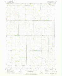
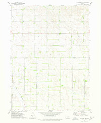
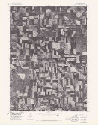
(22)- 1971 Map of Wausa, 1973 Print
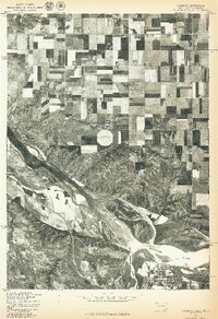
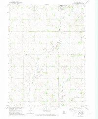 1971 Wausa1973 Print · USGSNortheast Nebraska at the start of the seventies shows a landscape defined by the winding North Fork Elkhorn River and the small-town hub of Wausa. Genealogists and rail historians can trace the Old Railroad Grade and the active Burlington Northern line across the Knox and Pierce county border.
 - 1971 Map of Magnet, 1973 Print
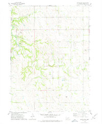
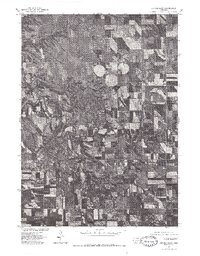
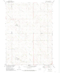 1971 Magnet1973 Print · USGSThe rural borderlands of Cedar, Knox, and Pierce Counties are captured here in the early 1970s. Genealogists and historians can trace the Burlington Northern line through McLean, locate the Magnet Cem, and follow an Old Railroad Grade.
 - 1974 Map of Sparta, 1978 Print
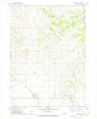
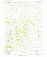
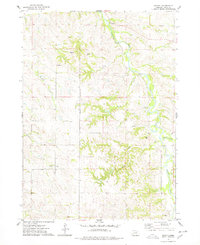 1974 Sparta1978 Print · USGSKnox County in the mid-1970s reveals a rural landscape divided by the Santee Indian Reservation Boundary. Genealogists and local historians can trace the area around Sparta or locate the Bazile Creek Ch along the winding Bazile Creek.
 - 1974 Map of Lindy, 1978 Print
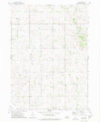 1974 Lindy1978 Print · USGSKnox County, Nebraska, is documented here in the mid-1970s, showing the agricultural lands surrounding the village of Lindy. Local historians can trace the SANTEE INDIAN RESERVATION BOUNDARY and geographic landmarks like Peoria and Hobo Creek.
 - 1974 Map of Midland, 1978 Print
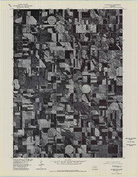
 1974 Midland1978 Print · USGSMidland and Breslau sit at the intersection of Knox and Pierce counties during the mid-1970s. Genealogists can trace family roots at Eden Valley Cem and Golgotha Ch or follow the waters of the West Branch North Fork Elkhorn River.
 - 1974 Map of Center West, 1978 Print
 1974 Center West1978 Print · USGSKnox County in the mid-1970s shows a landscape defined by the Santee Indian Reservation Boundary and rural crossroads. Local researchers can trace the Chicago and North Western rail line or locate the Cedar Hill Cem near Bazile Mills.
 - 1974 Map of Creighton, 1978 Print
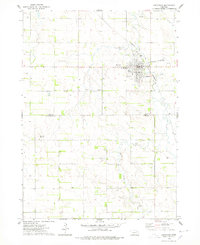 1974 Creighton1978 Print · USGSThe Knox and Antelope county border area is captured here during the mid-seventies, centered on the rail-served town of Creighton. Genealogists and local historians can trace the Chicago and North Western line, Greenwood Cem, and landmarks like Council Hill.
 - 1974 Map of Bloomfield, 1978 Print
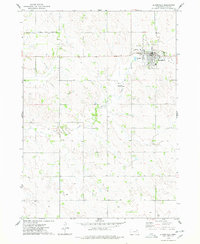 1974 Bloomfield1978 Print · USGSKnox County agricultural life and civic boundaries are preserved here in the mid-1970s. Researchers can trace the Old RR Gr near Bloomfield or locate the northern boundary of the Santee Indian Reservation.
 - 1974 Map of Plainview NE, 1978 Print
 1974 Plainview NE1978 Print · USGSThe intersection of Knox, Antelope, and Pierce counties in Nebraska is captured here during the mid-1970s. Trace the path of the Chicago and North Western railroad across the plains or locate local water sources like Spring Cr.
 - 1974 Map of Center East, 1979 Print
 1974 Center East1979 Print · USGSKnox County, Nebraska, is seen here in the mid-seventies, documenting the rural landscape near Center. Researchers can locate the Morrillville Cem, trace the waters of Bazile Creek, and see the Santee Indian Reservation Boundary.
 - 1974 Map of Howe Creek, 1979 Print
 1974 Howe Creek1979 Print · USGSKnox County land within the Santee Indian Reservation is documented here during the mid-seventies. Genealogists and local historians can trace the rural landscape around Blessed Redeemer Ch and the banks of Howe Creek.
 - 1974 Map of Bon Homme Colony, 1979 Print
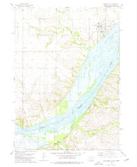
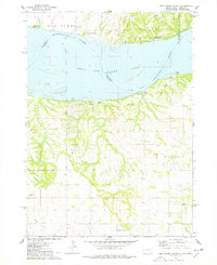 1974 Bon Homme Colony1979 Print · USGSThe Missouri River and Lewis and Clark Lake define this borderland during the mid-seventies, spanning the South Dakota and Nebraska state line. Researchers can trace the Bon Homme Colony, locate the Holy Faith Cem, and explore the topography of the Santee Indian Reservation.
 - 1977 Map of Niobrara
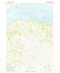
 1977 Niobrara1977 Print · USGSThe Nebraska-South Dakota borderlands come into focus in the late seventies, showing the dramatic confluence of the Niobrara River and Missouri River. Researchers can trace the layout of Niobrara and the varied agricultural patterns near Perkins.
 - 1977 Map of Center East, 1979 Print
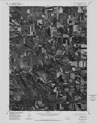
 1977 Center East1979 Print · USGSKnox County farmland and the small settlement of Center are captured in this late-1970s orthophoto. Researchers can trace the winding course of Brazile Creek and the rise of center-pivot irrigation systems across the Nebraska prairie.
 - 1977 Map of Bloomfield, 1979 Print
 1977 Bloomfield1979 Print · USGSBloomfield and the surrounding Knox County plains are captured in this late-seventies aerial survey during a period of agricultural transition. Researchers can trace the development of the Bloomfield town site and the natural course of Bazile Creek.
 - 1977 Map of Springfield, 1979 Print
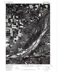 1977 Springfield1979 Print · USGSNear the South Dakota and Nebraska border in the late seventies, this aerial survey captures the town of Springfield perched above the river bluffs. Researchers can trace the mid-century channel of the Missouri River and examine the local layout of rural roads and homesteads.
 - 1977 Map of Lindy, 1979 Print
 1977 Lindy1979 Print · USGSAgricultural patterns in Knox County are captured during the late seventies, showing the rural landscape around Lindy. Local historians and genealogists can trace property boundaries and identify specific farmstead locations as they appeared when this imagery was recorded.
 - 1977 Map of Howe Creek, 1979 Print
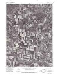
 1977 Howe Creek1979 Print · USGSKnox County farmland and deep prairie ravines are captured in the late seventies through this detailed aerial survey. Researchers can trace the winding course of Howe Creek and locate specific homesteads and field patterns used by the Bureau of Indian Affairs.
 - 1977 Map of Sparta, 1979 Print
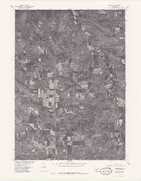 1977 Sparta1979 Print · USGSThe Knox County countryside is shown through aerial photography in the late 1970s, revealing the landscape of the Sparta area. Researchers can trace the winding path of Bazile Creek and study the layout of local farmsteads and field boundaries.
 - 1977 Map of Center West, 1979 Print
 1977 Center West1979 Print · USGSNortheastern Nebraska's Knox County comes into sharp focus during the late seventies, showing a landscape defined by structured agriculture and creek-side settlements. Researchers can trace the layout of Winnetoon, Center, and the historic mill site at Bazile Mills.
 - 1978 Map of Santee
 1978 Santee1978 Print · USGSThe Missouri River borderlands of Nebraska and South Dakota are captured here in the late seventies. Researchers can trace the Santee Indian Res Bdy and locate local landmarks like the Santee Recreation Area, Sand Islands, and several upland cemeteries.
 - 1978 Map of Springfield, 1979 Print
 1978 Springfield1979 Print · USGSThe Missouri River borderlands of South Dakota and Nebraska are captured here in the late seventies. Researchers can trace the layout of Springfield and the University of South Dakota at Springfield, or locate local burial grounds like St Vincents Cem and Emanuel Cem.
End of results
Showing maps 1-22 of 22
Top cities of Knox County
- Creighton historical maps
- Bloomfield historical maps
- Crofton historical maps
- Wausa historical maps
- Verdigre historical maps
- Niobrara historical maps
See more
Frequently asked questions
- What are the different types of historical maps available for Knox County?
- What is the oldest map of Knox County?
- Where can I purchase historical maps of Knox County for my home or office?
- Where can I download high-res historical maps of Knox County?
- Are there historical topographic maps available for Knox County?
- Is there historical aerial imagery available for Knox County?
- Where are historical maps of Knox County sourced from?