1940s Maps of Morrill County, Nebraska
Explore 9 historic maps of Morrill County from the 1940s. These maps offer a rare glimpse into what life looked like during the 1940s — showing old roads, neighborhoods, homes, and landmarks that have changed or disappeared over time.
Whether you're researching your family's past, planning a metal detecting trip, or studying how Morrill County's landscape evolved across the 1940s, these high-resolution maps are a powerful tool for exploring the history of this region.
- Focus on a specific era: All maps on this page are from the 1940s, giving you a focused view of this time period.
- See what’s changed: Compare century-old streets, trails, and buildings to today's modern landscape using overlays and satellite layers.
- Research with precision: Use these maps for genealogy, historical research, land use analysis, or educational projects.
- View, download, or print: Maps are fully viewable online in high resolution, and can be downloaded or printed for your own records.
Start exploring Morrill County's history through authentic maps from the 1940s. This is your window into the past.
Morrill County, NE maps
(9)- 1947 Map of Alliance, 1967 Print
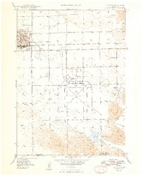
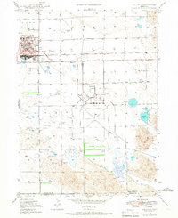 1947 Alliance1967 Print · USGSAlliance emerges as a bustling panhandle hub in the late 1940s, balancing its railroad roots with new aviation infrastructure. Researchers can locate the Courthouse, trace the Chicago Burlington and Quincy rail lines, and find rural landmarks like Greenwood Cem.2 unique versions available
 - 1947 Map of Bronco Lake, 1970 Print
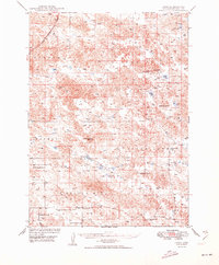
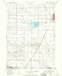 1947 Bronco Lake1970 Print · USGSThe Nebraska panhandle comes into focus in the late 1940s as the rail lines and rural school districts of Box Butte County are mapped in detail. Genealogists can trace the rural landscape through landmarks like Letan Sch, St Josephs Hospital, and the small settlement of Letan.2 unique versions available
 - 1948 Map of Hemingford 4 SW
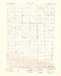 1948 Hemingford 4 SW1948 Print · USGSBox Butte and Morrill counties appear here in the late forties, revealing a working landscape of prairie ranching and isolated schoolhouses. Genealogists can locate family landmarks like School No 36 or trace the path of an Abandoned Canal and Snake Creek.4 unique versions available
 - 1948 Map of Hemingford 4 SE
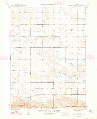 1948 Hemingford 4 SE1948 Print · USGSWestern Nebraska's ranching country comes into focus in the late 1940s, showing a landscape defined by water management and rural schooling. Genealogists can locate Hagaman Cem and trace the exact positions of School No 9 and School No 16 among the high plains.3 unique versions available
 - 1948 Map of Alliance
 1948 Alliance1948 Print · USGSAlliance emerges as a bustling post-war rail and aviation hub in the Nebraska panhandle during the late forties. Genealogists and researchers can trace local landmarks like Greenwood Cem, East Point Sch, and the expansive Alliance Airport.2 unique versions available
 - 1948 Map of Antioch, 1966 Print
 1948 Antioch1966 Print · USGSThe Nebraska sandhills near Antioch are captured here in the late 1940s, showing a landscape defined by alkali lakes and ranching. Genealogists can locate family holdings like Johnston Ranch and Bower Ranch, or trace school districts from School No 117 to School No 130.
 - 1949 Map of Lynn
 1949 Lynn1949 Print · USGSThe Nebraska panhandle in the late 1940s was a landscape of remote ranching outposts and vital water holes. Genealogists can trace rural life through numerous country schools like North School No 93 and landmark sites including Smith Ranch and Lynn.2 unique versions available
 - 1949 Map of Bronco Lake
 1949 Bronco Lake1949 Print · USGSNorthwestern Nebraska ranching and rail commerce take center stage in the late 1940s as the High Plains landscape begins its post-war shift. Trace the early footprint of Alliance or locate rural landmarks like Letan Sch and the namesake Bronco Lake.2 unique versions available
 - 1949 Map of Antioch
 1949 Antioch1949 Print · USGSSheridan County ranching and rail life are documented here in the late 1940s, just after the post-war aerial surveys. Researchers can trace rural school districts like School No 128 and the rail-side operations at Antioch and Hoffland.2 unique versions available
End of results
Showing maps 1-9 of 9
Top cities of Morrill County
Frequently asked questions
- What are the different types of historical maps available for Morrill County?
- What is the oldest map of Morrill County?
- Where can I purchase historical maps of Morrill County for my home or office?
- Where can I download high-res historical maps of Morrill County?
- Are there historical topographic maps available for Morrill County?
- Is there historical aerial imagery available for Morrill County?
- Where are historical maps of Morrill County sourced from?