1970s Maps of Morrill County, Nebraska
Explore 13 historic maps of Morrill County from the 1970s. These maps offer a rare glimpse into what life looked like during the 1970s — showing old roads, neighborhoods, homes, and landmarks that have changed or disappeared over time.
Whether you're researching your family's past, planning a metal detecting trip, or studying how Morrill County's landscape evolved across the 1970s, these high-resolution maps are a powerful tool for exploring the history of this region.
- Focus on a specific era: All maps on this page are from the 1970s, giving you a focused view of this time period.
- See what’s changed: Compare century-old streets, trails, and buildings to today's modern landscape using overlays and satellite layers.
- Research with precision: Use these maps for genealogy, historical research, land use analysis, or educational projects.
- View, download, or print: Maps are fully viewable online in high resolution, and can be downloaded or printed for your own records.
Start exploring Morrill County's history through authentic maps from the 1970s. This is your window into the past.
Morrill County, NE maps
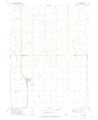
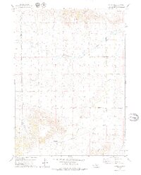
(13)- 1971 Map of Tar Valley SW, 1974 Print
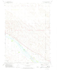 1971 Tar Valley SW1974 Print · USGSThe Nebraska plains near the Morrill and Garden county line are captured here in the early seventies, dominated by the wide North Platte River valley. Genealogists and historians can trace the paths of the Union Pacific railroad and irrigation landmarks like the Lisco Canal.
 - 1971 Map of Tar Valley, 1974 Print
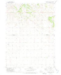
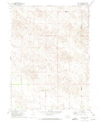 1971 Tar Valley1974 Print · USGSMorrill and Garden counties meet in this high-plains landscape during the early seventies, showcasing the ranching heart of the Nebraska Panhandle. Researchers can trace land boundaries and water sources like Horse Lake and the Frizler Fair Haven Ranch across Tar Valley.
 - 1972 Map of Lisco NW
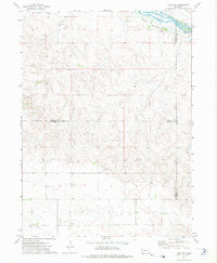 1972 Lisco NW1972 Print · USGSThe North Platte River valley in the early seventies preserves the path of the legendary Oregon Trail alongside modern irrigation canals. Genealogists and historians can locate the Lisco Memorial Cem and trace local county boundaries and utility lines like the Pipeline.
 - 1972 Map of Fairchild Ranch, 1975 Print
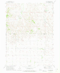
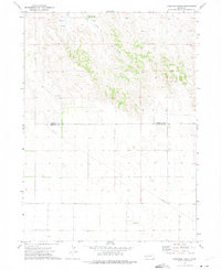 1972 Fairchild Ranch1975 Print · USGSThe Nebraska high plains at the Morrill and Cheyenne county line are captured here in the early seventies. Genealogists and local historians can trace family land and water rights near Fairchild Ranch, Fairchild, and the waters of Cedar Creek.
 - 1972 Map of Dalton, 1975 Print
 1972 Dalton1975 Print · USGSDalton and the Nebraska Panhandle high plains are captured here in the early seventies, centered on the Burlington Northern rail line. Researchers can trace local genealogy at St Marys Cem or locate the numerous Oil Wells and Gravel Pits that drove the local economy.
 - 1972 Map of Horsehead Ranch, 1975 Print
 1972 Horsehead Ranch1975 Print · USGSThe Nebraska panhandle's ranching and energy landscape is captured here in the early 1970s. Genealogists and historians can locate Sanders Cem and rural settlements like Walsh and Ickes alongside oil wells and the Horsehead Ranch.
 - 1972 Map of Mud Springs, 1975 Print
 1972 Mud Springs1975 Print · USGSWestern Nebraska ranching country meets the energy frontier in the early 1970s along the Cheyenne and Morrill county line. Researchers can locate the site of Mud Springs Sch or trace the early Oil Field infrastructure near Deep Holes Creek.
 - 1973 Map of Bridgeport SW, 1975 Print
 1973 Bridgeport SW1975 Print · USGSMorrill County agriculture and topography are captured in this 1970s aerial survey just as center-pivot irrigation was reshaping the Nebraska Panhandle. Researchers can trace the winding path of Pumpkin Creek and locate landmarks like Roundhouse Rock and Middle Creek.
 - 1973 Map of Potter 2 NE, 1975 Print
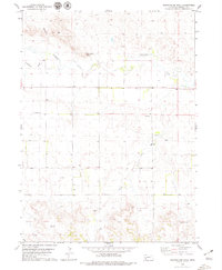
 1973 Potter 2 NE1975 Print · USGSWestern Nebraska farming and ranching landscapes are captured in detail during the early 1970s. Trace the intricate, winding course of the Lawrence Fork as it cuts through the high plains topography and established agricultural boundaries.
 - 1973 Map of Camp Clarke 3 SE, 1975 Print
 1973 Camp Clarke 3 SE1975 Print · USGSThe ranching and farming landscape of the Nebraska Panhandle comes into sharp focus during the early 1970s. Trace the rural crossroads at Redington or follow the waters of Pumpkin Creek and Lawrence Fork across the plains.
 - 1979 Map of Roundhouse Rock
 1979 Roundhouse Rock1979 Print · USGSMorrill County's high plains landscape is captured in the late 1970s, illustrating the vital role of water and geology in this ranching region. Genealogists and local historians can locate the Redington Cem or trace landmarks like Roundhouse Rock and Birdcage Gap.
 - 1979 Map of Potter 2 NE
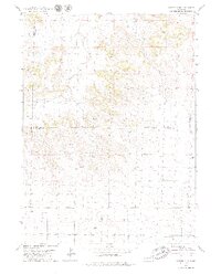 1979 Potter 2 NE1979 Print · USGSThe Nebraska panhandle in the late seventies reveals an active landscape of resource extraction and aviation. Researchers can trace the development of the local Oil Field and find landmarks like the Mayer Landing Strip and Lawrence Fork.2 unique versions available
 - 1979 Map of Redington
 1979 Redington1979 Print · USGSThe high plains of Morrill County are captured here in the late seventies as the regional oil industry expanded across the ranchlands. Genealogists and historians can locate the community of Redington, the Schuler-Olsen Landing Strip, and landmarks like Twin Mounds.2 unique versions available
End of results
Showing maps 1-13 of 13
Top cities of Morrill County
Frequently asked questions
- What are the different types of historical maps available for Morrill County?
- What is the oldest map of Morrill County?
- Where can I purchase historical maps of Morrill County for my home or office?
- Where can I download high-res historical maps of Morrill County?
- Are there historical topographic maps available for Morrill County?
- Is there historical aerial imagery available for Morrill County?
- Where are historical maps of Morrill County sourced from?