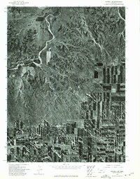
1973 Map of Potter 2 NE
USGS Topo · Published 1975About this map
The Lawrence Fork drainage system dominates this mid-1970s orthophotomosaic of western Nebraska. This specific sheet provides a high-contrast visual record of the land use patterns that define the region, showing a sharp divide between the untamed, eroded breaks of the creek valley and the rigid geometry of surrounding agricultural fields. The intricate drainage network of the Lawrence Fork carves through the landscape, revealing the complex topography of the high plains that is often obscured on standard line-drawn maps. This aerial perspective, captured in May 1973, preserves the exact footprint of dryland farming and grazing boundaries before modern irrigation or development could alter the historic section lines.
Find a feature on this map
1 named feature on this map. Tap any name to fly to it.
Don’t see what you’re looking for? This feature index may not catch every label — zoom into the map to look around manually.
Map Details
Editions of this 1973 Potter 2 NE Map
This is the sole edition of this map. No revisions or reprints were ever made.
Other maps of this area

1898 · Camp Clarke
USGS Topo · 1:125,000

1954 · Scottsbluff
USGS Topo · 1:250,000

1958 · Scottsbluff
USGS Topo · 1:250,000

1972 · Mud Springs SW
USGS Topo · 1:24,000

1972 · Horsehead Ranch
USGS Topo · 1:24,000

1973 · Potter 2 SW
USGS Topo · 1:24,000

1973 · Bridgeport SW
USGS Topo · 1:24,000

1973 · Potter 2 SE
USGS Topo · 1:24,000

1973 · Potter 2 NW
USGS Topo · 1:24,000
1973 · Camp Clarke 3 SE
USGS Topo · 1:24,000