
1972 Map of Horsehead Ranch
USGS Topo · Published 1975About this map
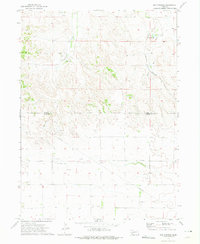
Horsehead Ranch lends its name to this High Plains landscape as it appeared in the early 1970s. Situated along the boundary where Morrill Co and Cheyenne Co meet, the terrain is defined by the drainages of Middle Creek and Greenwood Creek, which carve across the northern portion of the quadrangle. A notable concentration of energy infrastructure is evident, with multiple Oil Wells and a prominent Pipeline traversing the open range. Local navigation and commerce are marked by isolated points of interest such as the Radio Tower and the Mayer Landing Strip. For genealogists and local historians, the map preserves the location of Sanders Cem and small named locales including Walsh and Ickes, offering a precise record of rural settlement patterns and land use in this Nebraska panhandle region.
Find a feature on this map
12 named features on this map. Tap any name to fly to it.
Don’t see what you’re looking for? This feature index may not catch every label — zoom into the map to look around manually.
Map Details
Editions of this 1972 Horsehead Ranch Map
This is the sole edition of this map. No revisions or reprints were ever made.
Other maps of this area

1898 · Camp Clarke
USGS Topo · 1:125,000

1954 · Scottsbluff
USGS Topo · 1:250,000

1958 · Scottsbluff
USGS Topo · 1:250,000

1965 · Courthouse Rock
USGS Topo · 1:24,000

1972 · Mud Springs SW
USGS Topo · 1:24,000

1972 · Mud Springs SE
USGS Topo · 1:24,000
1972 · Mud Springs
USGS Topo · 1:24,000

1973 · Bridgeport SW
USGS Topo · 1:24,000

1973 · Potter 2 SE
USGS Topo · 1:24,000
1973 · Potter 2 NE
USGS Topo · 1:24,000