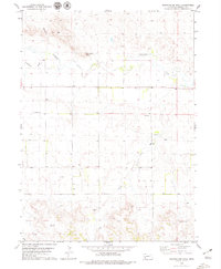
1979 Map of Roundhouse Rock
USGS Topo · Published 1979About this map
Roundhouse Rock and the surrounding high plains of Morrill County are documented here in the late 1970s, showcasing a landscape defined by cattle ranching and early energy exploration. The topography is marked by significant natural gaps and breaks, most notably Birdcage Gap, which provides passage through the northern bluffs. Water remains the critical factor for settlement and survival in this arid region, with the course of Pumpkin Creek and Middle Creek complemented by several named water sources like Spring and Duggers Spring. For genealogists, the Redington Cem stands as a primary point of interest in the northwestern corner. The map also records the footprint of local industry, including a Ford for crossing the creek, a Gravel Pit, and scattered evidence of petroleum interest indicated by an Oil Well and a Drill Hole.
Find a feature on this map
12 named features on this map. Tap any name to fly to it.
Don’t see what you’re looking for? This feature index may not catch every label — zoom into the map to look around manually.
Map Details
Editions of this 1979 Roundhouse Rock Map
This is the sole edition of this map. No revisions or reprints were ever made.
Other maps of this area

1898 · Camp Clarke
USGS Topo · 1:125,000

1954 · Scottsbluff
USGS Topo · 1:250,000

1958 · Scottsbluff
USGS Topo · 1:250,000

1965 · Bridgeport NW
USGS Topo · 1:24,000

1965 · South Bayard
USGS Topo · 1:24,000

1965 · Courthouse Rock
USGS Topo · 1:24,000
1965 · Bridgeport
USGS Topo · 1:24,000

1972 · Horsehead Ranch
USGS Topo · 1:24,000
1972 · Mud Springs
USGS Topo · 1:24,000

1973 · Bridgeport SW
USGS Topo · 1:24,000