Old Maps of Phelps County, Nebraska for Metal Detecting
Plan your next treasure hunt with 112 historic maps of Phelps County. Find old homesites, ghost towns, trails, and gathering spots that may be lost to time — perfect for identifying promising metal detecting locations.
- Locate forgotten sites: Uncover places like long-lost settlements, abandoned rail lines, or gathering spots.
- Plan better hunts: Use map overlays combined with LiDAR or satellite views to narrow in on historically rich areas.
- Made for detectorists: Thousands of hobbyists use these maps to discover relics, coins, and hidden history.
Use these historic maps to boost your research and find new opportunities beneath the surface of Phelps County.
Phelps County, NE maps
(112)- 1894 Map of Kearney
 1894 Kearney1894 Print · USGSKearney and the Platte River valley are captured in the late nineteenth century as a vital railroad junction and irrigation center. Genealogists and local historians can trace early settlements like Odessa and West Kearney, or study the complex river channels around Long Island and Evarts Island.2 unique versions available
 - 1896 Map of Lexington
 1896 Lexington1896 Print · USGSDawson and Gosper Counties in the mid-1890s are defined by the convergence of the Platte River and competing railroad lines. Genealogists can trace family settlements along the Union Pacific R. R. and the Burlington and Missouri River R. R., locating early sites like Elwood and Coyote.
 - 1896 Map of Holdrege
 1896 Holdrege1896 Print · USGSSouth-central Nebraska was a burgeoning network of rail towns and river settlements in the late nineteenth century. Genealogists can trace family roots along the Republican River valley in Alma, Bloomington, and Naponee, or explore the early growth of Holdrege as a vital railroad junction.5 unique versions available
 - 1896 Map of Kearney
 1896 Kearney1896 Print · USGSBuffalo County and the Platte River valley are captured in the late 1890s as the railroad network cemented the region's growth. Genealogists can locate family lands across townships like Williamsburg or trace the early paths of the Union Pacific R. R. and Kearney Canal.7 unique versions available
 - 1896 Map of Arapahoe
 1896 Arapahoe1896 Print · USGSThe Republican River valley thrived in the 1890s as a vital railroad corridor through south-central Nebraska and northern Kansas. Genealogists and local historians can trace the early rail stops and rural precincts like Arapahoe, Oxford, and the remote Rock Falls district.3 unique versions available
 - 1898 Map of Arapahoe, 1920 Print
 1898 Arapahoe1920 Print · USGSSouthwestern Nebraska was rapidly developing at the turn of the century as railroads mirrored the river valleys. Genealogists can trace family roots in towns like Arapahoe, Beaver City, and Oxford or locate landmarks like Rock Falls.2 unique versions available
 - 1899 Map of Lexington
 1899 Lexington1899 Print · USGSDawson and Gosper counties are captured during a period of rapid prairie development following the arrival of the transcontinental rails. Genealogists can trace the early grids of rail towns like Lexington and Bertrand or the spans of the Lexington Bridge.7 unique versions available
 - 1955 Map of Grand Island, 1967 Print
 1955 Grand Island1967 Print · USGSCentral Nebraska is seen here during a period of industrial and agricultural growth, centered on the vital Platte River corridor. Researchers can trace the mid-century footprints of the U S Naval Ammunition Depot and the Cornhusker Ordnance Plant.3 unique versions available
 - 1957 Map of Grand Island
 1957 Grand Island1957 Print · USGSCentral Nebraska and Northern Kansas are shown here during a period of massive hydraulic and military expansion in the mid-fifties. Researchers can trace the development of the Harlan County Reservoir and the massive wartime legacy of the Cornhusker Ordnance Plant.
 - 1958 Map of Grand Island
 1958 Grand Island1958 Print · USGSSouth-central Nebraska thrived as a rail and industrial hub during the late fifties, shaped by the braided Platte River. Genealogists and historians can trace rail lines like the Union Pacific RR through towns such as Kearney or locate the sprawling Cornhusker Ordnance Plant.
 - 1958 Map of Mascot, 1960 Print
 1958 Mascot1960 Print · USGSSouth-central Nebraska's rolling hills and township grids are captured here during the late fifties, showcasing the rural heart of the Missouri River Basin. Genealogists can locate Mascot and Oxford or trace family roots at Spring Grove Cem and Oxford Cem.2 unique versions available
 - 1958 Map of Oxford, 1960 Print
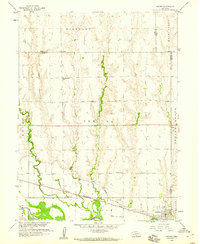 1958 Oxford1960 Print · USGSOxford and the Republican River valley are captured in the late fifties, showing a landscape defined by irrigation and rail. Genealogists can locate family-named sites such as Kellner Cem and several country schools including Hardscrabble Sch and Buffalo Sch.
 - 1961 Map of Elm Creek West, 1963 Print
 1961 Elm Creek West1963 Print · USGSCentral Nebraska's river valley and rail corridor are captured here in the early sixties, as the irrigation-fed landscape prepared for modern highway expansion. Genealogists can locate rural landmarks like Williamsburg Ch, East Twelfth Sch, and the small siding at Trued.
 - 1962 Map of Elm Creek East, 1964 Print
 1962 Elm Creek East1964 Print · USGSBuffalo County, Nebraska, is seen here during the transition to the interstate era in the early 1960s. Genealogists and local historians can trace the foundations of Elm Creek and Odessa or locate vanished landmarks like the Landing Field and early Gravel Pits.2 unique versions available
 - 1962 Map of Overton, 1964 Print
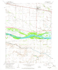 1962 Overton1964 Print · USGSOverton and the Platte River valley are captured in the early sixties as a major new interstate highway was taking shape. Genealogists and local historians can trace rural roots at Overton Cem, Adullam Ch, and the site of West Twelfth Sch.2 unique versions available
 - 1962 Map of Bertrand NW, 1964 Print
 1962 Bertrand NW1964 Print · USGSThe Platte River valley in the early sixties reveals a landscape in transition as the interstate highway began to carve through Nebraska's agricultural core. Genealogists can locate family-named landmarks like Robb Cem or trace early education at School No 3 and Spring Creek Sch.2 unique versions available
 - 1962 Map of Alfalfa Center, 1964 Print
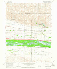 1962 Alfalfa Center1964 Print · USGSBuffalo County is shown during the early 1960s as a landscape in transition, where new highway construction began to parallel the historic rail lines. Researchers can trace rural school districts like School No 114 and family landmarks near Dove Hill Cem and Alfalfa Center.2 unique versions available
 - 1970 Map of Holdrege East, 1972 Print
 1970 Holdrege East1972 Print · USGSPhelps County, Nebraska, is seen here in the early 1970s as its rail-centered agricultural economy thrives. Researchers can trace the layout of HOLDREGE, locate rural landmarks like School No 7, and explore cemeteries such as Prairie Home.
 - 1970 Map of Axtell West, 1972 Print
 1970 Axtell West1972 Print · USGSThe rural prairie of Phelps and Kearney counties comes into focus in the early 1970s, showcasing the intricate irrigation network of the Mirage Canal. Local researchers can trace the rail corridor of the Burlington Northern through Axtell and Funk, or locate family sites like Fridhem Cem.
 - 1970 Map of Loomis, 1972 Print
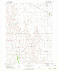 1970 Loomis1972 Print · USGSAgricultural life in Phelps County centered on the railroad siding at Loomis during the early 1970s. Genealogists and local historians can trace the rural landscape across Union and Laird townships, locating landmarks like the Shaw Cem and the Burlington Northern line.
 - 1970 Map of Bertrand SE, 1972 Print
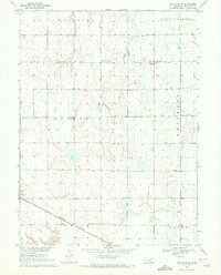 1970 Bertrand SE1972 Print · USGSThe Phelps County plains in the early seventies show a landscape of intensive irrigation and rail transport. Researchers can locate the Sandstrom Cem and trace the Burlington Northern tracks as they pass through Bertrand.
 - 1970 Map of Elm Creek SE, 1972 Print
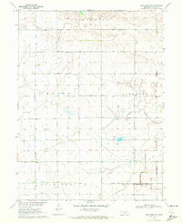 1970 Elm Creek SE1972 Print · USGSAgricultural life in Phelps County comes into focus during the early seventies, showing a highly organized landscape of section roads and irrigation. Genealogists and local researchers can locate the Magill Cemetery, School No 5, and the Emmaus Free Church among the farmsteads.
 - 1970 Map of Wilcox, 1972 Print
 1970 Wilcox1972 Print · USGSIn the early 1970s, the rural junction of Kearney and Phelps counties featured a landscape of conservation basins and rail corridors. Researchers can locate the Freewater Cem and St Johns Cem, or trace the path of the Burlington Northern and an Old Railroad Grade.
 - 1970 Map of Ragan, 1972 Print
 1970 Ragan1972 Print · USGSThe rural uplands of south-central Nebraska are captured here in the early 1970s, centered on the village of Ragan. Researchers can trace local genealogy and land use through landmarks like Antelope Cem, Immanuel Ch, and the Burlington Northern rail corridor.
 - 1970 Map of Kearney SW, 1972 Print
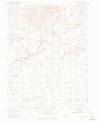 1970 Kearney SW1972 Print · USGSThe Nebraska plains southwest of Kearney show a landscape of high divides and agricultural engineering during the early seventies. Genealogists can trace property lines near North Creek or locate landmarks like the Aqueduct and Canal in Mirage.
Showing maps 1-25 of 112
Top cities of Phelps County
- Holdrege historical maps
- Bertrand historical maps
- Loomis historical maps
- Westmark historical maps
- Funk historical maps
- Atlanta historical maps
Frequently asked questions
- What are the different types of historical maps available for Phelps County?
- What is the oldest map of Phelps County?
- Where can I purchase historical maps of Phelps County for my home or office?
- Where can I download high-res historical maps of Phelps County?
- Are there historical topographic maps available for Phelps County?
- Is there historical aerial imagery available for Phelps County?
- Where are historical maps of Phelps County sourced from?