2020s Maps of Seward County, Nebraska
Explore 16 historic maps of Seward County from the 2020s. These maps offer a rare glimpse into what life looked like during the 2020s — showing old roads, neighborhoods, homes, and landmarks that have changed or disappeared over time.
Whether you're researching your family's past, planning a metal detecting trip, or studying how Seward County's landscape evolved across the 2020s, these high-resolution maps are a powerful tool for exploring the history of this region.
- Focus on a specific era: All maps on this page are from the 2020s, giving you a focused view of this time period.
- See what’s changed: Compare century-old streets, trails, and buildings to today's modern landscape using overlays and satellite layers.
- Research with precision: Use these maps for genealogy, historical research, land use analysis, or educational projects.
- View, download, or print: Maps are fully viewable online in high resolution, and can be downloaded or printed for your own records.
Start exploring Seward County's history through authentic maps from the 2020s. This is your window into the past.
Seward County, NE maps
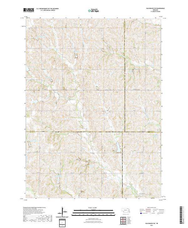
(16)- 2021 Map of Garland, 2021 Print
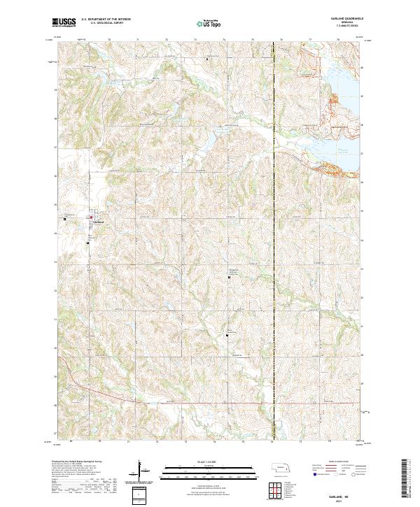 2021 Garland2021 Print · USGSGarland and the surrounding prairie of Seward and Lancaster Counties are captured here in the early 2020s. Researchers can trace rural heritage through numerous local burial sites like Germantown Cem and Mount Carmel Cem or explore the recreational trails surrounding Branched Oak Lake.
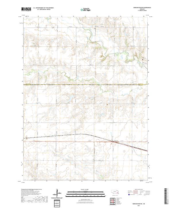
 - 2021 Map of Dorchester, 2021 Print
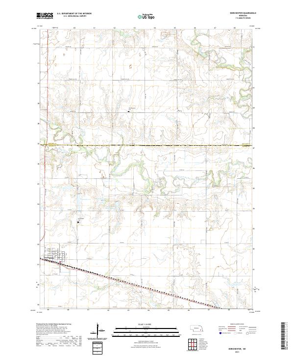 2021 Dorchester2021 Print · USGSThe borderlands of Saline and Seward counties are captured here in the early 2020s, centered on the village of Dorchester. Local researchers can trace family plots at Goldhammer Cem or follow the managed waters of the West Fork Big Blue River.
 - 2021 Map of Utica, 2021 Print
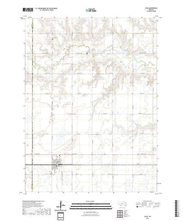 2021 Utica2021 Print · USGSThe village of Utica and the surrounding farmland of Seward County are captured here in the early twenty-first century. Researchers can trace rural lineages through local landmarks like Utica Cem, Blue Ridge Cem, and the waters of Lincoln Cr.
 - 2021 Map of Staplehurst, 2021 Print
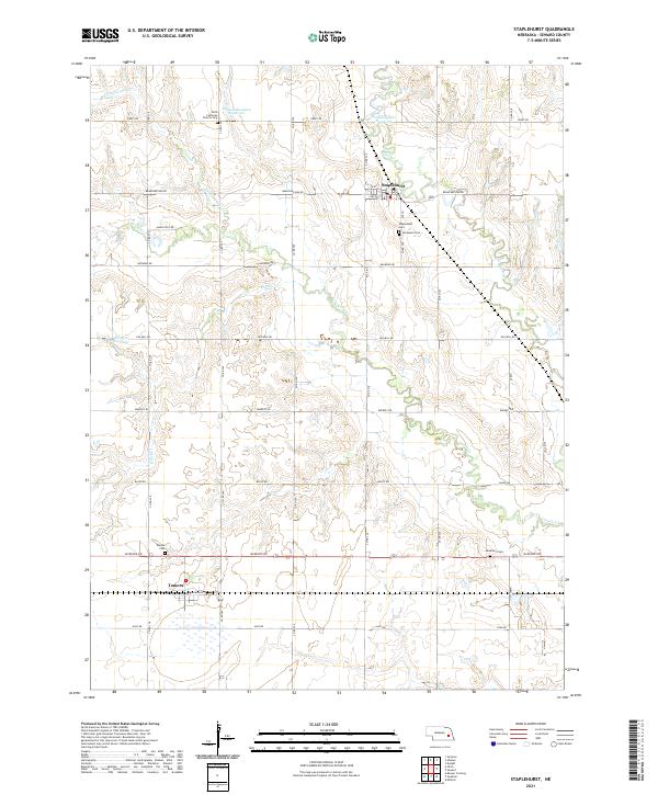 2021 Staplehurst2021 Print · USGSSeward County's agricultural heartland is documented here in the early 2020s, where the Big Blue River and Lincoln Cr meet. Researchers can trace family history through several local burial grounds, including Faith Lutheran Church Cem, Immanuel Cem, and Anderson Cem.
 - 2021 Map of Seward, 2021 Print
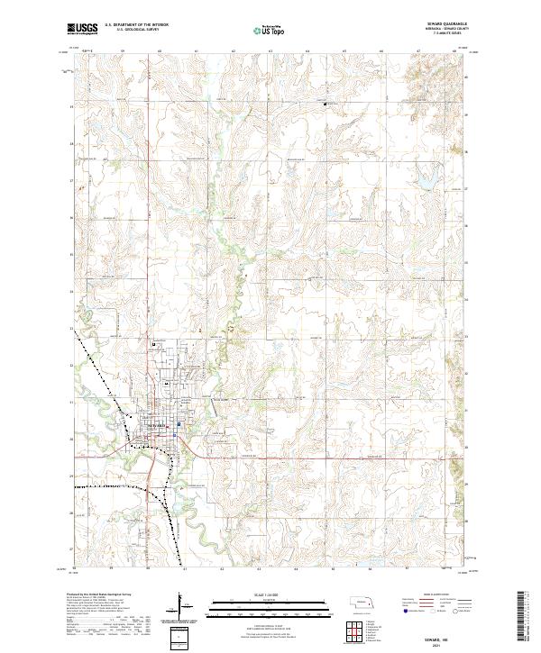 2021 Seward2021 Print · USGSSeward and the surrounding prairie were firmly established as an educational and civic center by the early 2020s. Researchers can trace local roots through the Seward County Courthouse, Seward Cem, and the campus of Concordia University Nebraska.
 - 2021 Map of Friend, 2021 Print
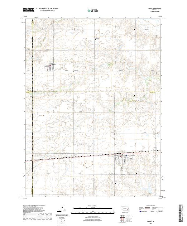 2021 Friend2021 Print · USGSSoutheast Nebraska’s rolling farm country is captured here in the early twenty-first century, centered on the historic crossroads of Friend and Cordova. Genealogists can trace rural family plots at Zastrow Cem and Johnson Creek Cem while mapping the waterways of N Fork Johnson Cr.
 - 2021 Map of Pleasant Dale, 2021 Print
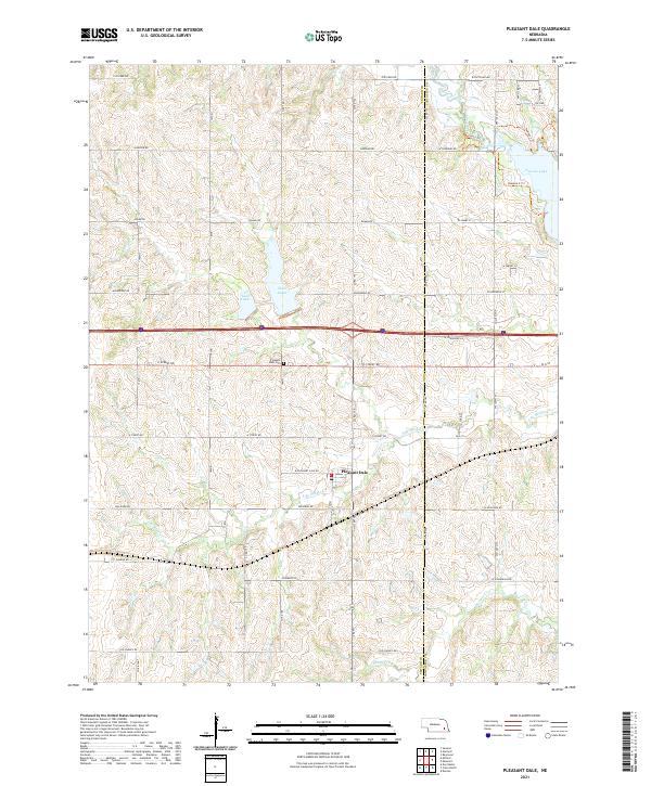 2021 Pleasant Dale2021 Print · USGSThe Seward and Lancaster County border comes alive in this contemporary survey of the Nebraska prairie. Researchers can trace local landmarks like Pleasant Dale Cem and the village of Pleasant Dale, or explore the shoreline of Pawnee Lake.
 - 2021 Map of Crete North, 2021 Print
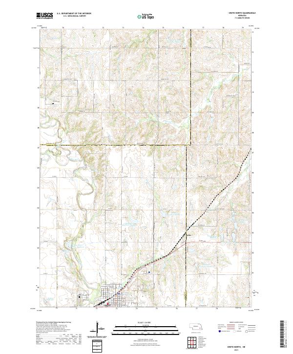 2021 Crete North2021 Print · USGSThe northern reaches of Crete and the surrounding farm country are captured here in the early 2020s. Researchers can trace rural lineages at Camden Cem and Riverside Cem or locate the tiny community of Berks along the corridor of Walnut Cr.
 - 2021 Map of Valparaiso SW, 2021 Print
 2021 Valparaiso SW2021 Print · USGSThe intersection of Butler, Saunders, Seward, and Lancaster counties comes into focus in this recent survey of Nebraska's agricultural heartland. Researchers can trace the modern water management system through numerous landmarks like Redtail Lake, Kozisek Reservoir, and Oak Cr.
 - 2021 Map of Beaver Crossing, 2021 Print
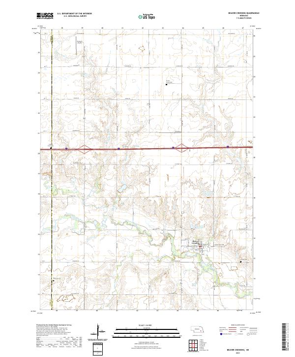 2021 Beaver Crossing2021 Print · USGSBeaver Crossing and the surrounding Seward County farmlands are documented here in the early twenty-first century. Researchers can locate several community landmarks including Prairie Grove Cem, Flying-V Airport, and the meanders of the West Fork Big Blue River.
 - 2021 Map of Dorchester NW, 2021 Print
 2021 Dorchester NW2021 Print · USGSThis rural landscape on the Seward and Saline county line shows a classic Nebraska farming district in the early twenty-first century. Genealogists and local historians can locate early burial sites at Englehaupt Cem and West Mills Cem or trace the path of the West Fork Big Blue River.
 - 2021 Map of Goehner, 2021 Print
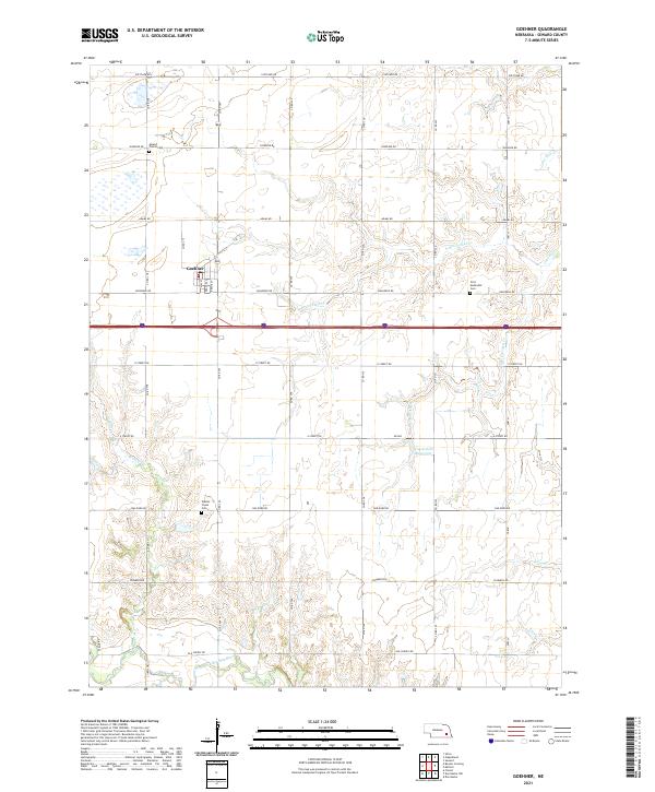 2021 Goehner2021 Print · USGSGoehner and the surrounding Seward County farmland are mapped here during the early twenty-first century. Genealogists and local researchers can locate established burial sites like Mound Prairie Cem and First Methodist Cem among the tributaries of the West Fork Big Blue River.
 - 2021 Map of Milford, 2021 Print
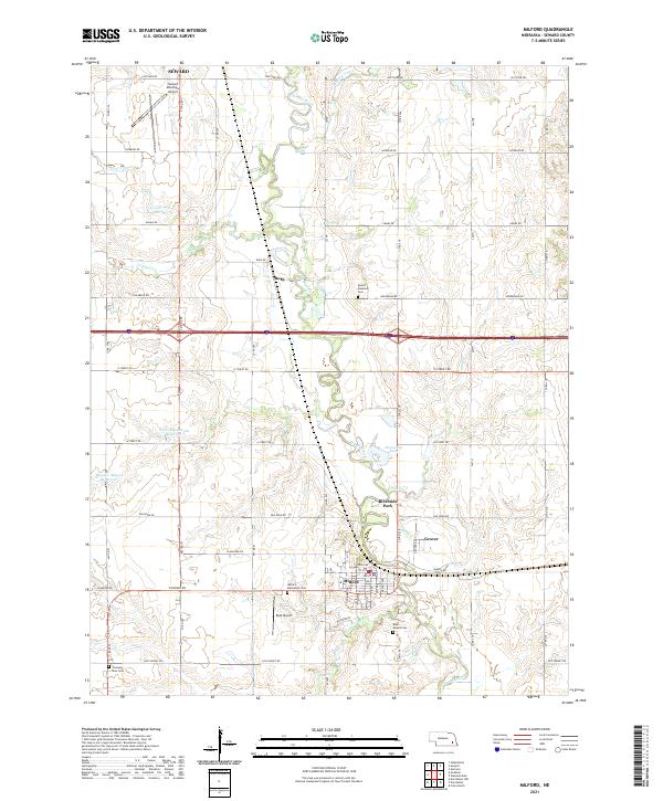 2021 Milford2021 Print · USGSSeward County's agricultural and river landscape is captured here in the early 2020s. Researchers can trace family history at Mount Pleasant Cem, locate landmarks like Roth Airport, and follow the winding path of the Big Blue River.
 - 2021 Map of Dwight, 2021 Print
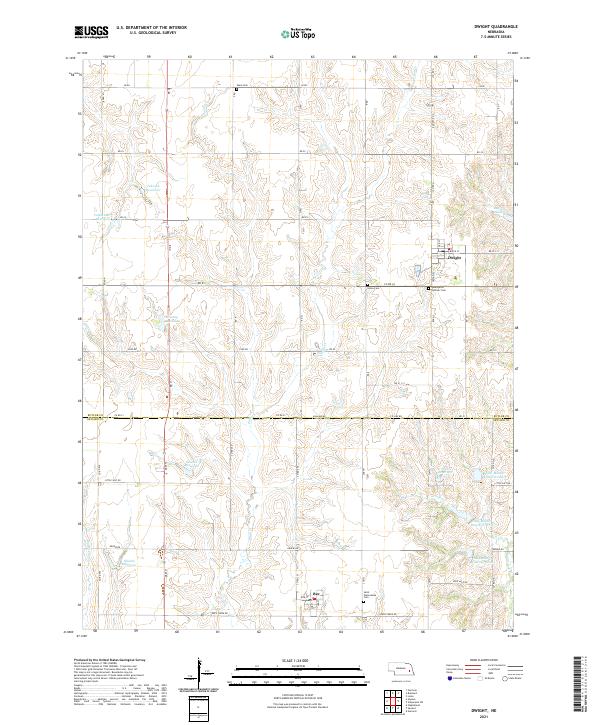 2021 Dwight2021 Print · USGSThe agricultural plains of Butler and Seward Counties are captured here in the early twenty-first century. Genealogists and local historians can trace rural property lines and burial sites like Assumption Catholic Cem and Saint Wenceslaus Cem.
 - 2021 Map of Surprise, 2021 Print
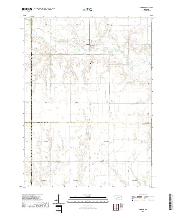 2021 Surprise2021 Print · USGSThe village of Surprise and the upper reaches of the Big Blue River are captured here at the start of the 2020s. Genealogists and local historians can trace the four-county boundary lines and locate landmarks like the Blue Valley Cem and Aldrich Reservoir.
 - 2021 Map of Ulysses, 2021 Print
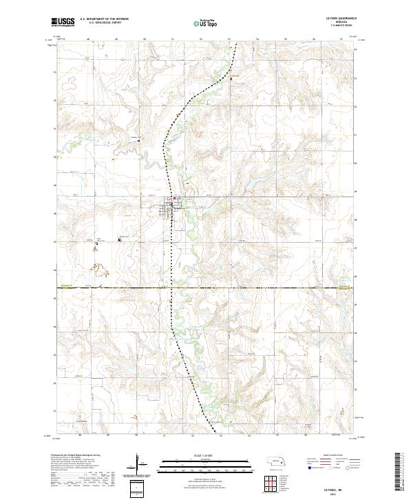 2021 Ulysses2021 Print · USGSThe village of Ulysses and its rural Butler County surroundings are captured here at the start of the 2020s. Genealogists can trace family plots at Ulysses Cem, Saint Marys Cem, and Grim Cem along the branches of the Big Blue River.
End of results
Showing maps 1-16 of 16
Top cities of Seward County
- Seward historical maps
- Milford historical maps
- Utica historical maps
- Beaver Crossing historical maps
- Staplehurst historical maps
- Garland historical maps
See more
Frequently asked questions
- What are the different types of historical maps available for Seward County?
- What is the oldest map of Seward County?
- Where can I purchase historical maps of Seward County for my home or office?
- Where can I download high-res historical maps of Seward County?
- Are there historical topographic maps available for Seward County?
- Is there historical aerial imagery available for Seward County?
- Where are historical maps of Seward County sourced from?