1960s Maps of Wayne County, Nebraska
Explore 12 historic maps of Wayne County from the 1960s. These maps offer a rare glimpse into what life looked like during the 1960s — showing old roads, neighborhoods, homes, and landmarks that have changed or disappeared over time.
Whether you're researching your family's past, planning a metal detecting trip, or studying how Wayne County's landscape evolved across the 1960s, these high-resolution maps are a powerful tool for exploring the history of this region.
- Focus on a specific era: All maps on this page are from the 1960s, giving you a focused view of this time period.
- See what’s changed: Compare century-old streets, trails, and buildings to today's modern landscape using overlays and satellite layers.
- Research with precision: Use these maps for genealogy, historical research, land use analysis, or educational projects.
- View, download, or print: Maps are fully viewable online in high resolution, and can be downloaded or printed for your own records.
Start exploring Wayne County's history through authentic maps from the 1960s. This is your window into the past.
Wayne County, NE maps
(12)- 1963 Map of Hoskins, 1964 Print
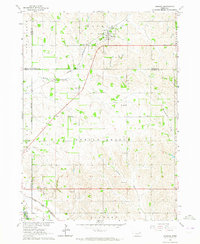 1963 Hoskins1964 Print · USGSWayne and Stanton County farmsteads and rural school districts are captured here in the early 1960s. Genealogists can trace family locations near landmarks like Trinity Cem, Peace Ch, and several historic school sites including School No 10.2 unique versions available
 - 1963 Map of Pilger, 1964 Print
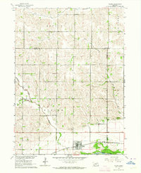 1963 Pilger1964 Print · USGSIn the early sixties, the Elkhorn River valley around Stanton County was a landscape of rail-served villages and a dense network of country school districts. Genealogists and local historians can trace the exact locations of School No 43, School No 7, and the Pilger Cem, alongside the Chicago and North Western rail corridor.
 - 1963 Map of Wayne SW, 1964 Print
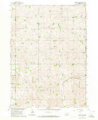
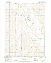
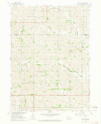 1963 Wayne SW1964 Print · USGSNortheast Nebraska farmland during the early sixties is shown here as a network of rural schools and small creek drainages. Researchers can locate the settlement of Spurville and trace ancestral sites like Bethlehem Cem or School No 23.
 - 1963 Map of Altona, 1964 Print
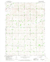
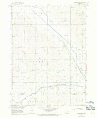
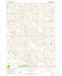 1963 Altona1964 Print · USGSCuming and Wayne Counties in the early sixties reveal a landscape of disciplined prairie farming and local school districts. Researchers can trace the legacy of early settlers at the Norwegian Cem and locate many rural schoolhouses, from School No 32 to School No 17.
 - 1963 Map of Winside, 1964 Print
 1963 Winside1964 Print · USGSWayne County agriculture and rail transport intersect in the early sixties near the village of Winside. Genealogists and researchers can trace local landmarks like Pleasantview Cemetery, School No 62, and the Chicago and North Western rail line.
 - 1963 Map of Norfolk NE, 1964 Print
 1963 Norfolk NE1964 Print · USGSThe rural border of Pierce and Wayne Counties is shown in the early sixties as a thriving network of prairie farms and townships. Researchers can locate community anchors like Swedish Cemetery, Zion Church, and the Chicago and North Western rail line.2 unique versions available
 - 1963 Map of Wayne, 1964 Print
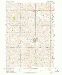
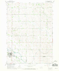
 1963 Wayne1964 Print · USGSWayne and its surrounding townships are shown in the early sixties, centered on the State Teachers College. Researchers can trace the Chicago and North Western line and find rural landmarks like Theophilus Ch or School No 88.
 - 1966 Map of Altona NW, 1967 Print
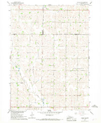
 1966 Altona NW1967 Print · USGSAgricultural Wayne County is captured in the mid-1960s as a landscape of rural school districts and winding creeks. Genealogists can trace family landmarks like La Porte Cem, St Pauls Ch, and numerous schoolhouses from School No 47 to School No 64.
 - 1966 Map of Altona SE, 1968 Print
 1966 Altona SE1968 Print · USGSNortheast Nebraska in the mid-1960s shows a landscape defined by township lines and tribal boundaries across Wayne and Cuming counties. Genealogists can trace rural family sites near St Peters Ch and historic one-room schoolhouses like School No 4 and School No 66.
 - 1966 Map of Altona NE, 1968 Print
 1966 Altona NE1968 Print · USGSThurston and Wayne County farmsteads and tribal lands are meticulously mapped in the mid-sixties as the local hydrology was being reshaped. Genealogists can locate family landmarks like Pleasant Valley Cem and McQuistan Sch alongside the path of the Chicago and North Western rail line.
 - 1967 Map of Wakefield SW, 1969 Print
 1967 Wakefield SW1969 Print · USGSDixon and Wayne Counties were defined by a robust rail-and-water network in the late sixties. Genealogists and local historians can locate rural landmarks like Cozy Nest Sch, Immanuel Ch, and the Wakefield Cem along Logan Creek.
 - 1967 Map of Wakefield, 1969 Print
 1967 Wakefield1969 Print · USGSWakefield and the surrounding farm townships were at a transition point in the late 1960s as railroad and water infrastructure shifted. Researchers can trace the Chicago and North Western rail line and the Indian Reservation Boundary near Logan Creek.
End of results
Showing maps 1-12 of 12
Top cities of Wayne County
- Wayne historical maps
- Winside historical maps
- Hoskins historical maps
- Carroll historical maps
- Sholes historical maps
Frequently asked questions
- What are the different types of historical maps available for Wayne County?
- What is the oldest map of Wayne County?
- Where can I purchase historical maps of Wayne County for my home or office?
- Where can I download high-res historical maps of Wayne County?
- Are there historical topographic maps available for Wayne County?
- Is there historical aerial imagery available for Wayne County?
- Where are historical maps of Wayne County sourced from?