1970s Maps of Enterprise, Clark County
Explore 2 historic maps of Enterprise from the 1970s. These maps offer a rare glimpse into what life looked like during the 1970s — showing old roads, neighborhoods, homes, and landmarks that have changed or disappeared over time.
Whether you're researching your family's past, planning a metal detecting trip, or studying how Enterprise's landscape evolved across the 1970s, these high-resolution maps are a powerful tool for exploring the history of this region.
- Focus on a specific era: All maps on this page are from the 1970s, giving you a focused view of this time period.
- See what’s changed: Compare century-old streets, trails, and buildings to today's modern landscape using overlays and satellite layers.
- Research with precision: Use these maps for genealogy, historical research, land use analysis, or educational projects.
- View, download, or print: Maps are fully viewable online in high resolution, and can be downloaded or printed for your own records.
Start exploring Enterprise's history through authentic maps from the 1970s. This is your window into the past.
Enterprise, Clark County maps
(2)- 1972 Map of Blue Diamond SE, 1974 Print
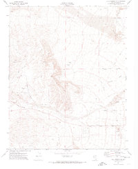 1972 Blue Diamond SE1974 Print · USGSClark County in the early seventies shows the desert beginning to yield to the expanding infrastructure of the Las Vegas Valley. Genealogists and historians can trace the early layout of Flamingo Rd and Sunset Road alongside industrial prospects and the Union Pacific rail line at Bard.2 unique versions available
 - 1973 Map of Las Vegas SW, 1977 Print
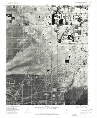 1973 Las Vegas SW1977 Print · USGSSouthwest of the Las Vegas valley in the early seventies, the desert floor is still defined by the Union Pacific line and emerging infrastructure. Trace the early layout of Mc Carran Field and the isolated settlement at Arden.
End of results
Showing maps 1-2 of 2
Frequently asked questions
- What are the different types of historical maps available for Enterprise?
- What is the oldest map of Enterprise?
- Where can I purchase historical maps of Enterprise for my home or office?
- Where can I download high-res historical maps of Enterprise?
- Are there historical topographic maps available for Enterprise?
- Is there historical aerial imagery available for Enterprise?
- Where are historical maps of Enterprise sourced from?