Old Maps of Enterprise, Nevada for Genealogy
Trace your family roots with 43 historic maps of Enterprise. These high-res maps reveal old neighborhoods, homesites, landmarks, and streets — helping you uncover where your ancestors lived and how the area evolved over time.
- Explore historic neighborhoods: Identify where your relatives may have lived in the 1800s or 1900s.
- Compare maps over time: Trace the changes in streets, buildings, and landmarks for multi-generational research.
- Perfect for genealogy & ancestry research: Used by family historians and researchers to map out lineage and migration.
These maps are an incredible resource for exploring your personal connection to Enterprise's past.
Enterprise, NV maps
(43)- 1907 Map of Las Vegas, 1956 Print
 1907 Las Vegas1956 Print · USGSSouthern Nevada is shown at a pivotal moment in the early 1900s as the rail network began to transform the desert landscape. Genealogists and historians can locate early homesteads and landmarks like Las Vegas Ranch, Mormon Well, and the Stirling Mine.
 - 1908 Map of Las Vegas
 1908 Las Vegas1908 Print · USGSSouthern Nevada was a frontier of rail and ranching in the years before major desert expansion. Trace the early footprints of Las Vegas and its surrounding outposts like Arden, Bracken, and the Stirling Mine.4 unique versions available
 - 1910 Map of Ivanpah, 1957 Print
 1910 Ivanpah1957 Print · USGSThe Mojave high desert at the start of the twentieth century was a landscape of remote mining camps and vital railroad junctions. Trace the early industrial footprint of Vanderbilt, the Copper World Mine, and the rail stops at Nipton and Kelso.
 - 1912 Map of Ivanpah
 1912 Ivanpah1912 Print · USGSThe Mojave high desert at the border of California and Nevada was a bustling corridor of mining and transcontinental rail at the start of the century. Genealogists and historians can trace defunct settlements and industrial sites like the abandoned copper smelter, Good Springs, and the Old Traction Road.5 unique versions available
 - 1942 Map of Ivanpah
 1942 Ivanpah1942 Print · USGSThe Mojave Desert frontier comes into focus during the early war years, showing a landscape shaped by mining and rail. You can trace the path of the Union Pacific through remote stops like Nipton, Goodsprings, and the junction at Barnwell.
 - 1947 Map of Kingman, 1948 Print
 1947 Kingman1948 Print · USGSThe tri-state Mojave desert region comes into focus during the late 1940s, as post-war travel began to surge along U S 66. Genealogists and historians can trace the mining-and-rail economy through the Atchison Topeka and Santa Fe line, the Copper World Mine, and old settlements like Oatman or Goodsprings.2 unique versions available
 - 1948 Map of Kingman
 1948 Kingman1948 Print · USGSThe Mojave Desert at the dawn of the fifties shows a landscape of deep canyons and booming mines along the Arizona and Nevada border. Genealogists and historians can trace rail-stop towns and mining claims like Oatman, Searchlight, and the Mohawk Mine.
 - 1952 Map of Blue Diamond, 1953 Print
 1952 Blue Diamond1953 Print · USGSBlue Diamond and the surrounding Nevada desert appear here in the early fifties during a period of active quarrying and ranching. Genealogists and historians can trace family-named outposts like Bar Nothing Ranch or Oliver Ranch and locate early industry at the Blue Diamond Mine.5 unique versions available
 - 1952 Map of Las Vegas, 1956 Print
 1952 Las Vegas1956 Print · USGSLas Vegas and its early suburbs are captured here in the early fifties during a period of rapid post-war aviation and industrial expansion. Researchers can trace family-named sites like Warm Springs Ranch and vanished landmarks like the Las Vegas Race Track or Mc Carran Field.
 - 1954 Map of Las Vegas
 1954 Las Vegas1954 Print · USGSLas Vegas and the Mojave Desert are shown in the early fifties as the region's military and recreational footprint expanded. Genealogists and historians can trace the early layout of North Las Vegas, the sites of Indian Springs Air Force Base, and long-established towns like Bunkerville.5 unique versions available
 - 1954 Map of Kingman, 1964 Print
 1954 Kingman1964 Print · USGSThe High Desert borderlands come to life in the mid-fifties, showing the intersection of mining legacies and massive river projects. Researchers can trace old rail stops like Roach Station, mining sites such as Chloride, and river landmarks like Searchlight Ferry.4 unique versions available
 - 1955 Map of Kingman
 1955 Kingman1955 Print · USGSThe Mojave Desert and Colorado River corridor come alive in the mid-fifties, showing a landscape of mining camps and rail junctions. Trace the river to the Searchlight Ferry or locate old desert mining sites like Goldroad and the Great Monster Mine.
 - 1957 Map of Las Vegas
 1957 Las Vegas1957 Print · USGSSouthern Nevada in the mid-fifties is a landscape of massive federal ranges and the early growth of Las Vegas. Researchers can trace the development of McCarran Field, the expansive Lake Mead National Recreation Area, and the industrial footprint of Henderson.
 - 1958 Map of Kingman
 1958 Kingman1958 Print · USGSThe tri-state desert borders of Arizona, Nevada, and California are shown in the late fifties as a network of mining camps and river crossings. Genealogists and historians can trace the legacy of remote outposts like Oatman, Chloride, and the Searchlight Ferry along the Colorado River.2 unique versions available
 - 1959 Map of Las Vegas
 1959 Las Vegas1959 Print · USGSSouthern Nevada in the late fifties was a landscape of rapid suburban growth and massive federal installations. Genealogists and historians can trace early housing at Victory Village, the grounds of Camp Desert Rock, and the remote Tule Springs Ranch.
 - 1960 Map of Kingman
 1960 Kingman1960 Print · USGSThe high desert landscape of the Arizona-Nevada border comes alive in the mid-twentieth century, showcasing the rise of recreation alongside deep-rooted mining history. Genealogists and historians can trace the roots of towns like Kingman and Oatman, or locate remote sites like the Lucky Dutchman Mine and Santa Claus.3 unique versions available
 - 1960 Map of Goodsprings, 1961 Print
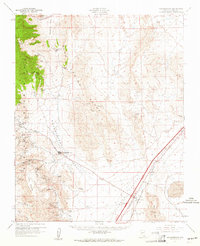 1960 Goodsprings1961 Print · USGSIn the arid desert of southern Nevada during the early sixties, the mining district around Goodsprings remains a prominent fixture of the landscape. Researchers can trace dozens of specific claims like the Yellow Pine Mine and Bluejay Mine, or locate the isolated settlement of Jean near the Union Pacific tracks.2 unique versions available
 - 1960 Map of Sloan, 1961 Print
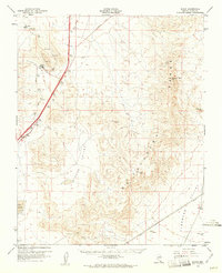 1960 Sloan1961 Print · USGSThe Clark County desert comes into focus in the early 1960s as a corridor of rail industry and mountain terrain. Trace the Union Pacific line through Sloan and Erie, or locate industrial landmarks like the Quarries and the Bard (Site).3 unique versions available
 - 1962 Map of Las Vegas
 1962 Las Vegas1962 Print · USGSSouthern Nevada is captured here during a period of significant military and industrial growth in the early sixties. Researchers can trace the development of Las Vegas alongside the Magnesium Plant in Henderson and the expansive Nellis Air Force Base.
 - 1967 Map of Las Vegas SW, 1968 Print
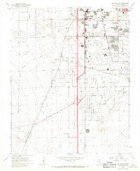 1967 Las Vegas SW1968 Print · USGSThe southern Las Vegas valley in the mid-1960s was a desert landscape undergoing a dramatic industrial and recreational transformation. Local historians can trace early landmarks like the Stardust International Raceway and the Union Pacific Railroad stops at Arden and Bracken.5 unique versions available
 - 1972 Map of Blue Diamond SE, 1974 Print
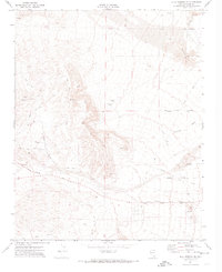 1972 Blue Diamond SE1974 Print · USGSClark County in the early seventies shows the desert beginning to yield to the expanding infrastructure of the Las Vegas Valley. Genealogists and historians can trace the early layout of Flamingo Rd and Sunset Road alongside industrial prospects and the Union Pacific rail line at Bard.2 unique versions available
 - 1973 Map of Las Vegas SW, 1977 Print
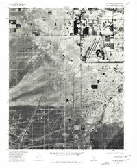 1973 Las Vegas SW1977 Print · USGSSouthwest of the Las Vegas valley in the early seventies, the desert floor is still defined by the Union Pacific line and emerging infrastructure. Trace the early layout of Mc Carran Field and the isolated settlement at Arden.
 - 1985 Map of Mesquite Lake
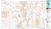 1985 Mesquite Lake1985 Print · USGSThe high desert along the Nevada-California line is captured here in the mid-1980s, showcasing a landscape defined by historic mining and transit. Researchers can trace numerous old claims like the Potosi Mine and Yellow Pine Mine or follow the historic Old Spanish Trail.2 unique versions available
 - 1986 Map of Las Vegas
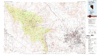 1986 Las Vegas1986 Print · USGSThe Mojave Desert landscape around mid-1980s Las Vegas reveals a city in transition, surrounded by vast federal preserves and the high peaks of the Spring Mountains. Trace the development of Henderson and Arden, or locate remote landmarks like Gagnier Station and the Calico Hills.4 unique versions available
 - 1989 Map of Bird Spring, 1990 Print
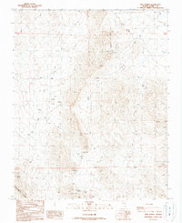 1989 Bird Spring1990 Print · USGSThe Bird Spring Range and its desert mining landscape come to life in this late twentieth-century survey. Trace a history of excavation through the Arden Quarries, the Nevada Royale Quarries, and the namesake Bird Spring.
Showing maps 1-25 of 43
Frequently asked questions
- What are the different types of historical maps available for Enterprise?
- What is the oldest map of Enterprise?
- Where can I purchase historical maps of Enterprise for my home or office?
- Where can I download high-res historical maps of Enterprise?
- Are there historical topographic maps available for Enterprise?
- Is there historical aerial imagery available for Enterprise?
- Where are historical maps of Enterprise sourced from?