Old Maps of Nelson, Nevada for Academic Research
Study the evolution of Nelson with 17 high-resolution historic maps. Whether you're teaching, researching, or modeling changes in land use, these maps provide essential visual documentation of urban, environmental, and geographic change.
- Analyze long-term change: Track patterns in development, transportation, and natural features.
- Ideal for environmental or urban studies: Support academic projects with primary historical map data.
- Use in the classroom or lab: Educators and researchers rely on these maps to bring historical context to life.
These maps are a powerful tool for teaching, research, and visualizing how Nelson has changed over the decades.
Nelson, NV maps
(17)- 1886 Map of Camp Mohave
 1886 Camp Mohave1886 Print · USGSThe Colorado River and the Cerbat mining districts define this territory during the mid-1880s. Genealogists and historians can trace the early rail stops at Kingman and Beale, or find the locations of frontier mining camps like Chloride and Mineral Park.
 - 1892 Map of Camp Mohave
 1892 Camp Mohave1892 Print · USGSThe Colorado River frontier in the 1890s reveals a network of isolated mining camps and military outposts. Trace the early river-crossing economy and mining boomtowns through Eldorado Ferry, the Patterson Mine, and the military station at Camp Mohave.8 unique versions available
 - 1926 Map of Nelson
 1926 Nelson1926 Print · USGSThe Colorado River borderlands in the mid-twenties appear here as a landscape of desert canyons and future infrastructure. Researchers can trace the original river course through Eldorado Canyon and locate early sites like Nelson and the Middle Black Canyon Dam Site.
 - 1942 Map of Camp Mohave
 1942 Camp Mohave1942 Print · USGSThe tri-state borderlands of Nevada, Arizona, and California are captured here in the early 1940s, highlighting a landscape of deep canyons and high-desert mining camps. Researchers can trace historic rail lines and find remote outposts like Searchlight, Nelson, and the riverfront Fort Mohave Indian Reservation.
 - 1947 Map of Kingman, 1948 Print
 1947 Kingman1948 Print · USGSThe tri-state Mojave desert region comes into focus during the late 1940s, as post-war travel began to surge along U S 66. Genealogists and historians can trace the mining-and-rail economy through the Atchison Topeka and Santa Fe line, the Copper World Mine, and old settlements like Oatman or Goodsprings.2 unique versions available
 - 1948 Map of Kingman
 1948 Kingman1948 Print · USGSThe Mojave Desert at the dawn of the fifties shows a landscape of deep canyons and booming mines along the Arizona and Nevada border. Genealogists and historians can trace rail-stop towns and mining claims like Oatman, Searchlight, and the Mohawk Mine.
 - 1954 Map of Kingman, 1964 Print
 1954 Kingman1964 Print · USGSThe High Desert borderlands come to life in the mid-fifties, showing the intersection of mining legacies and massive river projects. Researchers can trace old rail stops like Roach Station, mining sites such as Chloride, and river landmarks like Searchlight Ferry.4 unique versions available
 - 1955 Map of Kingman
 1955 Kingman1955 Print · USGSThe Mojave Desert and Colorado River corridor come alive in the mid-fifties, showing a landscape of mining camps and rail junctions. Trace the river to the Searchlight Ferry or locate old desert mining sites like Goldroad and the Great Monster Mine.
 - 1958 Map of Kingman
 1958 Kingman1958 Print · USGSThe tri-state desert borders of Arizona, Nevada, and California are shown in the late fifties as a network of mining camps and river crossings. Genealogists and historians can trace the legacy of remote outposts like Oatman, Chloride, and the Searchlight Ferry along the Colorado River.2 unique versions available
 - 1958 Map of Nelson, 1959 Print
 1958 Nelson1959 Print · USGSThe Eldorado Canyon mining district is captured here in the late fifties, during a period of active high-desert exploration. Genealogists and historians can locate dozens of individual claims and camps, including the Techatticup Mine, Capital Camp, and the Occidental Mine.2 unique versions available
 - 1960 Map of Kingman
 1960 Kingman1960 Print · USGSThe high desert landscape of the Arizona-Nevada border comes alive in the mid-twentieth century, showcasing the rise of recreation alongside deep-rooted mining history. Genealogists and historians can trace the roots of towns like Kingman and Oatman, or locate remote sites like the Lucky Dutchman Mine and Santa Claus.3 unique versions available
 - 1983 Map of Boulder City
 1983 Boulder City1983 Print · USGSThe Nevada-Arizona borderlands come alive in the early 1980s, centered on the Colorado River and the industrial activity of the surrounding ranges. Researchers can locate dozens of historic prospects such as the Klondyke Mine, Liberty Mine, and Dixie Queen Mine.2 unique versions available
 - 1984 Map of Nelson
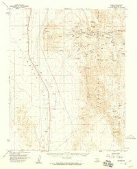
 1984 Nelson1984 Print · USGSMining operations in the southern Nevada desert were in a period of transition in the mid-eighties as the old district around Nelson met the boundary of federal recreation lands. Researchers can trace dozens of specific lode sites including the Techatticup Mine, Mockingbird Tunnels, and Capitol Camp.
 - 2012 Map of Nelson, 2012 Print
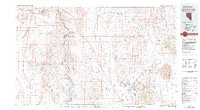
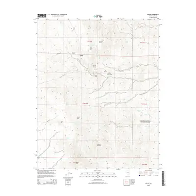
 2012 Nelson2012 Print · USGSCovers Nelson, including Clark County, United States, and other nearby areas
 - 2014 Map of Nelson, 2014 Print
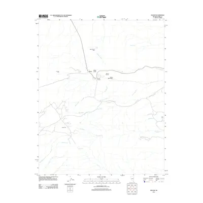
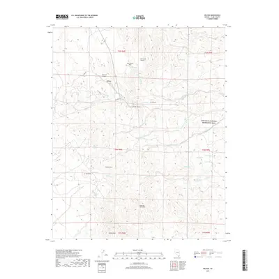
 2014 Nelson2014 Print · USGSCovers Nelson, including Clark County, United States, and other nearby areas
 - 2018 Map of Nelson, 2018 Print
 2018 Nelson2018 Print · USGSCovers Nelson, including Clark County, United States, and other nearby areas
 - 2021 Map of Nelson, 2021 Print
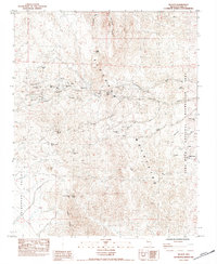
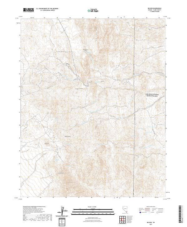 2021 Nelson2021 Print · USGSSouthern Nevada's high desert reveals its complex terrain and small outposts in the early 2020s. Researchers can trace the drainage patterns of Techatticup Wash and locate vital desert water sources like Miners Spring and Aztec Spring near the settlement of Nelson.
End of results
Showing maps 1-17 of 17
Top cities near Nelson
Frequently asked questions
- What are the different types of historical maps available for Nelson?
- What is the oldest map of Nelson?
- Where can I purchase historical maps of Nelson for my home or office?
- Where can I download high-res historical maps of Nelson?
- Are there historical topographic maps available for Nelson?
- Is there historical aerial imagery available for Nelson?
- Where are historical maps of Nelson sourced from?