Old Maps of Silver Peak, Nevada for Genealogy
Trace your family roots with 15 historic maps of Silver Peak. These high-res maps reveal old neighborhoods, homesites, landmarks, and streets — helping you uncover where your ancestors lived and how the area evolved over time.
- Explore historic neighborhoods: Identify where your relatives may have lived in the 1800s or 1900s.
- Compare maps over time: Trace the changes in streets, buildings, and landmarks for multi-generational research.
- Perfect for genealogy & ancestry research: Used by family historians and researchers to map out lineage and migration.
These maps are an incredible resource for exploring your personal connection to Silver Peak's past.
Silver Peak, NV maps
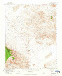
(15)- 1898 Map of Silver Peak, 1954 Print
 1898 Silver Peak1954 Print · USGSEsmeralda County mining camps and remote desert springs are captured here at the close of the nineteenth century. Researchers can trace the early industrial infrastructure of the Drinkwater Mine and the Silver Peak R.R. near the town of Blair.
 - 1900 Map of Silver Peak
 1900 Silver Peak1900 Print · USGSSilver Peak and the surrounding mining districts were centers of industry at the turn of the century. Genealogists and historians can trace old wagon routes through Emigrant Pass and locate remote desert sites like the Drinkwater Mine or Tarantula Spring.5 unique versions available
 - 1908 Map of Lida
 1908 Lida1908 Print · USGSEsmeralda County enters its mining peak at the start of the twentieth century as rail lines and boomtowns transform the high desert. Researchers can trace the exact layout of the Tonopah and Goldfield RR, find remote camps like Diamondfield, and locate the Rattlesnake Mine.
 - 1913 Map of Lida
 1913 Lida1913 Print · USGSThe Nevada and California borderlands appear here at the peak of the gold rush era, centered on the bustling streets of Goldfield. Genealogists and historians can trace the early rail networks of the Bullfrog Goldfield RR and locate camps like Gen Thomas Camp or the remote Palmetto Mine.5 unique versions available
 - 1954 Map of Goldfield, 1967 Print
 1954 Goldfield1967 Print · USGSThe Nevada desert during the early Cold War era shows the convergence of traditional mining districts and military expansion. Genealogists and historians can trace the Tonopah and Tidewater Railroad route and locate remote sites like Gold Point and Scottys Castle.3 unique versions available
 - 1955 Map of Goldfield
 1955 Goldfield1955 Print · USGSThe Nevada desert in the mid-fifties reveals a landscape of mining camps and military expansion. You can trace legacy sites from the Klondike Mine to Gold Point, and locate remote outposts like Bonnie Claire and Staininger Ranch at the edge of Death Valley.
 - 1958 Map of Goldfield
 1958 Goldfield1958 Print · USGSThe Nevada-California borderlands in the late fifties show a landscape defined by mining history and emerging military ranges. Researchers can trace old routes to Scotty's Castle, identify the locations of Numerous mines near Gold Point, and find Goldfield at its peak.2 unique versions available
 - 1962 Map of Goldfield
 1962 Goldfield1962 Print · USGSThe Nevada desert during the early sixties reveals a landscape of high-stakes military ranges and waning mining districts. Trace the path of the old railroad grade between Goldfield and Beatty, or locate the isolated sites of Gold Point and Lida.
 - 1963 Map of Silver Peak, 1965 Print
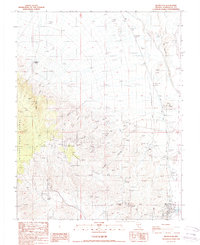
 1963 Silver Peak1965 Print · USGSEsmeralda County mining and settlement patterns are frozen in time during the early 1960s as the desert landscape transitions from rail to road. Researchers can trace the Old Railroad Grade past Blair or locate the Mary Mine and Cem near Silver Peak.2 unique versions available
 - 1985 Map of Goldfield
 1985 Goldfield1985 Print · USGSEsmeralda County and the surrounding high desert are captured in the mid-eighties as modern infrastructure intersected with a century of mining history. Researchers can locate remote extraction sites like the Mohawk Mine, early outposts at Klondike, and geothermal features like Alkali Hot Spring.
 - 1987 Map of Silver Peak
 1987 Silver Peak1987 Print · USGSEsmeralda County's mining heart is on display in the 1980s, revealing a landscape etched with historic shafts and desert settlements. Genealogists and industrial historians can trace the foundations of Blair, find the Silver Peak Cemetery, and locate named claims like the Vanderbilt Mine.
 - 2012 Map of Silver Peak, 2012 Print
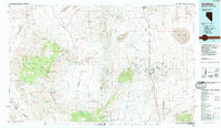
 2012 Silver Peak2012 Print · USGSCovers Silver Peak, including Esmeralda County, United States, and other nearby areas
 - 2014 Map of Silver Peak, 2014 Print
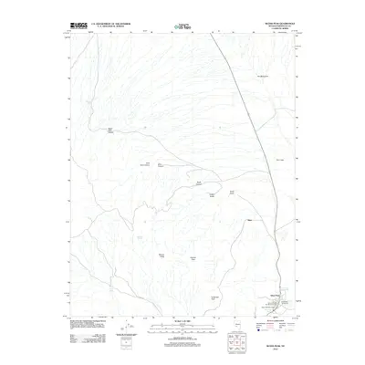
 2014 Silver Peak2014 Print · USGSCovers Silver Peak, including Esmeralda County, United States, and other nearby areas
 - 2018 Map of Silver Peak, 2018 Print
 2018 Silver Peak2018 Print · USGSCovers Silver Peak, including Esmeralda County, United States, and other nearby areas
 - 2021 Map of Silver Peak, 2021 Print
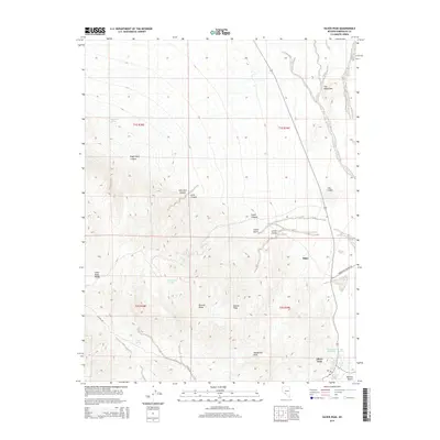
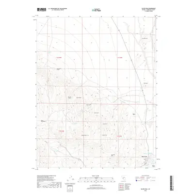
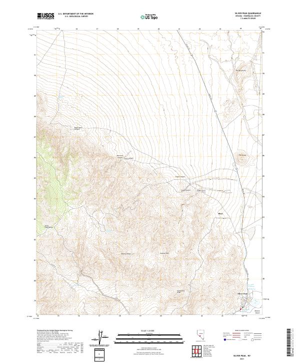 2021 Silver Peak2021 Print · USGSSilver Peak and the high-desert mining country of Esmeralda County are shown here in the early twenty-first century. Researchers can trace the layout of Blair and Silver Peak, locate remote water sources like Tarantula Spring, and explore the terrain of Mineral Ridge.
End of results
Showing maps 1-15 of 15
Frequently asked questions
- What are the different types of historical maps available for Silver Peak?
- What is the oldest map of Silver Peak?
- Where can I purchase historical maps of Silver Peak for my home or office?
- Where can I download high-res historical maps of Silver Peak?
- Are there historical topographic maps available for Silver Peak?
- Is there historical aerial imagery available for Silver Peak?
- Where are historical maps of Silver Peak sourced from?