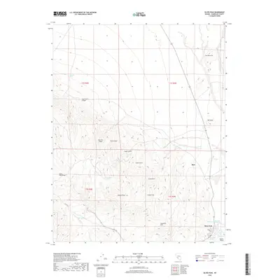
2018 Map of Silver Peak
USGS Topo · Published 2018About this map
Silver Peak and the nearby site of Blair anchor this high-desert landscape in the southwestern corner of Esmeralda County. The map details a complex geological and hydraulic environment, from the thermal waters at Silver Peak Hot Springs and Hot Spring to the distinct landforms of the Monocline and the Crater. Evidence of the region’s long mining legacy is visible in names like Mineral Ridge, Galena Flats, and Custer Gulch, while the surrounding Silver Peak Range is dissected by several named drainages including Great Gulch and New York Canyon. The transition from the rugged highlands down to the arid floor of the Ralston Desert is traced by several isolated water sources such as Tarantula Spring, Macaroni Spring, and Coyote Spring, which were vital markers in this water-scarce terrain.
Find a feature on this map
26 named features on this map. Tap any name to fly to it.
Don’t see what you’re looking for? This feature index may not catch every label — zoom into the map to look around manually.
Map Details
Editions of this 2018 Silver Peak Map
This is the sole edition of this map. No revisions or reprints were ever made.
Other maps of this area

1898 · Silver Peak
USGS Topo · 1:125,000

1900 · Silver Peak
USGS Topo · 1:125,000

1908 · Lida
USGS Topo · 1:250,000

1913 · Lida
USGS Topo · 1:250,000

1954 · Goldfield
USGS Topo · 1:250,000

1955 · Goldfield
USGS Topo · 1:250,000

1958 · Goldfield
USGS Topo · 1:250,000

1962 · Goldfield
USGS Topo · 1:250,000
1963 · Piper Peak
USGS Topo · 1:62,500

1963 · Silver Peak
USGS Topo · 1:62,500