1950s Maps of Nevin, Nevada
Explore 3 historic maps of Nevin from the 1950s. These maps offer a rare glimpse into what life looked like during the 1950s — showing old roads, neighborhoods, homes, and landmarks that have changed or disappeared over time.
Whether you're researching your family's past, planning a metal detecting trip, or studying how Nevin's landscape evolved across the 1950s, these high-resolution maps are a powerful tool for exploring the history of this region.
- Focus on a specific era: All maps on this page are from the 1950s, giving you a focused view of this time period.
- See what’s changed: Compare century-old streets, trails, and buildings to today's modern landscape using overlays and satellite layers.
- Research with precision: Use these maps for genealogy, historical research, land use analysis, or educational projects.
- View, download, or print: Maps are fully viewable online in high resolution, and can be downloaded or printed for your own records.
Start exploring Nevin's history through authentic maps from the 1950s. This is your window into the past.
Nevin, NV maps
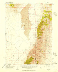
(3)- 1955 Map of Millett, 1963 Print
 1955 Millett1963 Print · USGSCentral Nevada in the mid-fifties is a landscape of high-desert basins and remote outposts. Researchers can trace historic ranching sites like Petersons Mill and Grass Valley Ranch or locate the McCoy Mining Camp.4 unique versions available
 - 1956 Map of Walti Hot Springs, 1957 Print
 1956 Walti Hot Springs1957 Print · USGSThe high desert of central Nevada is captured here in the mid-1950s, showing the remote ranching outposts along the Simpson Park Range. You can trace early jeep trails and family landmarks like Walti Ranch, Keystone Mine, and the thermal Hot Springs.2 unique versions available
 - 1959 Map of Millett
 1959 Millett1959 Print · USGSThe high basins and ranges of central Nevada are captured here in the late fifties, showcasing a landscape of remote cattle ranches and high-altitude mining. Researchers can trace historic family holdings like McLeod Ranch or locate the McCoy Mining Camp and the Austin Summit mountain pass.2 unique versions available
End of results
Showing maps 1-3 of 3
Frequently asked questions
- What are the different types of historical maps available for Nevin?
- What is the oldest map of Nevin?
- Where can I purchase historical maps of Nevin for my home or office?
- Where can I download high-res historical maps of Nevin?
- Are there historical topographic maps available for Nevin?
- Is there historical aerial imagery available for Nevin?
- Where are historical maps of Nevin sourced from?