Old Maps of Nevin, Nevada for Academic Research
Study the evolution of Nevin with 11 high-resolution historic maps. Whether you're teaching, researching, or modeling changes in land use, these maps provide essential visual documentation of urban, environmental, and geographic change.
- Analyze long-term change: Track patterns in development, transportation, and natural features.
- Ideal for environmental or urban studies: Support academic projects with primary historical map data.
- Use in the classroom or lab: Educators and researchers rely on these maps to bring historical context to life.
These maps are a powerful tool for teaching, research, and visualizing how Nevin has changed over the decades.
Nevin, NV maps
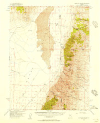
(11)- 1926 Map of Roberts Mountains, 1955 Print
 1926 Roberts Mountains1955 Print · USGSCentral Nevada in the mid-1920s is a landscape of remote mountain ranges and isolated valley ranching. Genealogists and historians can trace family-named locations like Hall Creek Ranch, Sadler Sch, and the Keystone Mine across the high desert.
 - 1929 Map of Roberts Mountains
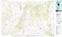
 1929 Roberts Mountains1929 Print · USGSCentral Nevada in the late 1920s reveals a vast ranching and mining landscape organized around vital water sources. Researchers can trace early family outposts like Roberts Creek Ranch and Grubbs Ranch or locate remote schools such as Simpson Park Sch.4 unique versions available
 - 1955 Map of Millett, 1963 Print
 1955 Millett1963 Print · USGSCentral Nevada in the mid-fifties is a landscape of high-desert basins and remote outposts. Researchers can trace historic ranching sites like Petersons Mill and Grass Valley Ranch or locate the McCoy Mining Camp.4 unique versions available
 - 1956 Map of Walti Hot Springs, 1957 Print
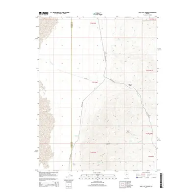
 1956 Walti Hot Springs1957 Print · USGSThe high desert of central Nevada is captured here in the mid-1950s, showing the remote ranching outposts along the Simpson Park Range. You can trace early jeep trails and family landmarks like Walti Ranch, Keystone Mine, and the thermal Hot Springs.2 unique versions available
 - 1959 Map of Millett
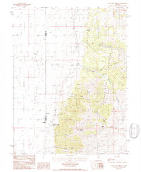
 1959 Millett1959 Print · USGSThe high basins and ranges of central Nevada are captured here in the late fifties, showcasing a landscape of remote cattle ranches and high-altitude mining. Researchers can trace historic family holdings like McLeod Ranch or locate the McCoy Mining Camp and the Austin Summit mountain pass.2 unique versions available
 - 1979 Map of Simpson Park Mtns
 1979 Simpson Park Mtns1979 Print · USGSCentral Nevada's high desert basins and mountain ranges come alive in this late-seventies survey of the Lander and Eureka county line. Researchers can locate remote industrial and water features like the Lone Mountain Mine, Hot Springs, and a secluded Landing Field.2 unique versions available
 - 1986 Map of Walti Hot Springs
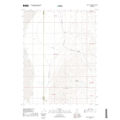
 1986 Walti Hot Springs1986 Print · USGSGrass Valley and the Simpson Park Mountains are captured here in the mid-1980s during a period of active ranching and research. Trace the history of high-desert outposts like the Gund Ranch or the Keystone Mine.
 - 2012 Map of Walti Hot Springs, 2012 Print
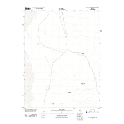 2012 Walti Hot Springs2012 Print · USGSCovers Nevin, including Lander County, Eureka County, and other nearby areas
 - 2014 Map of Walti Hot Springs, 2014 Print
 2014 Walti Hot Springs2014 Print · USGSCovers Nevin, including Lander County, Eureka County, and other nearby areas
 - 2018 Map of Walti Hot Springs, 2018 Print
 2018 Walti Hot Springs2018 Print · USGSCovers Nevin, including Lander County, Eureka County, and other nearby areas
 - 2021 Map of Walti Hot Springs, 2021 Print
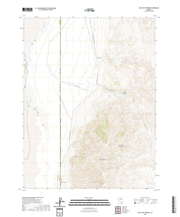 2021 Walti Hot Springs2021 Print · USGSEureka and Lander counties are captured here in a period of modern ranching and high-desert isolation. Genealogists and local historians can trace the remote geography of Walti Hot Springs, McClusky Peak, and the Simpson Park Mountains.
End of results
Showing maps 1-11 of 11
Frequently asked questions
- What are the different types of historical maps available for Nevin?
- What is the oldest map of Nevin?
- Where can I purchase historical maps of Nevin for my home or office?
- Where can I download high-res historical maps of Nevin?
- Are there historical topographic maps available for Nevin?
- Is there historical aerial imagery available for Nevin?
- Where are historical maps of Nevin sourced from?