
1979 Map of Simpson Park Mtns
USGS Topo · Published 1979About this map
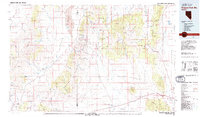
Toiyabe National Forest and the Simpson Park Mountains dominate this central Nevada landscape, where the high desert is defined by a series of north-south running basins and ranges. The map illustrates a remote terrain where water is the primary driver of geography, featuring Carico Lake in its namesake valley and significant geothermal points like Hot Springs and Little Hot Springs in Grass Valley.
Find a feature on this map
25 named features on this map. Tap any name to fly to it.
Don’t see what you’re looking for? This feature index may not catch every label — zoom into the map to look around manually.
Map Details
Editions of this 1979 Simpson Park Mtns Map
2 editions found
Other maps of this area

1926 · Roberts Mountains
USGS Topo · 1:250,000

1929 · Roberts Mountains
USGS Topo · 1:250,000

1932 · Sonoma Range
USGS Topo · 1:250,000

1934 · Jiggs
USGS Topo · 1:125,000

1937 · Mineral Hill
USGS Topo · 1:48,000

1937 · Jiggs
USGS Topo · 1:125,000

1938 · Cortez
USGS Topo · 1:48,000

1939 · Sonoma Range
USGS Topo · 1:250,000

1943 · Mineral Hill
USGS Topo · 1:62,500

1944 · Cortez
USGS Topo · 1:62,500