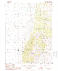
1986 Map of Walti Hot Springs
USGS Topo · Published 1986About this map
Walti Hot Springs and the expansive Alkali Flat anchor this mid-1980s topographic study of the borderlands between Lander and Eureka Counties. The landscape is defined by the sharp transition from the level floor of Grass Valley to the high elevations of the Simpson Park Mountains, where McClusky Peak dominates the local skyline. This era shows a working high-desert environment where ranching and resource extraction overlap. Scattered settlements like Allen Ranch and Baumann Ranch sit alongside the Gund Ranch, an academic research outpost situated near the thermal waters of the hot springs. Higher in the canyons, evidence of prospecting and industry is visible at the Keystone Mine, while a network of named water sources such as Rye Patch Spring and Mud Spring provide the lifeblood for this arid terrain.
Find a feature on this map
24 named features on this map. Tap any name to fly to it.
Don’t see what you’re looking for? This feature index may not catch every label — zoom into the map to look around manually.
Map Details
Editions of this 1986 Walti Hot Springs Map
This is the sole edition of this map. No revisions or reprints were ever made.
Other maps of this area

1926 · Roberts Mountains
USGS Topo · 1:250,000

1929 · Roberts Mountains
USGS Topo · 1:250,000

1938 · Cortez
USGS Topo · 1:48,000

1944 · Cortez
USGS Topo · 1:62,500

1949 · Roberts Creek Mtn
USGS Topo · 1:62,500

1951 · Roberts Creek Mtn
USGS Topo · 1:62,500

1955 · Millett
USGS Topo · 1:250,000

1955 · Winnemucca
USGS Topo · 1:250,000

1956 · Walti Hot Springs
USGS Topo · 1:62,500

1957 · Horse Creek Valley
USGS Topo · 1:62,500