
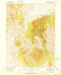
1951 Map of Roberts Creek Mtn
USGS Topo · Published 1951About this map
High desert ranching and mountain peaks dominate this 1951 study of the Eureka County landscape. The terrain is defined by the massive Roberts Mountains, where Roberts Creek Mtn and Cooper Pk tower over the surrounding drainage basins. Evidence of the region’s pastoral economy is visible through several established homesteads, including Indian Ranch, Willow Creek Ranch, Three Bar Ranch, and Roberts Creek Ranch. These outposts are strategically located near vital water sources like Denay Creek, Willow Creek, and Roberts Creek.
Find a feature on this map
41 named features on this map. Tap any name to fly to it.
Don’t see what you’re looking for? This feature index may not catch every label — zoom into the map to look around manually.
Map Details
Editions of this 1951 Roberts Creek Mtn Map
2 editions found
Other maps of this area

1926 · Roberts Mountains
USGS Topo · 1:250,000

1929 · Roberts Mountains
USGS Topo · 1:250,000

1937 · Mineral Hill
USGS Topo · 1:48,000

1938 · Cortez
USGS Topo · 1:48,000

1943 · Mineral Hill
USGS Topo · 1:62,500

1944 · Cortez
USGS Topo · 1:62,500

1949 · Garden Valley
USGS Topo · 1:62,500

1949 · Roberts Creek Mtn
USGS Topo · 1:62,500

1951 · Garden Valley
USGS Topo · 1:62,500

1955 · Millett
USGS Topo · 1:250,000