1900s (20th Century) Maps of Winnemucca, Nevada
Explore 11 historic maps of Winnemucca from the 1900s (20th Century). These maps offer a rare glimpse into what life looked like during the 1900s — showing old roads, neighborhoods, homes, and landmarks that have changed or disappeared over time.
Whether you're researching your family's past, planning a metal detecting trip, or studying how Winnemucca's landscape evolved across the 1900s, these high-resolution maps are a powerful tool for exploring the history of this region.
- Focus on a specific era: All maps on this page are from the 1900s, giving you a focused view of this time period.
- See what’s changed: Compare century-old streets, trails, and buildings to today's modern landscape using overlays and satellite layers.
- Research with precision: Use these maps for genealogy, historical research, land use analysis, or educational projects.
- View, download, or print: Maps are fully viewable online in high resolution, and can be downloaded or printed for your own records.
Start exploring Winnemucca's history through authentic maps from the 1900s. This is your window into the past.
Winnemucca, NV maps
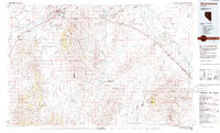
(11)- 1932 Map of Sonoma Range, 1955 Print
 1932 Sonoma Range1955 Print · USGSNorthern Nevada in the early thirties is captured here along the Humboldt River and its flanking desert ranges. Genealogists and historians can trace numerous family-named landmarks like Prida Ranch and Childress Ranch, or locate the Site of Old Indian Fort and Barber Sch.5 unique versions available
 - 1939 Map of Sonoma Range
 1939 Sonoma Range1939 Print · USGSHigh-desert ranching and deep-earth mining define this Nevada landscape during the late thirties. Researchers can trace historical family holdings like Seven Devils Ranch, early educational sites such as Pearce Sch, and industrial landmarks including the Copper Canyon Mine.5 unique versions available
 - 1955 Map of Winnemucca, 1968 Print
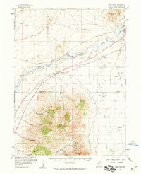
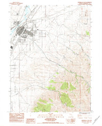
 1955 Winnemucca1968 Print · USGSNorthern Nevada's high desert corridor is captured here in the mid-fifties, centered on the river-and-rail hub of Winnemucca. Researchers can trace the dual tracks of the Southern Pacific and Western Pacific railroads through towns like Golconda and Valmy.3 unique versions available
 - 1958 Map of Winnemucca
 1958 Winnemucca1958 Print · USGSNorthern Nevada in the late fifties was defined by the parallel rhythms of the great transcontinental railroads and a resilient mining industry. Genealogists and historians can trace old mining camps and remote rail sidings from Gold Acres and Palisade to the Adelaide district.2 unique versions available
 - 1958 Map of Winnemucca, 1960 Print
 1958 Winnemucca1960 Print · USGSWinnemucca and the high peaks of the Sonoma Range are captured here in the late fifties, during a period of steady growth for this railroad crossroads. Researchers can trace the dual tracks of the Southern Pacific and Western Pacific or locate historic mining sites like Adelaide and the Harmony Mine.3 unique versions available
 - 1958 Map of Rose Creek, 1960 Print
 1958 Rose Creek1960 Print · USGSThe Humboldt River corridor and the Sonoma Range meet here during the late 1950s, a period defined by rail traffic and high-desert mining. Researchers can trace the dual lines of the Southern Pacific and Western Pacific, find the Auburn Mine, and locate the old settlement of Rose Creek.2 unique versions available
 - 1962 Map of Winnemucca
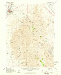
 1962 Winnemucca1962 Print · USGSNorthern Nevada's high desert comes alive in the mid-1950s as a vital transportation and mining corridor following the Humboldt River. Trace the early rail-and-ranch economy through stops like Palisade, find old workings at the Adelaide Mine, and see the layout of Winnemucca before the interstate era.
 - 1975 Map of Winnemucca NW, 1980 Print
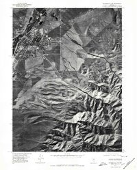 1975 Winnemucca NW1980 Print · USGSThe high desert landscape of Winnemucca during the mid-1970s comes to life in this aerial orthophotoquad. Researchers can examine the town's expansion toward the Sonoma Range and trace geographic landmarks like Water Canyon and Thomas Creek.
 - 1982 Map of Winnemucca West
 1982 Winnemucca West1982 Print · USGSHumboldt County’s high desert landscape comes into focus in the early eighties as the Humboldt River winds through Grass Valley. Researchers can locate aviation landmarks like the Winnemucca Municipal Airport and trace industrial sites such as various Gravel Pits.
 - 1983 Map of Winnemucca East
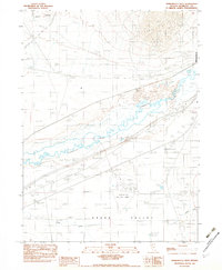
 1983 Winnemucca East1983 Print · USGSWinnemucca thrived as a desert crossroads in the early eighties, where the river and rail lines met the high mountains. Trace local history through the Wentz Cem, the Winnemucca Indian Colony, and the mining legacy at Harmony Mine.
 - 1986 Map of Winnemucca
 1986 Winnemucca1986 Print · USGSNorthern Nevada in the mid-eighties shows a landscape of deep basins and mountain-bound mines connected by the heavy rail corridors of the Humboldt River valley. Trace the legacy of extraction at the Adelaide Mine or explore the transit hubs of Winnemucca and Golconda.
End of results
Showing maps 1-11 of 11
Top cities near Winnemucca
Top neighborhoods of Winnemucca
Frequently asked questions
- What are the different types of historical maps available for Winnemucca?
- What is the oldest map of Winnemucca?
- Where can I purchase historical maps of Winnemucca for my home or office?
- Where can I download high-res historical maps of Winnemucca?
- Are there historical topographic maps available for Winnemucca?
- Is there historical aerial imagery available for Winnemucca?
- Where are historical maps of Winnemucca sourced from?