1960s Maps of Lyon County, Nevada
Explore 8 historic maps of Lyon County from the 1960s. These maps offer a rare glimpse into what life looked like during the 1960s — showing old roads, neighborhoods, homes, and landmarks that have changed or disappeared over time.
Whether you're researching your family's past, planning a metal detecting trip, or studying how Lyon County's landscape evolved across the 1960s, these high-resolution maps are a powerful tool for exploring the history of this region.
- Focus on a specific era: All maps on this page are from the 1960s, giving you a focused view of this time period.
- See what’s changed: Compare century-old streets, trails, and buildings to today's modern landscape using overlays and satellite layers.
- Research with precision: Use these maps for genealogy, historical research, land use analysis, or educational projects.
- View, download, or print: Maps are fully viewable online in high resolution, and can be downloaded or printed for your own records.
Start exploring Lyon County's history through authentic maps from the 1960s. This is your window into the past.
Lyon County, NV maps
(8)- 1960 Map of Reno
 1960 Reno1960 Print · USGSThe high desert of western Nevada comes alive in this mid-century survey of the Reno-Tahoe region. Genealogists and historians can trace rail lines like the Southern Pacific RR and locate remote outposts such as Olinghouse, Nixon, and the Olinghouse Mine.2 unique versions available
 - 1960 Map of Virginia City, 1976 Print
 1960 Virginia City1976 Print · USGSThe Comstock Lode is shown in detail at mid-century, mapping the industrial footprint of the silver mining boom. Genealogists and historians can locate mining infrastructure, the Sutro Tunnel, and settlements like Gold Hill, Silver City, and American Flat.
 - 1962 Map of Walker Lake
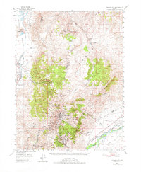
 1962 Walker Lake1962 Print · USGSThe high desert of western Nevada and the Sierra Nevada crest meet in this mid-century study of the Eastern Sierra frontier. Researchers can trace the Southern Pacific rail lines connecting Hawthorne to remote mining outposts like Bodie, Aurora, and Mina.
 - 1964 Map of Walker Lake
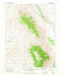
 1964 Walker Lake1964 Print · USGSThe high desert and the Sierra Nevada peaks come together in the mid-1960s, showing a landscape defined by mining, military installations, and vast wilderness. Genealogists and historians can trace the remnants of old mining camps at Bodie or Candelaria and follow the Southern Pacific rail lines.2 unique versions available
 - 1964 Map of Schurz, 1966 Print
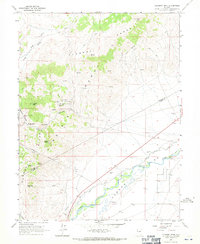
 1964 Schurz1966 Print · USGSThe community of Schurz and the surrounding reservation land are documented here in the mid-1960s as a vital desert crossroads. Genealogists and historians can trace the Southern Pacific line past the Hospital or locate mining sites like Northern Lights Mine.2 unique versions available
 - 1967 Map of Flowery Peak, 1970 Print
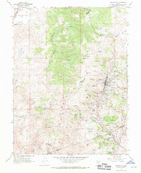
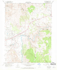
 1967 Flowery Peak1970 Print · USGSStorey County mining and Carson River irrigation are captured in detail during the late sixties. Researchers can trace the subterranean path of the Sutro Tunnel or locate historic extraction sites like the Lady Bryan Mine and Monte Cristo (Site).4 unique versions available
 - 1967 Map of Virginia City, 1971 Print
 1967 Virginia City1971 Print · USGSVirginia City and the Comstock Lode mining district are shown here in the late sixties, highlighting the intense industrial footprint of the Nevada silver boom. Local historians can trace the foundations of Gold Hill, the Sutro Tunnel, and family sites near the Hebrew Cem.3 unique versions available
 - 1968 Map of New Empire, 1971 Print
 1968 New Empire1971 Print · USGSCarson City and the Virginia Range meet in this late-sixties study of Nevada's industrial heartland and growing capital. Researchers can trace the ruins of historic silver-processing sites like the Morgan Mill and the Old Mexican Mill along the Carson River.3 unique versions available
End of results
Showing maps 1-8 of 8
Top cities of Lyon County
- Fernley historical maps
- Dayton historical maps
- Silver Springs historical maps
- Yerington historical maps
- Stagecoach historical maps
- Smith Valley historical maps
See more
Frequently asked questions
- What are the different types of historical maps available for Lyon County?
- What is the oldest map of Lyon County?
- Where can I purchase historical maps of Lyon County for my home or office?
- Where can I download high-res historical maps of Lyon County?
- Are there historical topographic maps available for Lyon County?
- Is there historical aerial imagery available for Lyon County?
- Where are historical maps of Lyon County sourced from?