1900s (20th Century) Maps of Lyon County, Nevada
Explore 103 historic maps of Lyon County from the 1900s (20th Century). These maps offer a rare glimpse into what life looked like during the 1900s — showing old roads, neighborhoods, homes, and landmarks that have changed or disappeared over time.
Whether you're researching your family's past, planning a metal detecting trip, or studying how Lyon County's landscape evolved across the 1900s, these high-resolution maps are a powerful tool for exploring the history of this region.
- Focus on a specific era: All maps on this page are from the 1900s, giving you a focused view of this time period.
- See what’s changed: Compare century-old streets, trails, and buildings to today's modern landscape using overlays and satellite layers.
- Research with precision: Use these maps for genealogy, historical research, land use analysis, or educational projects.
- View, download, or print: Maps are fully viewable online in high resolution, and can be downloaded or printed for your own records.
Start exploring Lyon County's history through authentic maps from the 1900s. This is your window into the past.
Lyon County, NV maps
(103)- 1908 Map of Carson Sink, 1954 Print
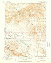
 1908 Carson Sink1954 Print · USGSChurchill County at the opening of the century reveals a landscape of desert mining camps and nascent river irrigation. Genealogists and historians can trace the early streets of Fallon, the remote Nevada Hills Mine, and the location of Dixie.3 unique versions available
 - 1909 Map of Hawthorne, 1955 Print
 1909 Hawthorne1955 Print · USGSWestern Nevada and the California borderlands are captured here during the height of the early mining era. Genealogists and historians can trace rail-depot life and remote outposts from Hawthorne to Belleville, including vanished sites like Oro City and Buckley Camp.
 - 1909 Map of Bridgeport, 1956 Print
 1909 Bridgeport1956 Print · USGSThe High Sierra and Mono Basin are seen here in the decade following the peak of the local gold boom. Genealogists and historians can trace old stage routes and find significant mining sites like the Dunderberg Mine and the remote settlement of Belfort.
 - 1910 Map of Carson Sink
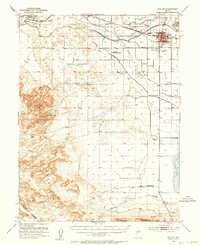
 1910 Carson Sink1910 Print · USGSWestern Nevada at the end of the first decade of the century shows a landscape defined by desert mining camps and the burgeoning Carson-Truckee irrigation projects. Genealogists and historians can trace the early streets of Fallon or locate remote camps like Rawhide and the Nevada Wonder Mine.5 unique versions available
 - 1911 Map of Bridgeport
 1911 Bridgeport1911 Print · USGSMono County at the start of the twentieth century was a landscape of high-altitude mining camps and early park boundaries. Trace the footprints of the gold era at Bodie, locate family ranching history at Mormon Ranch, or study the remote Masonic Liberty Mine.7 unique versions available
 - 1911 Map of Hawthorne
 1911 Hawthorne1911 Print · USGSEarly Nevada mining and rail history come alive in this survey of the Walker Lake region during the era of steam and silver. Researchers can trace the routes of the Southern Pacific System and locate the sites of Lucky Boy, Marietta, and Belleville.4 unique versions available
 - 1915 Map of Hawthorne, 1951 Print
 1915 Hawthorne1951 Print · USGSWestern Nevada at the turn of the century shows a landscape dominated by mining outposts and the reaching arms of the Southern Pacific System. Genealogists can trace early residents to sites like Candelaria, Sodaville, and Mina or locate vanished camps such as Buckley Camp.
 - 1920 Map of Bridgeport
 1920 Bridgeport1920 Print · USGSThe High Sierra and Mono Basin are shown here in the early twentieth century, during a peak period of mining and ranching. Researchers can locate vanished camps like Star City, trace the California Masonic Road, and find family names at Conway Ranch.
 - 1948 Map of Walker Lake
 1948 Walker Lake1948 Print · USGSThe high desert of Nevada and the eastern Sierra Nevada are captured just after the war as mining and ranching shaped the local economy. Genealogists can trace family connections to centers like Hawthorne and Mina or locate the historic Rockland Mines and Aurora.2 unique versions available
 - 1950 Map of Virginia City, 1955 Print
 1950 Virginia City1955 Print · USGSVirginia City and the Comstock mining corridor are seen here at mid-century, amidst a dense concentration of historic shafts and early settlement sites. Researchers can trace the legacy of silver mining through Gold Hill, the Utah Shaft, and several cemeteries that overlook the mountain ranges.3 unique versions available
 - 1951 Map of Weber Reservoir, 1953 Print
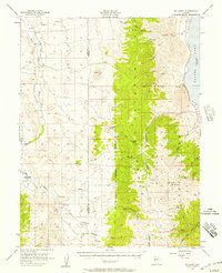
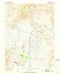
 1951 Weber Reservoir1953 Print · USGSLyon and Churchill Counties appear in the early fifties as a landscape of essential water management and mountain transit. Researchers can trace the Southern Pacific rail line, mining prospects in the Terrill Mts, and the construction of the Weber Dam.5 unique versions available
 - 1951 Map of Fallon, 1953 Print
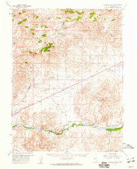
 1951 Fallon1953 Print · USGSFallon and the surrounding Lahontan Valley are captured here in the early fifties as irrigation and ranching redefined the high desert. Researchers can trace historic rural education and transport, from the Oats Park Sch to the legendary Pony Express Route and Smith Ranch.3 unique versions available
 - 1952 Map of Virginia City
 1952 Virginia City1952 Print · USGSStorey County's mining heartland is revealed in the mid-century, documenting the legendary Comstock Lode settlements and engineering works. Researchers can trace the massive Sutro Tunnel, locate the Lousetown (Site), and find family roots in Gold Hill or Virginia City.2 unique versions available
 - 1956 Map of Mt. Grant, 1957 Print
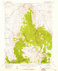
 1956 Mt. Grant1957 Print · USGSThe Wassuk Range and the western shores of Walker Lake are captured here in the mid-1950s. Local researchers can trace family ranching sites like the Flying M Ranch, the East Walker School, and various mining Prospects along the high peaks.3 unique versions available
 - 1956 Map of Aurora, 1957 Print
 1956 Aurora1957 Print · USGSThe Nevada-California borderlands are documented here in the mid-fifties, capturing the remnant mining hubs and high desert ranches of the era. Genealogists and historians can trace the Aurora townsite, the Cresco Mine, and local landmarks like Lucky Boy Pass.3 unique versions available
 - 1956 Map of Dayton, 1958 Print
 1956 Dayton1958 Print · USGSThe silver-country landscape around the Carson River is shown here in the mid-1950s, bridging the mining era and modern institutional development. Researchers can trace the Old RR Grade and locate historic sites such as Mound House and the Daney Mine.3 unique versions available
 - 1956 Map of Desert Creek Peak, 1958 Print
 1956 Desert Creek Peak1958 Print · USGSThe Nevada-California borderlands were a hub of high-desert mining and ranching during the mid-fifties. Researchers can trace the original Von Schmidt Line (1872) and locate historic sites like Rickey Mine, Sulfur (Site), and Hoye Bridge.3 unique versions available
 - 1956 Map of Fales Hot Springs, 1960 Print
 1956 Fales Hot Springs1960 Print · USGSThe high Sierra backcountry and Mono County mining districts are captured here in the mid-1950s. Genealogists and historians can trace the foundations of the regional economy through sites like Sonora Junction Hardy Station, Burcham, and the Tiger Mines.5 unique versions available
 - 1957 Map of Walker Lake
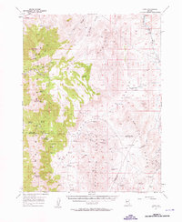
 1957 Walker Lake1957 Print · USGSThe Nevada-California borderlands in the mid-1950s show a rugged network of mining camps and river-valley towns centered around Walker Lake. Researchers can trace the Southern Pacific rail line and locate historical sites like Bodie, Sodaville, and the Leviathan Sulphur Mine.4 unique versions available
 - 1957 Map of Wellington
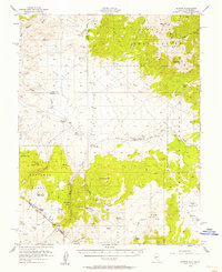
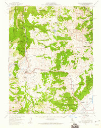
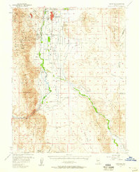
 1957 Wellington1957 Print · USGSLyon County ranching and mining enter the mid-century era as the West Walker River sustains the growing settlements of Wellington and Smith. Researchers can trace irrigation networks, family holdings like Artesia Ranch, and numerous prospects including the Ludwig Mine.4 unique versions available
 - 1957 Map of Como
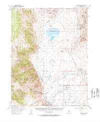
 1957 Como1957 Print · USGSLyon and Douglas County mining and ranching lands are captured here in the mid-fifties, showing the high-altitude terrain before modern development. You can trace early trails and mining operations at Como, the Hercules Mine, and Sunrise Camp.3 unique versions available
 - 1957 Map of Wabuska, 1958 Print
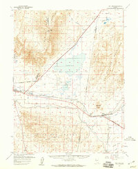
 1957 Wabuska1958 Print · USGSMason Valley in the late fifties was a landscape of ranching and industry where the railroad met the edge of the desert. Researchers can trace the layout of the Southern Pacific through Wabuska, identify the Thompson Smelter (Site), and locate family landmarks like Campbell Lane.2 unique versions available
 - 1957 Map of Yerington, 1959 Print
 1957 Yerington1959 Print · USGSThe Mason Valley and Smith Valley region thrived on a mix of river-fed agriculture and copper mining in the late fifties. Genealogists and historians can trace the Nevada Copper Belt Railroad and locate family landmarks like Sanders School or the Yerington Cemetery.3 unique versions available
 - 1957 Map of Churchill Butte, 1959 Print
 1957 Churchill Butte1959 Print · USGSThe Carson River valley in the late fifties reveals a landscape of pioneer ruins and active mining. Trace the remnants of Fort Churchill near the Southern Pacific tracks or locate high-desert mines like the Ramsey Comstock Mine and Talapoosa.3 unique versions available
 - 1957 Map of Two Tips, 1959 Print
 1957 Two Tips1959 Print · USGSThe high-desert terrain of central Nevada is captured here during the late 1950s, showing a landscape shaped by rail and irrigation. Genealogists and historians can trace the Southern Pacific corridor through Hazen and Argo, or locate the abandoned salt evaporators and early prospects.2 unique versions available
Showing maps 1-25 of 103
Top cities of Lyon County
- Fernley historical maps
- Dayton historical maps
- Silver Springs historical maps
- Yerington historical maps
- Stagecoach historical maps
- Smith Valley historical maps
See more
Frequently asked questions
- What are the different types of historical maps available for Lyon County?
- What is the oldest map of Lyon County?
- Where can I purchase historical maps of Lyon County for my home or office?
- Where can I download high-res historical maps of Lyon County?
- Are there historical topographic maps available for Lyon County?
- Is there historical aerial imagery available for Lyon County?
- Where are historical maps of Lyon County sourced from?