Old Maps of Hawthorne, Nevada for Genealogy
Trace your family roots with 20 historic maps of Hawthorne. These high-res maps reveal old neighborhoods, homesites, landmarks, and streets — helping you uncover where your ancestors lived and how the area evolved over time.
- Explore historic neighborhoods: Identify where your relatives may have lived in the 1800s or 1900s.
- Compare maps over time: Trace the changes in streets, buildings, and landmarks for multi-generational research.
- Perfect for genealogy & ancestry research: Used by family historians and researchers to map out lineage and migration.
These maps are an incredible resource for exploring your personal connection to Hawthorne's past.
Hawthorne, NV maps
(20)- 1909 Map of Hawthorne, 1955 Print
 1909 Hawthorne1955 Print · USGSWestern Nevada and the California borderlands are captured here during the height of the early mining era. Genealogists and historians can trace rail-depot life and remote outposts from Hawthorne to Belleville, including vanished sites like Oro City and Buckley Camp.
 - 1911 Map of Hawthorne
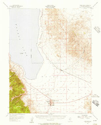
 1911 Hawthorne1911 Print · USGSEarly Nevada mining and rail history come alive in this survey of the Walker Lake region during the era of steam and silver. Researchers can trace the routes of the Southern Pacific System and locate the sites of Lucky Boy, Marietta, and Belleville.4 unique versions available
 - 1915 Map of Hawthorne, 1951 Print
 1915 Hawthorne1951 Print · USGSWestern Nevada at the turn of the century shows a landscape dominated by mining outposts and the reaching arms of the Southern Pacific System. Genealogists can trace early residents to sites like Candelaria, Sodaville, and Mina or locate vanished camps such as Buckley Camp.
 - 1948 Map of Walker Lake
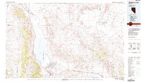
 1948 Walker Lake1948 Print · USGSThe high desert of Nevada and the eastern Sierra Nevada are captured just after the war as mining and ranching shaped the local economy. Genealogists can trace family connections to centers like Hawthorne and Mina or locate the historic Rockland Mines and Aurora.2 unique versions available
 - 1955 Map of Hawthorne, 1957 Print
 1955 Hawthorne1957 Print · USGSHawthorne and the shores of Walker Lake are captured here during the mid-fifties, when the town was a vital rail and military center. Researchers can trace the layout of the Naval Ammunition Depot, locate the Mineral Co High Sch, and follow the Southern Pacific tracks through Thorne.3 unique versions available
 - 1957 Map of Walker Lake
 1957 Walker Lake1957 Print · USGSThe Nevada-California borderlands in the mid-1950s show a rugged network of mining camps and river-valley towns centered around Walker Lake. Researchers can trace the Southern Pacific rail line and locate historical sites like Bodie, Sodaville, and the Leviathan Sulphur Mine.4 unique versions available
 - 1962 Map of Walker Lake
 1962 Walker Lake1962 Print · USGSThe high desert of western Nevada and the Sierra Nevada crest meet in this mid-century study of the Eastern Sierra frontier. Researchers can trace the Southern Pacific rail lines connecting Hawthorne to remote mining outposts like Bodie, Aurora, and Mina.
 - 1964 Map of Walker Lake
 1964 Walker Lake1964 Print · USGSThe high desert and the Sierra Nevada peaks come together in the mid-1960s, showing a landscape defined by mining, military installations, and vast wilderness. Genealogists and historians can trace the remnants of old mining camps at Bodie or Candelaria and follow the Southern Pacific rail lines.2 unique versions available
 - 1985 Map of Walker Lake
 1985 Walker Lake1985 Print · USGSMineral County in the mid-1980s reveals a unique landscape of military expansion and high-desert settlement. Researchers can trace the massive Hawthorne Ammunition Depot, find old mining sites like the Rita Mine, and locate the Southern Pacific rail line.2 unique versions available
 - 1987 Map of Hawthorne East
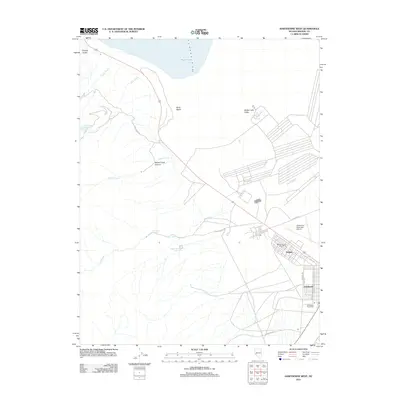
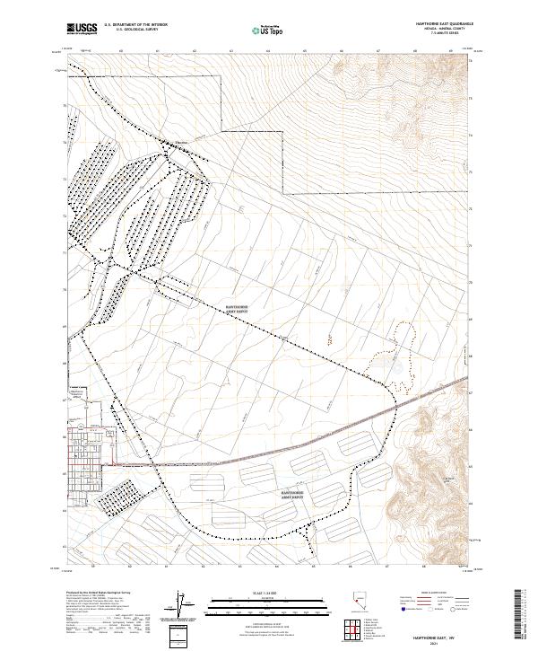
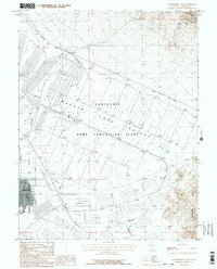 1987 Hawthorne East1987 Print · USGSMineral County in the late 1980s reveals a unique landscape of military logistics and high-desert mining. Researchers can trace the massive grid of the Hawthorne Army Ammunition Plant and find remote workings like the Dover Mine or the rail junction at Thorne.3 unique versions available
 - 1987 Map of Hawthorne West
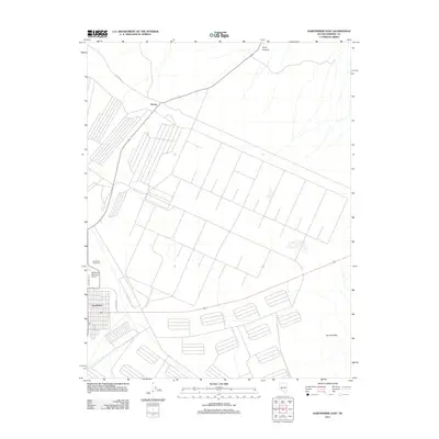
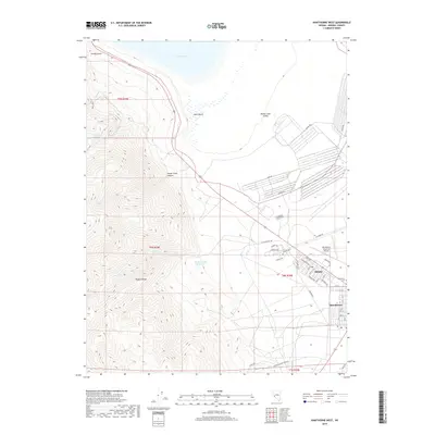
 1987 Hawthorne West1987 Print · USGSNear the shore of Walker Lake in the late 1980s, this Nevada landscape is defined by its massive military and aeronautical presence. Genealogists and historians can trace the layout of Babbitt, the local Cem, and the Hawthorne Municipal Airport.2 unique versions available
 - 2011 Map of Hawthorne West, 2011 Print
 2011 Hawthorne West2011 Print · USGSCovers Hawthorne, including Mineral County, United States, and other nearby areas
 - 2011 Map of Hawthorne East, 2011 Print
 2011 Hawthorne East2011 Print · USGSCovers Hawthorne, including Mineral County, United States, and other nearby areas
 - 2014 Map of Hawthorne West, 2014 Print
 2014 Hawthorne West2014 Print · USGSCovers Hawthorne, including Mineral County, United States, and other nearby areas
 - 2014 Map of Hawthorne East, 2014 Print
 2014 Hawthorne East2014 Print · USGSCovers Hawthorne, including Mineral County, United States, and other nearby areas
 - 2018 Map of Hawthorne West, 2018 Print
 2018 Hawthorne West2018 Print · USGSCovers Hawthorne, including Mineral County, United States, and other nearby areas
 - 2018 Map of Hawthorne East, 2018 Print
 2018 Hawthorne East2018 Print · USGSCovers Hawthorne, including Mineral County, United States, and other nearby areas
 - 2021 Map of Hawthorne West, 2021 Print
 2021 Hawthorne West2021 Print · USGSCovers Hawthorne, including Mineral County, United States, and other nearby areas
 - 2021 Map of Hawthorne East, 2021 Print
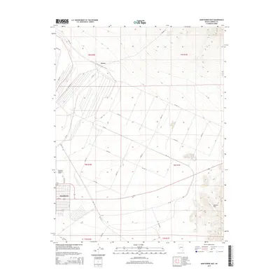
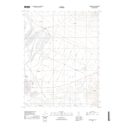
 2021 Hawthorne East2021 Print · USGSMineral County reveals its industrial and desert landscape in this recent survey of the area east of Hawthorne. Genealogists and local historians can trace the community's layout through the Hawthorne Cem, the settlement at Thorne, and the PO.
 - 2023 Map of Hawthorne West, 2023 Print
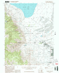
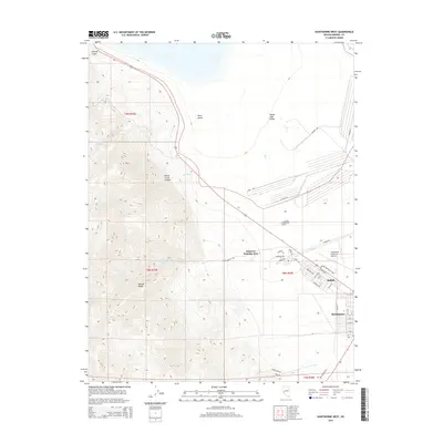
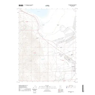
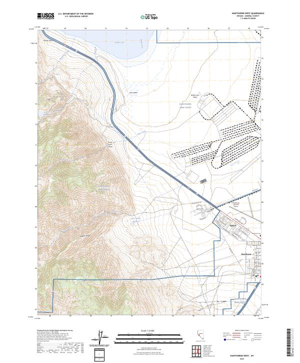 2023 Hawthorne West2023 Print · USGSThe community of Hawthorne and the HAWTHORNE ARMY DEPOT are shown at the edge of the Wassuk Range in this modern survey. Researchers can trace the grid of Babbitt, locate the Hawthorne Cem, and study the desert terrain around Walker Lake.
End of results
Showing maps 1-20 of 20
Top cities near Hawthorne
Frequently asked questions
- What are the different types of historical maps available for Hawthorne?
- What is the oldest map of Hawthorne?
- Where can I purchase historical maps of Hawthorne for my home or office?
- Where can I download high-res historical maps of Hawthorne?
- Are there historical topographic maps available for Hawthorne?
- Is there historical aerial imagery available for Hawthorne?
- Where are historical maps of Hawthorne sourced from?