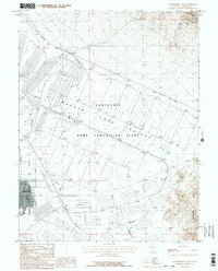
1987 Map of Hawthorne East
USGS Topo · Published 1987About this map
The Hawthorne Army Ammunition Plant dominates this mid-1980s survey, illustrating a massive grid of bunkers and facilities occupying the Walker Lake Valley. This landscape reflects a specialized military industrial footprint, where the town of Hawthorne serves as a residential and logistical hub on the edge of a vast Military Reservation. The transport infrastructure is dictated by these defense needs, including the Southern Pacific railroad line curving through the valley to serve the small settlement at Thorne.
Find a feature on this map
15 named features on this map. Tap any name to fly to it.
Don’t see what you’re looking for? This feature index may not catch every label — zoom into the map to look around manually.
Map Details
Editions of this 1987 Hawthorne East Map
3 editions found
Other maps of this area

1909 · Hawthorne
USGS Topo · 1:250,000

1911 · Hawthorne
USGS Topo · 1:250,000

1915 · Hawthorne
USGS Topo · 1:250,000

1948 · Walker Lake
USGS Topo · 1:250,000

1955 · Powell Mtn
USGS Topo · 1:62,500

1955 · Hawthorne
USGS Topo · 1:62,500

1957 · Walker Lake
USGS Topo · 1:250,000

1962 · Walker Lake
USGS Topo · 1:250,000

1964 · Walker Lake
USGS Topo · 1:250,000

1967 · Pamlico
USGS Topo · 1:24,000