Old Maps of Mineral County, Nevada for Hiking & Exploration
Hike through history with 525 historic maps of Mineral County. Explore old trails, ghost towns, and forgotten backroads — perfect for outdoor adventurers and local explorers.
- Rediscover forgotten places: Map out old mining camps, roads, and footpaths that no longer exist on modern maps.
- Layer with modern tools: Combine with LiDAR or satellite views to plan hikes through historical terrain.
- Made for exploration: Popular among hikers, overlanders, and local history lovers.
Use these maps to find adventure and explore the hidden past of Mineral County.
Mineral County, NV maps
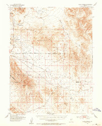
(525)- 1891 Map of Wellington
 1891 Wellington1891 Print · USGSThe high desert borderlands of Mono and Esmeralda counties come alive in the late nineteenth century as miners and ranchers navigate the eastern Sierra. Genealogists and historians can trace the foundations of Pine Grove, Rockland, and the Ludwig Mine.
 - 1893 Map of Wellington, 1899 Print
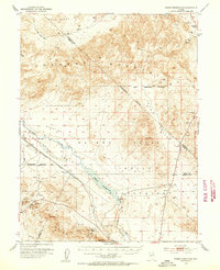
 1893 Wellington1899 Print · USGSThe high valleys of the California-Nevada border were a rugged frontier of mines and ranching in the late nineteenth century. Genealogists and historians can trace early settlements like Wellington, the remote Ludwig Mine, and the mountain camps of Pine Grove and Rockland.6 unique versions available
 - 1907 Map of Tonopah, 1955 Print
 1907 Tonopah1955 Print · USGSCentral Nevada's mining heartland comes alive in this survey of the high desert and mountain ranges at the peak of the silver and gold booms. Researchers can trace the early rail networks of the Goldfield RR and locate sites like Round Mountain, the Orizaba Mine, and Darrough's Hot Springs.
 - 1908 Map of Tonopah
 1908 Tonopah1908 Print · USGSCentral Nevada's mining boom is frozen in time in this early century survey of the Tonopah and Manhattan districts. Trace the old Tonopah and Goldfield RR lines to vanished camps like Berlin and active sites such as the Nevada Mine.3 unique versions available
 - 1908 Map of Carson Sink, 1954 Print
 1908 Carson Sink1954 Print · USGSChurchill County at the opening of the century reveals a landscape of desert mining camps and nascent river irrigation. Genealogists and historians can trace the early streets of Fallon, the remote Nevada Hills Mine, and the location of Dixie.3 unique versions available
 - 1909 Map of Hawthorne, 1955 Print
 1909 Hawthorne1955 Print · USGSWestern Nevada and the California borderlands are captured here during the height of the early mining era. Genealogists and historians can trace rail-depot life and remote outposts from Hawthorne to Belleville, including vanished sites like Oro City and Buckley Camp.
 - 1909 Map of Bridgeport, 1956 Print
 1909 Bridgeport1956 Print · USGSThe High Sierra and Mono Basin are seen here in the decade following the peak of the local gold boom. Genealogists and historians can trace old stage routes and find significant mining sites like the Dunderberg Mine and the remote settlement of Belfort.
 - 1910 Map of Carson Sink
 1910 Carson Sink1910 Print · USGSWestern Nevada at the end of the first decade of the century shows a landscape defined by desert mining camps and the burgeoning Carson-Truckee irrigation projects. Genealogists and historians can trace the early streets of Fallon or locate remote camps like Rawhide and the Nevada Wonder Mine.5 unique versions available
 - 1911 Map of Bridgeport
 1911 Bridgeport1911 Print · USGSMono County at the start of the twentieth century was a landscape of high-altitude mining camps and early park boundaries. Trace the footprints of the gold era at Bodie, locate family ranching history at Mormon Ranch, or study the remote Masonic Liberty Mine.7 unique versions available
 - 1911 Map of Hawthorne
 1911 Hawthorne1911 Print · USGSEarly Nevada mining and rail history come alive in this survey of the Walker Lake region during the era of steam and silver. Researchers can trace the routes of the Southern Pacific System and locate the sites of Lucky Boy, Marietta, and Belleville.4 unique versions available
 - 1914 Map of Mt. Morrison
 1914 Mt. Morrison1914 Print · USGSThe High Sierra and Mono Basin are seen here in the early twentieth century, showing a network of remote ranches and early timber camps. Researchers can trace historic sites like Mono Mills, the remote Dutch Petes Ranch, and the Casa Diablo Mine.8 unique versions available
 - 1915 Map of Hawthorne, 1951 Print
 1915 Hawthorne1951 Print · USGSWestern Nevada at the turn of the century shows a landscape dominated by mining outposts and the reaching arms of the Southern Pacific System. Genealogists can trace early residents to sites like Candelaria, Sodaville, and Mina or locate vanished camps such as Buckley Camp.
 - 1917 Map of White Mountain
 1917 White Mountain1917 Print · USGSThe high desert borderlands of California and Nevada come alive in this survey from the mid-1910s. Researchers can trace the Southern Pacific rail line past remote outposts like Benton Sta. or locate high-altitude workings at the Sacramento Mine and Gold Hit.7 unique versions available
 - 1920 Map of Bridgeport
 1920 Bridgeport1920 Print · USGSThe High Sierra and Mono Basin are shown here in the early twentieth century, during a peak period of mining and ranching. Researchers can locate vanished camps like Star City, trace the California Masonic Road, and find family names at Conway Ranch.
 - 1947 Map of Mariposa, 1948 Print
 1947 Mariposa1948 Print · USGSThe High Sierra and Owens Valley transition is captured here in the late 1940s, just as the region’s hydroelectric and tourism infrastructure was maturing. Genealogists and historians can trace old ranger stations, the Casa Diablo Mine, and rail stops along the Southern Pacific like Benton Station and Zurich.2 unique versions available
 - 1948 Map of Walker Lake
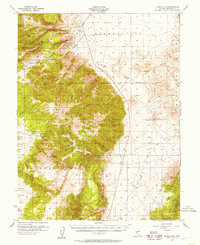
 1948 Walker Lake1948 Print · USGSThe high desert of Nevada and the eastern Sierra Nevada are captured just after the war as mining and ranching shaped the local economy. Genealogists can trace family connections to centers like Hawthorne and Mina or locate the historic Rockland Mines and Aurora.2 unique versions available
 - 1948 Map of Mariposa, 1951 Print
 1948 Mariposa1951 Print · USGSThe High Sierra and Mariposa foothills are shown here in the late 1940s as the post-war tourism and water infrastructure expanded. Genealogists and historians can locate vanished waypoints like Mormon Bar, the Glacier Point Hotel, and the granite quarries of Knowles.
 - 1951 Map of Allen Springs, 1953 Print
 1951 Allen Springs1953 Print · USGSChurchill and Mineral counties at the start of the 1950s reveal a landscape of mining claims and remote outposts. Researchers can trace early mineral works at Pyramid Mine and locate ephemeral desert water at Allen Springs or Lee Hot Springs.3 unique versions available
 - 1951 Map of Weber Reservoir, 1953 Print
 1951 Weber Reservoir1953 Print · USGSLyon and Churchill Counties appear in the early fifties as a landscape of essential water management and mountain transit. Researchers can trace the Southern Pacific rail line, mining prospects in the Terrill Mts, and the construction of the Weber Dam.5 unique versions available
 - 1955 Map of Powell Mtn, 1957 Print
 1955 Powell Mtn1957 Print · USGSMining history and military boundaries define the Garfield Hills during the mid-fifties. Researchers can locate the Lucky Boy Mine and Lucky Boy site near Lucky Boy Pass or trace the Naval Ammunition Depot Reservation border.3 unique versions available
 - 1955 Map of Hawthorne, 1957 Print
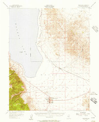 1955 Hawthorne1957 Print · USGSHawthorne and the shores of Walker Lake are captured here during the mid-fifties, when the town was a vital rail and military center. Researchers can trace the layout of the Naval Ammunition Depot, locate the Mineral Co High Sch, and follow the Southern Pacific tracks through Thorne.3 unique versions available
 - 1955 Map of Millett, 1963 Print
 1955 Millett1963 Print · USGSCentral Nevada in the mid-fifties is a landscape of high-desert basins and remote outposts. Researchers can trace historic ranching sites like Petersons Mill and Grass Valley Ranch or locate the McCoy Mining Camp.4 unique versions available
 - 1956 Map of Mt. Grant, 1957 Print
 1956 Mt. Grant1957 Print · USGSThe Wassuk Range and the western shores of Walker Lake are captured here in the mid-1950s. Local researchers can trace family ranching sites like the Flying M Ranch, the East Walker School, and various mining Prospects along the high peaks.3 unique versions available
 - 1956 Map of Aurora, 1957 Print
 1956 Aurora1957 Print · USGSThe Nevada-California borderlands are documented here in the mid-fifties, capturing the remnant mining hubs and high desert ranches of the era. Genealogists and historians can trace the Aurora townsite, the Cresco Mine, and local landmarks like Lucky Boy Pass.3 unique versions available
 - 1956 Map of Tonopah, 1974 Print
 1956 Tonopah1974 Print · USGSCentral Nevada in the mid-fifties reveals a landscape shaped by mining and military footprints. Trace old silver districts near Tonopah and Manhattan, or locate early industrial sites like the Borax works at Columbus Salt Marsh.2 unique versions available
Showing maps 1-25 of 525
Top cities of Mineral County
Frequently asked questions
- What are the different types of historical maps available for Mineral County?
- What is the oldest map of Mineral County?
- Where can I purchase historical maps of Mineral County for my home or office?
- Where can I download high-res historical maps of Mineral County?
- Are there historical topographic maps available for Mineral County?
- Is there historical aerial imagery available for Mineral County?
- Where are historical maps of Mineral County sourced from?