1980s Maps of Mineral County, Nevada
Explore 63 historic maps of Mineral County from the 1980s. These maps offer a rare glimpse into what life looked like during the 1980s — showing old roads, neighborhoods, homes, and landmarks that have changed or disappeared over time.
Whether you're researching your family's past, planning a metal detecting trip, or studying how Mineral County's landscape evolved across the 1980s, these high-resolution maps are a powerful tool for exploring the history of this region.
- Focus on a specific era: All maps on this page are from the 1980s, giving you a focused view of this time period.
- See what’s changed: Compare century-old streets, trails, and buildings to today's modern landscape using overlays and satellite layers.
- Research with precision: Use these maps for genealogy, historical research, land use analysis, or educational projects.
- View, download, or print: Maps are fully viewable online in high resolution, and can be downloaded or printed for your own records.
Start exploring Mineral County's history through authentic maps from the 1980s. This is your window into the past.
Mineral County, NV maps
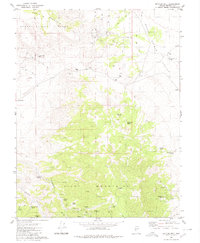
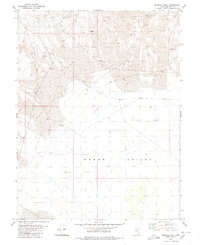
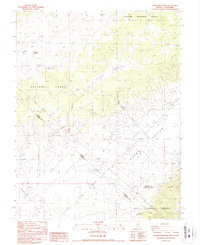
(63)- 1980 Map of Kibby Flat
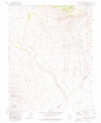
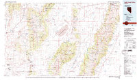
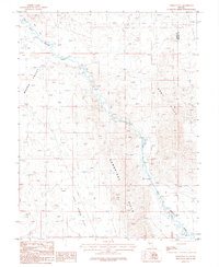
 1980 Kibby Flat1980 Print · USGSThe arid basins of the Monte Cristo Valley are captured here as they appeared in 1980, detailing a landscape defined by mining and desert infrastructure. Trace old industrial footprints at the Dunham Mill (Site) and high-altitude mining at the Tiffany Mine.
 - 1980 Map of Rawhide
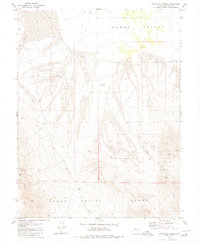
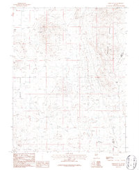
 1980 Rawhide1980 Print · USGSMineral County mining history is preserved in this late twentieth-century survey of the Rawhide District. Researchers can locate the National Mill (Ruins), trace the Old Railroad Grade, and find local landmarks like Hooligan Hill and the Rawhide Cemetery.2 unique versions available
 - 1980 Map of Cole Spring
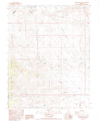
 1980 Cole Spring1980 Print · USGSEsmeralda and Nye counties meet at the high-desert spring and rugged mountain ridges documented here in the early eighties. Researchers can locate remote mineral prospects, a quarry, and the vital water source at Cole Spring along the edge of the Cirac Valley.2 unique versions available
 - 1980 Map of Mount Annie
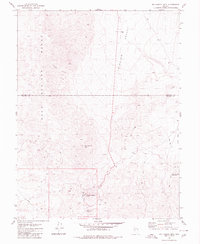
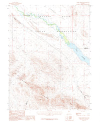
 1980 Mount Annie1980 Print · USGSThe high desert of Mineral and Nye Counties is shown here in the 1980s, highlighting the geothermal features and remote basins of the Nevada interior. Researchers can trace land use through isolated Prospects, water sources like Hot Well, and landmarks including Mount Annie.
 - 1980 Map of Bettles Well
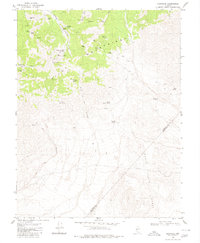
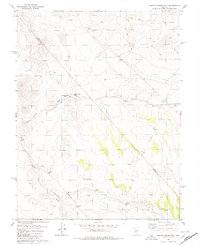
 1980 Bettles Well1980 Print · USGSMineral County's high desert was a landscape of remote mines and vital springs during the early eighties. Genealogists and historians can trace the geography of the Pilot Mountains through isolated landmarks like Bettles Well, the Lakeview Mine, and Warner Corral Spring.
 - 1980 Map of Eddyville
 1980 Eddyville1980 Print · USGSThe Pilot Mountains of central Nevada are shown in the 1980s as a landscape defined by high-altitude mining and desert springs. Researchers can locate remote sites like Eddyville and trace the proximity of the Dunlap Tunnel and Hasbrouck Mine to vital water at Mustang Spring.
 - 1980 Map of Luning
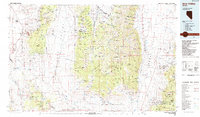
 1980 Luning1980 Print · USGSLuning and the surrounding Mineral County desert are shown in the late seventies as a hub of rail transit and mountain springs. Genealogists and historians can trace the Southern Pacific line past Luning, locating Ruins and Prospects near the Gabbs Valley Range.2 unique versions available
 - 1980 Map of Black Spring
 1980 Black Spring1980 Print · USGSThe high desert of Nye and Mineral Counties is revealed in the late seventies as a land of expansive basins and hidden springs. Researchers can trace the paths of Ione Wash or locate remote sites like Black Spring and a lonely Prospect near the Royston Hills.
 - 1980 Map of Dicalite Summit
 1980 Dicalite Summit1980 Print · USGSMineral and Esmeralda counties met in this high-desert mining landscape during the late twentieth century. Metal detectorists and historians can trace the paths of several Jeep Trails leading to the Good Hope Mine and the Desert Scheelite Mine.
 - 1980 Map of Poinsettia Spring
 1980 Poinsettia Spring1980 Print · USGSMineral County, Nevada, is shown here during the late twentieth century as a landscape of remote mines and desert ranches. Researchers can locate isolated landmarks like the Grave near Poinsettia Mine or the curiously named Car Frame Windmill.
 - 1980 Map of Big Kasock Mtn
 1980 Big Kasock Mtn1980 Print · USGSThe high-desert terrain on the Churchill and Mineral County line is captured here in the late 1970s. Researchers can locate the Nevada Scheelite Camp and Eagleville while tracing mining Prospect sites near Big Kasock Mtn.
 - 1980 Map of Granny Goose Well
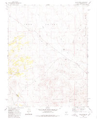
 1980 Granny Goose Well1980 Print · USGSStewart Valley and the Nye-Mineral county line appear here as they were in the late 1970s. Researchers can locate the historical Antone Station (Site), trace remote water sources like Granny Goose Well, and find old desert workings near Indian Well.
 - 1980 Map of Murphys Well
 1980 Murphys Well1980 Print · USGSGabbs Valley in the late 1970s and early 1980s reveals a high-desert landscape defined by mineral exploration and arid-land survival. Trace the routes of a desert economy through features like Murphys Well, the isolated Mine, and remote Prospects.
 - 1985 Map of Excelsior Mts
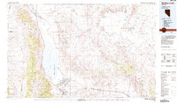
 1985 Excelsior Mts1985 Print · USGSThe Nevada-California borderlands were a center of high-desert mining and military activity in the 1980s. Local history buffs can trace the Southern Pacific rail line and locate heritage sites like the Borealis Mine and Sodaville.2 unique versions available
 - 1985 Map of Walker Lake
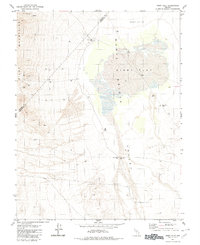
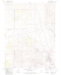
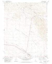
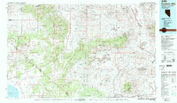
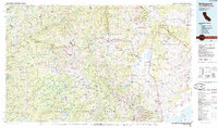
 1985 Walker Lake1985 Print · USGSMineral County in the mid-1980s reveals a unique landscape of military expansion and high-desert settlement. Researchers can trace the massive Hawthorne Ammunition Depot, find old mining sites like the Rita Mine, and locate the Southern Pacific rail line.2 unique versions available
 - 1985 Map of Smith Valley
 1985 Smith Valley1985 Print · USGSThe Nevada-California borderlands are captured here in the mid-1980s, showcasing the high-desert valleys and Sierra peaks. Trace the mining history at Leviathan Mine or explore the early communities of Minden, Wellington, and the Washoe Indian Res.2 unique versions available
 - 1985 Map of Smith Creek Valley
 1985 Smith Creek Valley1985 Print · USGSCentral Nevada in the mid-eighties shows a high-desert landscape of isolated mining sites and remote rangeland. Researchers can trace old operations like the Double Eagle Mine and Hasbrouck Mine or locate the Yomba Indian Reservation and Peterson Station.2 unique versions available
 - 1985 Map of Bridgeport
 1985 Bridgeport1985 Print · USGSThe High Sierra and Nevada borderlands are captured in the mid-1980s, documenting a landscape of national forests and high-altitude mining districts. Researchers can trace historic operations like the Bodie Mine and May Lundy Mine or locate early settlements at Aurora and Baker Station.
 - 1985 Map of Ione Valley
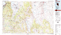
 1985 Ione Valley1985 Print · USGSCentral Nevada in the mid-eighties was a landscape of high desert basins and legendary mining districts. Genealogists and historians can trace the foundations of Round Mountain, the operations of the Manhattan Dredge, and the locations of remote sites like Grantsville and Ione.2 unique versions available
 - 1986 Map of River Spring
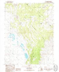 1986 River Spring1986 Print · USGSThe high desert along the California-Nevada border is captured here in the mid-1980s, documenting a remote landscape of springs and forest boundaries. Genealogists and researchers can trace the old settlement at Pizona and locate vital water sources like River Spring Lakes and Antelope Spring.2 unique versions available
 - 1986 Map of Yerington SE, 1987 Print
 1986 Yerington SE1987 Print · USGSLyon County and the East Walker River are captured during the mid-1980s as the desert landscape transitions from valley ranching to upland mining. Researchers can trace historical prospecting sites like several mine shafts and prospects near the Gray Hills.
 - 1986 Map of Yerington NE, 1987 Print
 1986 Yerington NE1987 Print · USGSLyon County and the mineral-rich slopes of the Wassuk Range appear here in the mid-1980s during a period of active geological exploration. Researchers can trace historic mining operations at the Blue Jay Mine, locate a local Landing Strip, and survey the topography of Pumpkin Hollow.
 - 1987 Map of Volcanic Hills West
 1987 Volcanic Hills West1987 Print · USGSEsmeralda County, Nevada, is captured in the late 1980s as a landscape of high-desert mining and isolated springs. Modern researchers can locate the F and L Mine, trace the Pinchot Trail, and identify water sources at Sand Spring Canyon and Wildhorse Flat.
 - 1987 Map of Weber Reservoir
 1987 Weber Reservoir1987 Print · USGSThe Walker River valley in the late eighties was a center of indigenous land, rail transit, and mineral exploration. Genealogists and historians can trace the Southern Pacific corridor as it passes Weber Reservoir and numerous high-desert prospects.
 - 1987 Map of Truman Meadows
 1987 Truman Meadows1987 Print · USGSHigh desert springs and the historic interstate boundary define this borderland region in the late eighties. Researchers can trace the original Von Schmidt Line past the Open Pit Mine or locate water sources like McBride Springs and Orchard Spring.
Showing maps 1-25 of 63
Top cities of Mineral County
Frequently asked questions
- What are the different types of historical maps available for Mineral County?
- What is the oldest map of Mineral County?
- Where can I purchase historical maps of Mineral County for my home or office?
- Where can I download high-res historical maps of Mineral County?
- Are there historical topographic maps available for Mineral County?
- Is there historical aerial imagery available for Mineral County?
- Where are historical maps of Mineral County sourced from?