Old Maps of Mount Montgomery, Nevada for Academic Research
Study the evolution of Mount Montgomery with 13 high-resolution historic maps. Whether you're teaching, researching, or modeling changes in land use, these maps provide essential visual documentation of urban, environmental, and geographic change.
- Analyze long-term change: Track patterns in development, transportation, and natural features.
- Ideal for environmental or urban studies: Support academic projects with primary historical map data.
- Use in the classroom or lab: Educators and researchers rely on these maps to bring historical context to life.
These maps are a powerful tool for teaching, research, and visualizing how Mount Montgomery has changed over the decades.
Mount Montgomery, NV maps
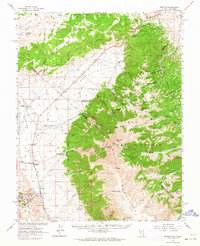
(13)- 1917 Map of White Mountain
 1917 White Mountain1917 Print · USGSThe high desert borderlands of California and Nevada come alive in this survey from the mid-1910s. Researchers can trace the Southern Pacific rail line past remote outposts like Benton Sta. or locate high-altitude workings at the Sacramento Mine and Gold Hit.7 unique versions available
 - 1947 Map of Mariposa, 1948 Print
 1947 Mariposa1948 Print · USGSThe High Sierra and Owens Valley transition is captured here in the late 1940s, just as the region’s hydroelectric and tourism infrastructure was maturing. Genealogists and historians can trace old ranger stations, the Casa Diablo Mine, and rail stops along the Southern Pacific like Benton Station and Zurich.2 unique versions available
 - 1948 Map of Mariposa, 1951 Print
 1948 Mariposa1951 Print · USGSThe High Sierra and Mariposa foothills are shown here in the late 1940s as the post-war tourism and water infrastructure expanded. Genealogists and historians can locate vanished waypoints like Mormon Bar, the Glacier Point Hotel, and the granite quarries of Knowles.
 - 1957 Map of Mariposa, 1966 Print
 1957 Mariposa1966 Print · USGSThe High Sierra and Owens Valley appear in the mid-fifties, showing the intersection of conservation, hydroelectric power, and mountain industry. Genealogists and researchers can trace local landmarks like Yosemite Cemetery, the remote Kinsley Station, and the Pine Creek Mine.4 unique versions available
 - 1962 Map of Benton, 1964 Print
 1962 Benton1964 Print · USGSBenton and the surrounding White Mountain high desert are captured in the early sixties as a landscape of remote ranches and remnant mines. Researchers can trace the Old Railroad Grade and locate historic sites like Montgomery City and the Buckskin Mine.2 unique versions available
 - 1963 Map of Mariposa
 1963 Mariposa1963 Print · USGSThe High Sierra and Owens Valley meet in the early sixties, showing a landscape defined by gold-rush history and massive post-war water projects. Genealogists and researchers can trace old mining routes near Mariposa, locate the Glacier Point Hotel, and find small settlements like Coarse Gold or Knowles Junction.
 - 1987 Map of Mt. Montgomery
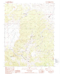 1987 Mt. Montgomery1987 Print · USGSIn the high desert of the late eighties, this survey captures the transition from Mineral to Esmeralda County during a period of active mining. Researchers can trace the path of the Old Railroad Grade and locate historic workings such as the Buckskin Mine and Queen Mine.
 - 1988 Map of Benton Range
 1988 Benton Range1988 Print · USGSThe high desert and alpine peaks of the California-Nevada border come alive in this late-century survey of the Benton Range. Researchers can trace the heritage of remote outposts like Benton and Montgomery City alongside historic workings like the Black Warrior Mine.2 unique versions available
 - 1994 Map of Mt. Montgomery, 1997 Print
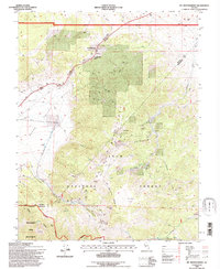 1994 Mt. Montgomery1997 Print · USGSThe Nevada-California borderlands of the mid-nineties reveal a landscape defined by high-desert mining and infrastructure. Trace the operations at the Queen Canyon Mine, follow the Old Railroad Grade, and locate the Gold Hit site near the Pinchot Canyon.
 - 2012 Map of Mount Montgomery, 2012 Print
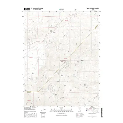
 2012 Mount Montgomery2012 Print · USGSCovers Mount Montgomery, including Esmeralda County, Mineral County, and other nearby areas
 - 2014 Map of Mount Montgomery, 2014 Print
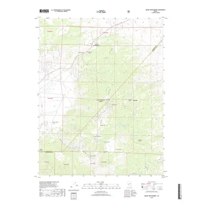
 2014 Mount Montgomery2014 Print · USGSCovers Mount Montgomery, including Esmeralda County, Mineral County, and other nearby areas
 - 2018 Map of Mount Montgomery, 2018 Print
 2018 Mount Montgomery2018 Print · USGSCovers Mount Montgomery, including Esmeralda County, Mineral County, and other nearby areas
 - 2021 Map of Mount Montgomery, 2021 Print
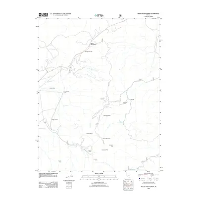
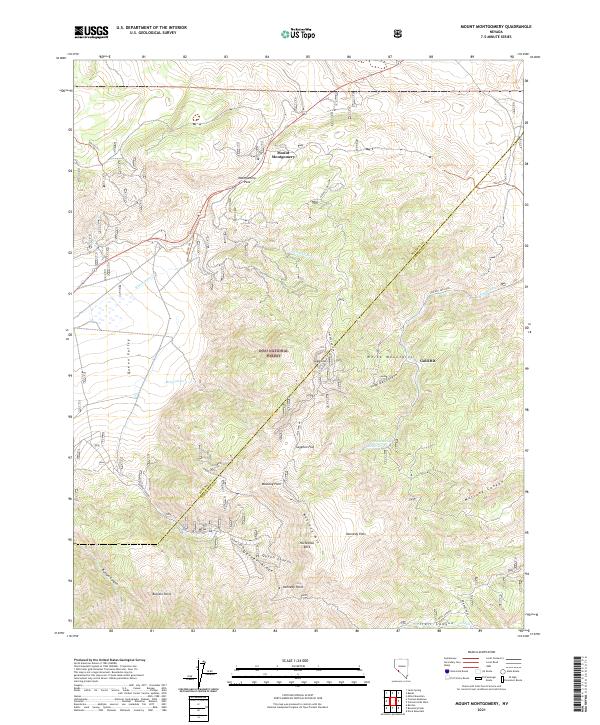 2021 Mount Montgomery2021 Print · USGSThe eastern White Mountains near the Mineral and Esmeralda county line are shown here in the early 2020s. Trace high-altitude landmarks like Montgomery Pass and Mustang Mtn, or follow the winding B&B Mine Road through Inyo National Forest.
End of results
Showing maps 1-13 of 13
Top cities near Mount Montgomery
Frequently asked questions
- What are the different types of historical maps available for Mount Montgomery?
- What is the oldest map of Mount Montgomery?
- Where can I purchase historical maps of Mount Montgomery for my home or office?
- Where can I download high-res historical maps of Mount Montgomery?
- Are there historical topographic maps available for Mount Montgomery?
- Is there historical aerial imagery available for Mount Montgomery?
- Where are historical maps of Mount Montgomery sourced from?