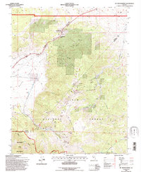
1994 Map of Mt. Montgomery
USGS Topo · Published 1997About this map
The rugged high-desert landscape of White Mountains and the northern tip of the Inyo National Forest define this 1994 survey on the Nevada-California border. This region is a study in extraction and infrastructure, dominated by the mining activity surrounding Mt Montgomery Pass. A network of mines, including the Queen Canyon Mine, Albert Mine, and Spor Mine, are etched into the canyons of Mustang Mountain and Garnet Ridge, marking a history of hard-rock prospecting that persisted late into the twentieth century.
Find a feature on this map
41 named features on this map. Tap any name to fly to it.
Don’t see what you’re looking for? This feature index may not catch every label — zoom into the map to look around manually.
Map Details
Editions of this 1994 Mt. Montgomery Map
This is the sole edition of this map. No revisions or reprints were ever made.
Other maps of this area

1909 · Hawthorne
USGS Topo · 1:250,000

1911 · Hawthorne
USGS Topo · 1:250,000

1915 · Hawthorne
USGS Topo · 1:250,000

1917 · White Mountain
USGS Topo · 1:125,000

1947 · Mariposa
USGS Topo · 1:250,000

1948 · Walker Lake
USGS Topo · 1:250,000

1948 · Mariposa
USGS Topo · 1:250,000

1957 · Walker Lake
USGS Topo · 1:250,000

1957 · Mariposa
USGS Topo · 1:250,000

1962 · Walker Lake
USGS Topo · 1:250,000