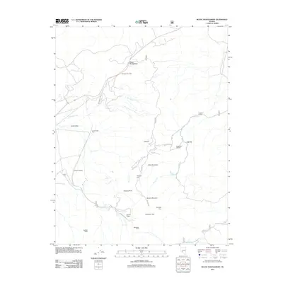
2012 Map of Mount Montgomery
USGS Topo · Published 2012About this map
Mount Montgomery sits at a strategic crossing within the high-elevation landscape of the White Mountains, where the modern corridor of the highway meets the historic Montgomery Pass. This 2012 survey documents the enduring infrastructure of Mineral County, including the Candelaria Pipeline and a network of high-country access points like B&B Mine Rd. The terrain is defined by dramatic elevation changes, from the depths of Sugarloaf Canyon and Queen Canyon to prominent landmarks such as Mustang Mountain and Sugarloaf. The map reveals a land utilized for both ranching and resource management, evidenced by the Hereford Valley Ranch and names like Gold Hit and Pinchot Springs. These features indicate the continued importance of water sources like Hutchinson Cr and Brownie Cr in an otherwise arid environment, while trails like Pinchot Crk Loop suggest contemporary recreational use of the old mining and ranching corridors.
Find a feature on this map
32 named features on this map. Tap any name to fly to it.
Don’t see what you’re looking for? This feature index may not catch every label — zoom into the map to look around manually.
Map Details
Editions of this 2012 Mount Montgomery Map
This is the sole edition of this map. No revisions or reprints were ever made.
Other maps of this area

1909 · Hawthorne
USGS Topo · 1:250,000

1911 · Hawthorne
USGS Topo · 1:250,000

1915 · Hawthorne
USGS Topo · 1:250,000

1917 · White Mountain
USGS Topo · 1:125,000

1947 · Mariposa
USGS Topo · 1:250,000

1948 · Walker Lake
USGS Topo · 1:250,000

1948 · Mariposa
USGS Topo · 1:250,000

1957 · Walker Lake
USGS Topo · 1:250,000

1957 · Mariposa
USGS Topo · 1:250,000

1962 · Walker Lake
USGS Topo · 1:250,000