Old Maps of Sheepshead, Nevada for Hiking & Exploration
Hike through history with 10 historic maps of Sheepshead. Explore old trails, ghost towns, and forgotten backroads — perfect for outdoor adventurers and local explorers.
- Rediscover forgotten places: Map out old mining camps, roads, and footpaths that no longer exist on modern maps.
- Layer with modern tools: Combine with LiDAR or satellite views to plan hikes through historical terrain.
- Made for exploration: Popular among hikers, overlanders, and local history lovers.
Use these maps to find adventure and explore the hidden past of Sheepshead.
Sheepshead, NV maps
(10)- 1886 Map of Granite Range
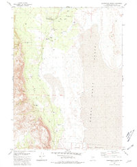
 1886 Granite Range1886 Print · USGSNorthwestern Nevada in the late nineteenth century was a frontier of great lakes and dry basins. Researchers can trace early geography from the Salt Works 3830 in the northern flats to water sources like Sheep-head Spring and Hot Springs.
 - 1894 Map of Granite Range
 1894 Granite Range1894 Print · USGSNorthwestern Nevada was a landscape of stark basins and vital springs during the late nineteenth century. Researchers can trace the early industrial footprint of the Salt Works 3830 and locate perennial water sources like Sheep-head Spring and Smoke Creek.7 unique versions available
 - 1955 Map of Lovelock, 1963 Print
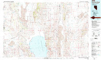
 1955 Lovelock1963 Print · USGSNorthwestern Nevada’s vast desert basins and military ranges are captured here in the mid-fifties, showing a landscape defined by the Humboldt River and the great Pyramid Lake. Genealogists and historians can trace isolated rail stops like Gerlach and Empire, or locate historic workings such as the Golden Eagle Mine and Pershing Mine.5 unique versions available
 - 1959 Map of Lovelock
 1959 Lovelock1959 Print · USGSNorthwestern Nevada in the late fifties is a study in vast desert basins and isolated rail outposts like Gerlach and Sulphur. You can trace the Humboldt River corridor through Lovelock, identify mid-century military zones, and locate the Mine Mill in the northern ranges.2 unique versions available
 - 1981 Map of Sheepshead Spring
 1981 Sheepshead Spring1981 Print · USGSNorthwestern Nevada ranching life and desert hydrology are preserved here in the early eighties. Genealogists and historians can locate remote outposts like Cornell Place, the Sheepshead Ranch, and the Pyramid Lake Indian Reservation boundary.2 unique versions available
 - 1984 Map of Kumiva Peak
 1984 Kumiva Peak1984 Print · USGSThe high desert of Washoe and Pershing counties is captured here in the mid-1980s, centered on the stark beauty of the Pyramid Lake basin. Researchers can trace the dual rail lines of the Southern Pacific and Western Pacific as they navigate the Sand Pass and the edges of the Smoke Creek Desert.
 - 2011 Map of Sheepshead Spring, 2011 Print
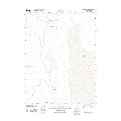 2011 Sheepshead Spring2011 Print · USGSCovers Sheepshead, including Washoe County, United States, and other nearby areas
 - 2014 Map of Sheepshead Spring, 2014 Print
 2014 Sheepshead Spring2014 Print · USGSCovers Sheepshead, including Washoe County, United States, and other nearby areas
 - 2018 Map of Sheepshead Spring, 2018 Print
 2018 Sheepshead Spring2018 Print · USGSCovers Sheepshead, including Washoe County, United States, and other nearby areas
 - 2021 Map of Sheepshead Spring, 2021 Print
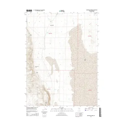
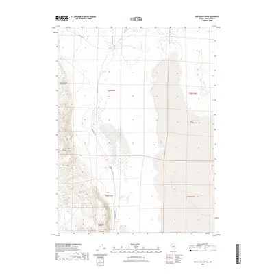
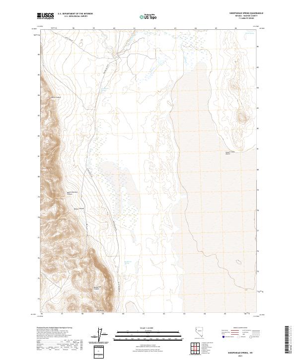 2021 Sheepshead Spring2021 Print · USGSWashoe County's high-desert landscape is captured here in the early twenty-first century, showing the transition from the Smoke Creek Desert to the Sand Range. Researchers can trace remote routes like Surprise Valley Rd and locate vital water sources like Sheepshead Spring and Buckbrush Spring.
End of results
Showing maps 1-10 of 10
Frequently asked questions
- What are the different types of historical maps available for Sheepshead?
- What is the oldest map of Sheepshead?
- Where can I purchase historical maps of Sheepshead for my home or office?
- Where can I download high-res historical maps of Sheepshead?
- Are there historical topographic maps available for Sheepshead?
- Is there historical aerial imagery available for Sheepshead?
- Where are historical maps of Sheepshead sourced from?