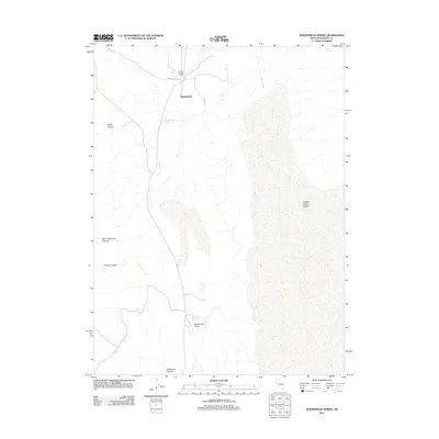
2011 Map of Sheepshead Spring
USGS Topo · Published 2011About this map
Sheepshead is situated at the northwestern edge of the expansive Smoke Creek Desert in this high-desert Nevada landscape. The area is defined by its critical water sources, including Sheepshead Spring, Mocho Spring, and Buckbrush Spring, which historically supported movement through this arid basin. Transport across the terrain is primarily facilitated by Smoke Creek Rd, which winds near the banks of Lower Smoke Creek.
Find a feature on this map
13 named features on this map. Tap any name to fly to it.
Don’t see what you’re looking for? This feature index may not catch every label — zoom into the map to look around manually.
Map Details
Editions of this 2011 Sheepshead Spring Map
This is the sole edition of this map. No revisions or reprints were ever made.
Other maps of this area

1886 · Granite Range
USGS Topo · 1:250,000

1894 · Granite Range
USGS Topo · 1:250,000

1955 · Lovelock
USGS Topo · 1:250,000

1959 · Lovelock
USGS Topo · 1:250,000

1965 · Fox Range
USGS Topo · 1:62,500

1980 · Salt Marsh
USGS Topo · 1:24,000
1980 · Red Rock Canyon
USGS Topo · 1:24,000
1980 · Parker Canyon
USGS Topo · 1:24,000
1980 · Sand Pass
USGS Topo · 1:24,000

1980 · Hog Spring
USGS Topo · 1:24,000