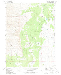
1980 Map of Salt Marsh
USGS Topo · Published 1980About this map
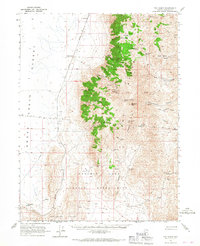
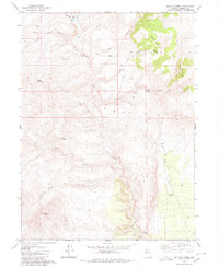
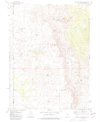
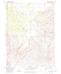
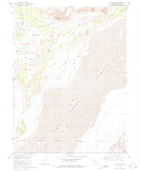
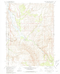
Salt Marsh Desert defines this arid stretch of northwestern Nevada, where groundwater resources and saline features dominate the landscape. In this 1980 survey, the interplay between water and mineral deposits is evident at the Salt Works Well 3883 and several instances of ruins that suggest earlier human attempts to harness the land's resources. To the west, the topography rises sharply at Burro Mountain, with travelers crossing the ridge via Burro Mountain Pass. The lowlands are marked by extensive alkali flats and a series of artesian features, including Flowing Well 3889 and other indexed flowing wells. The northern drainage is captured by Buffalo Slough and the Parker Reservoirs, while Smoke Creek cuts through the southern portion of the quadrangle, illustrating the drainage patterns that characterize this high desert environment during the late twentieth century.
Find a feature on this map
23 named features on this map. Tap any name to fly to it.
Don’t see what you’re looking for? This feature index may not catch every label — zoom into the map to look around manually.
Map Details
Editions of this 1980 Salt Marsh Map
This is the sole edition of this map. No revisions or reprints were ever made.
Other maps of this area

1886 · Granite Range
USGS Topo · 1:250,000

1894 · Granite Range
USGS Topo · 1:250,000

1955 · Lovelock
USGS Topo · 1:250,000

1959 · Lovelock
USGS Topo · 1:250,000
1965 · Fox Range
USGS Topo · 1:62,500
1980 · Buffalo Creek
USGS Topo · 1:24,000
1980 · Red Rock Canyon
USGS Topo · 1:24,000
1980 · Mixie Flat
USGS Topo · 1:24,000
1980 · Hog Spring
USGS Topo · 1:24,000
1980 · Smoke Creek Ranch
USGS Topo · 1:24,000