Old Maps of Strafford County, New Hampshire for Academic Research
Study the evolution of Strafford County with 151 high-resolution historic maps. Whether you're teaching, researching, or modeling changes in land use, these maps provide essential visual documentation of urban, environmental, and geographic change.
- Analyze long-term change: Track patterns in development, transportation, and natural features.
- Ideal for environmental or urban studies: Support academic projects with primary historical map data.
- Use in the classroom or lab: Educators and researchers rely on these maps to bring historical context to life.
These maps are a powerful tool for teaching, research, and visualizing how Strafford County has changed over the decades.
Strafford County, NH maps
(151)- 1891 Map of Berwick
 1891 Berwick1891 Print · USGSThe Maine-New Hampshire borderlands are captured here in the late nineteenth century, defined by the industrial river valleys and growing rail lines. Researchers can trace the early layout of Sanford, locate the mill sites at Emerys Mills, or follow the Rochester and Portland Railroad through the Lebanon hills.
 - 1891 Map of Newfield
 1891 Newfield1891 Print · USGSThe York County hill country comes to life in the 1890s, when the region was a tapestry of mill towns and scattered farm hamlets. Researchers can trace the early layout of Limerick, the industry at Ossipee Mills, and the border-spanning waters of Great East Pond.
 - 1893 Map of Dover
 1893 Dover1893 Print · USGSThe Maine and New Hampshire borderlands come alive in this late nineteenth-century survey of the Seacoast and Piscataqua River regions. Genealogists and historians can trace defunct rail stops like Barrington Station and South Newmarket Junction or locate the industrial Great Works mill.5 unique versions available
 - 1893 Map of Berwick
 1893 Berwick1893 Print · USGSThe Maine-New Hampshire borderlands come alive in the late nineteenth century as a hub of water-powered industry and rail transport. Researchers can trace the sprawling rural hamlets of Lebanon and the industrial activity at Great Falls along the Salmon Falls River.6 unique versions available
 - 1893 Map of Newfield
 1893 Newfield1893 Print · USGSMaine's borderlands and the York County interior are captured in the late nineteenth century as small-scale industry thrived along the rivers. Researchers can trace historic family lands near Great East Pond or study the early village layouts of Ossipee Mills, South Parsonsfield, and Maplewood.6 unique versions available
 - 1916 Map of Dover
 1916 Dover1916 Print · USGSCoastal New Hampshire and the Maine borderlands are captured here during the height of the rail era. Genealogists can locate dozens of district schools like Madbury School and trace the paths of the Boston and Maine Railroad through Portsmouth and Dover.2 unique versions available
 - 1917 Map of Mt. Pawtuckaway, 1957 Print
 1917 Mt. Pawtuckaway1957 Print · USGSSoutheast New Hampshire in the early 1900s was a landscape of concentrated village centers and active rail lines. Genealogists can locate family landmarks like Rundlett Hills and Winkley School or trace the early paths of the Isinglass River and Pawtuckaway Pond.
 - 1918 Map of Dover
 1918 Dover1918 Print · USGSCoastal New Hampshire and the Maine borderlands are captured here during the First World War era, showing a landscape defined by tidal rivers and rail networks. Genealogists can trace family landmarks and early civic life through the State College in Durham, the Kittery Depot, and local schoolhouses like Marshwood.6 unique versions available
 - 1919 Map of Mt. Pawtuckaway
 1919 Mt. Pawtuckaway1919 Print · USGSSoutheastern New Hampshire is captured just after the Great War, showing a landscape of upland farms and rural villages connected by the Boston and Maine Railroad. Genealogists can locate family-named landmarks and institutions like the Winkley School, Nottingham Square, and the County Farm.5 unique versions available
 - 1919 Map of Alton
 1919 Alton1919 Print · USGSEastern New Hampshire in the years following the Great War reveals a landscape of high ridges and valley settlements. Trace ancestral roots through small rural outposts like Middleton Corners and schools like the Willeytown School or Ten Rod School.6 unique versions available
 - 1928 Map of Wolfeboro
 1928 Wolfeboro1928 Print · USGSThe Lakes Region thrives in the late twenties as a premier destination for rail travelers and summer residents. Trace family history through Wolfeboro landmarks like Brewster Academy or find old stop-offs along the Boston and Maine RR.7 unique versions available
 - 1933 Map of Berwick
 1933 Berwick1933 Print · USGSThe Salmon Falls River valley in the early thirties was a bustling corridor of rail and river industry between New Hampshire and Maine. Researchers can trace the path of the Boston and Maine RR through Rochester or locate rural landmarks like Hayes Sta and Walnut Grove Ch.
 - 1933 Map of Newfield
 1933 Newfield1933 Print · USGSThe Maine-New Hampshire borderlands in the early 1930s are captured here as a series of connected lakeside settlements. Trace family roots and old property lines near Milton Mills, Spinney Church, and the shores of Great East Lake.
 - 1937 Map of Newfield
 1937 Newfield1937 Print · USGSThe Maine and New Hampshire borderlands are captured here during the late 1930s, showing a landscape defined by riverside villages and glacial lakes. Genealogists and historians can trace family locations near Ossipee Mills, Spuney Ch, and the many hamlets of Parsonsfield.3 unique versions available
 - 1937 Map of Berwick
 1937 Berwick1937 Print · USGSThe Maine-New Hampshire borderlands are captured here in the mid-1930s, showing a landscape defined by the Salmon Falls River and the region's busy rail lines. Researchers can trace old routes to North Rochester PO, Hayes Sta, and the school at S Milton Sch.3 unique versions available
 - 1939 Map of Mt. Pawtuckaway
 1939 Mt. Pawtuckaway1939 Print · USGSSoutheastern New Hampshire is shown just before the mid-century as a land of granite hills, numerous ponds, and deep-rooted villages. Trace the path of the Boston and Maine Railroad or locate family sites like the Poore Farm School and Nottingham Square.
 - 1941 Map of Dover
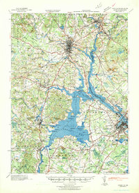 1941 Dover1941 Print · USGSCoastal New Hampshire and the Maine borderlands are captured here just before the mobilization of the early 1940s. Genealogists can trace family lands near Garrison Hill, old district schools like Witchtrot Sch, and the rail depots at Greenland Village Sta.
 - 1941 Map of Berwick, 1957 Print
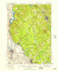 1941 Berwick1957 Print · USGSThe borderlands of Maine and New Hampshire come alive in this mid-century survey of the industrial and rural landscape along the Salmon Falls River. Researchers can trace the Boston and Maine rail line through Rindgemere Sta or locate family landmarks like Miller Corner and Lincoln Sch.
 - 1942 Map of Newfield, 1959 Print
 1942 Newfield1959 Print · USGSThe Maine and New Hampshire borderlands come to life in the early 1940s, showing a network of mill towns and mountain peaks. Researchers can trace family lines through small settlements like South Parsonsfield, locate the Spinney Ch, or explore the shores of Great East Lake and Mousam Lake.
 - 1944 Map of Mt. Pawtuckaway
 1944 Mt. Pawtuckaway1944 Print · USGSMid-century Rockingham and Strafford counties are captured here at a time when rural schoolhouses and rail lines still defined the local landscape. Genealogists can trace family names across Winkley Sch and Philbrick Sch, or locate vanished industries like the Deer Mill and the Boston and Maine Railroad.
 - 1944 Map of Berwick
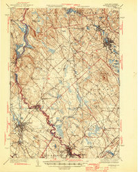 1944 Berwick1944 Print · USGSThe Maine-New Hampshire borderlands are captured here during the wartime era, showing the industrial and rural landscapes of York and Strafford counties. Genealogists can trace family names at Blaisdell Corners or locate the Evergreen Cem and numerous rural schools like Washington Sch.3 unique versions available
 - 1944 Map of Newfield
 1944 Newfield1944 Print · USGSYork County and the New Hampshire borderlands are captured here during the mid-1940s, showing a landscape of mill towns and interconnected lakes. Genealogists and historians can trace family-named sites like Dearborn Mtn and Stevens Cor or explore the early layouts of Limerick and Milton Mills.2 unique versions available
 - 1949 Map of Portland
 1949 Portland1949 Print · USGSCoastal Maine and the New Hampshire interior are shown in detail during the late forties, from the bustling harbors to the lakeside villages. Researchers can trace historical rail networks like the Boston & Maine RR and locate coastal defenses such as Fort Preble.3 unique versions available
 - 1950 Map of Dover East
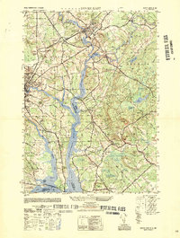 1950 Dover East1950 Print · USGSThe borderlands of New Hampshire and Maine are captured here at mid-century, following the winding Salmon Falls River through a landscape of rail-connected towns. Researchers can trace historic cemeteries and schools such as Pine Hill Cem, Pear Yard School, and the junction at Eliot Depot.
 - 1952 Map of Dover West
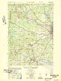 1952 Dover West1952 Print · USGSCoastal New Hampshire's interior during the early 1950s shows a landscape of small townships and rail-connected farms before major highway expansion. Researchers can trace the mid-century footprint of the University of New Hampshire, local landmarks like the Madbury Church, and the route of the Maine Central RR.
Showing maps 1-25 of 151
Top cities of Strafford County
- Dover historical maps
- Rochester historical maps
- Somersworth historical maps
- Durham historical maps
- Barrington historical maps
- Farmington historical maps
See more
Frequently asked questions
- What are the different types of historical maps available for Strafford County?
- What is the oldest map of Strafford County?
- Where can I purchase historical maps of Strafford County for my home or office?
- Where can I download high-res historical maps of Strafford County?
- Are there historical topographic maps available for Strafford County?
- Is there historical aerial imagery available for Strafford County?
- Where are historical maps of Strafford County sourced from?