2020s Maps of Clinton Township, New Jersey
Explore 4 historic maps of Clinton Township from the 2020s. These maps offer a rare glimpse into what life looked like during the 2020s — showing old roads, neighborhoods, homes, and landmarks that have changed or disappeared over time.
Whether you're researching your family's past, planning a metal detecting trip, or studying how Clinton Township's landscape evolved across the 2020s, these high-resolution maps are a powerful tool for exploring the history of this region.
- Focus on a specific era: All maps on this page are from the 2020s, giving you a focused view of this time period.
- See what’s changed: Compare century-old streets, trails, and buildings to today's modern landscape using overlays and satellite layers.
- Research with precision: Use these maps for genealogy, historical research, land use analysis, or educational projects.
- View, download, or print: Maps are fully viewable online in high resolution, and can be downloaded or printed for your own records.
Start exploring Clinton Township's history through authentic maps from the 2020s. This is your window into the past.
Clinton Township, NJ maps
(4)- 2023 Map of Pittstown, 2023 Print
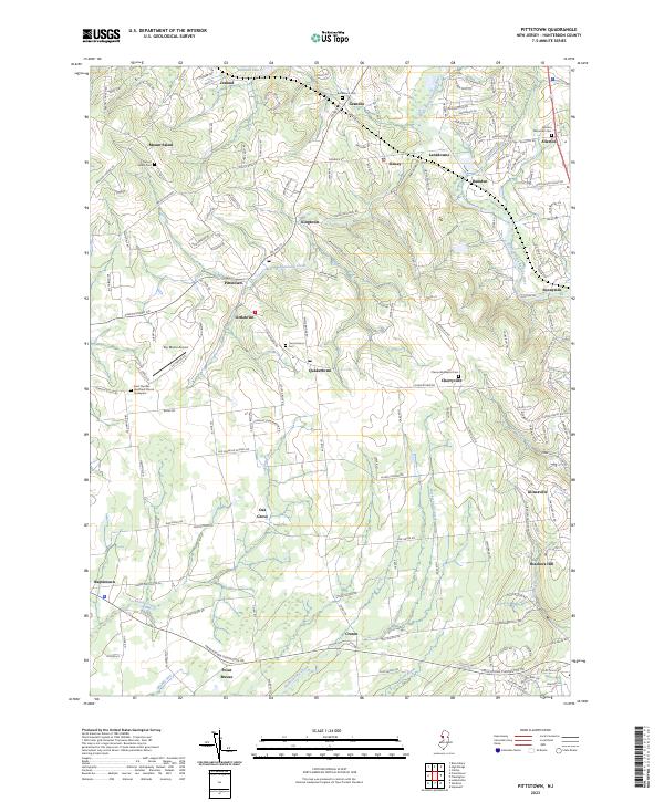 2023 Pittstown2023 Print · USGSHunterdon County's rural heritage is preserved in this detailed study of the area's crossroads and waterways. Genealogists can trace family roots at the Saint Thomas Episcopal Church Graveyard or explore the hamlets of Pittstown and Quakertown.
 - 2023 Map of Califon, 2023 Print
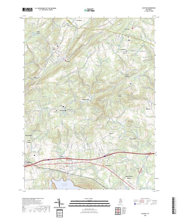 2023 Califon2023 Print · USGSHunterdon and Morris Counties are shown here during the early twenty-first century as modern growth integrates with historic rural centers. Genealogists and historians can trace local roots through the Fairmount Cemetery, McCrea Mills, and the historic Cokesbury churchyards.
 - 2023 Map of Flemington, 2023 Print
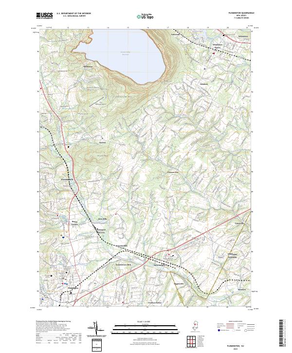 2023 Flemington2023 Print · USGSFlemington and the surrounding Hunterdon County countryside are documented here in the early twenty-first century. Genealogists can trace family names at Newell Cem and Three Bridges Reformed Church Cem, or locate former industrial sites like Rockefellows Mills.
 - 2023 Map of High Bridge, 2023 Print
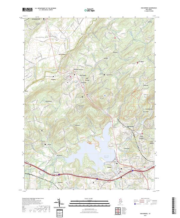 2023 High Bridge2023 Print · USGSHunterdon and Warren counties are seen here in the modern era, where industrial history meets significant water infrastructure. Genealogists can locate family burial sites at Fountain Grove Cem or Norton Cem and trace the rail corridors through Hampton Junction and Bells Crossing.
End of results
Showing maps 1-4 of 4
Top cities near Clinton Township
- Franklin Township historical maps
- Bridgewater Township historical maps
- Hillsborough Township historical maps
- Mount Olive historical maps
- Raritan Township historical maps
- Montgomery Township historical maps
See more
Top neighborhoods of Clinton Township
- Cedar Heights historical maps
- Mariannes Corner historical maps
- Readingsburg historical maps
- Annandale historical maps
- Cokesbury historical maps
- Hamden historical maps
See more
Frequently asked questions
- What are the different types of historical maps available for Clinton Township?
- What is the oldest map of Clinton Township?
- Where can I purchase historical maps of Clinton Township for my home or office?
- Where can I download high-res historical maps of Clinton Township?
- Are there historical topographic maps available for Clinton Township?
- Is there historical aerial imagery available for Clinton Township?
- Where are historical maps of Clinton Township sourced from?