1980s Maps of Monmouth County, New Jersey
Explore 10 historic maps of Monmouth County from the 1980s. These maps offer a rare glimpse into what life looked like during the 1980s — showing old roads, neighborhoods, homes, and landmarks that have changed or disappeared over time.
Whether you're researching your family's past, planning a metal detecting trip, or studying how Monmouth County's landscape evolved across the 1980s, these high-resolution maps are a powerful tool for exploring the history of this region.
- Focus on a specific era: All maps on this page are from the 1980s, giving you a focused view of this time period.
- See what’s changed: Compare century-old streets, trails, and buildings to today's modern landscape using overlays and satellite layers.
- Research with precision: Use these maps for genealogy, historical research, land use analysis, or educational projects.
- View, download, or print: Maps are fully viewable online in high resolution, and can be downloaded or printed for your own records.
Start exploring Monmouth County's history through authentic maps from the 1980s. This is your window into the past.
Monmouth County, NJ maps
(10)- 1982 Map of Trenton, 1983 Print
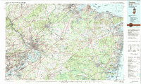 1982 Trenton1983 Print · USGSCentral New Jersey and the Delaware River valley are captured in the early eighties during a time of major highway expansion and suburban maturation. Researchers can trace the grounds of Princeton University, the historic Monmouth Battlefield, and the sprawling Fort Dix.
 - 1983 Map of Long Branch, 1984 Print
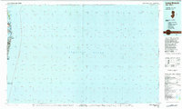 1983 Long Branch1984 Print · USGSThe Jersey Shore in the early 1980s is captured here, tracing the coastline from the tip of the peninsula to the bustling beachfronts. Researchers can locate coastal neighborhoods like Sea Bright and Low Moor, and trace the shorelines of Lake Takanassee and the Shrewsbury River.
 - 1984 Map of Newark, 1985 Print
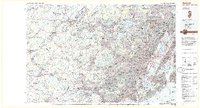 1984 Newark1985 Print · USGSNorthern New Jersey's massive industrial and transit network is on full display in the mid-eighties, showing the region just before modern redevelopment. Genealogists and historians can trace the dense urban grids of Newark, find historic landmarks like Ellis Island, and locate the sprawling Picatinny Arsenal in the western hills.
 - 1984 Map of Long Island West, 1986 Print
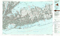 1984 Long Island West1986 Print · USGSWestern Long Island in the mid-eighties shows a mature suburban landscape defined by its famous expressways and historic rail lines. Researchers can trace the development of planned communities like Levittown or locate landmarks such as Fort Totten Mil Res and Stony Brook.2 unique versions available
 - 1986 Map of Newark, 1987 Print
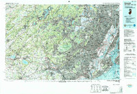 1986 Newark1987 Print · USGSNorthern New Jersey during the mid-eighties shows an incredible transition from the industrial harbor to the wooded Highlands. Researchers can trace the massive footprints of Picatinny Arsenal and Newark International Airport or explore protected lands like the Great Swamp National Wildlife Refuge.
 - 1986 Map of Trenton, 1987 Print
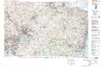 1986 Trenton1987 Print · USGSCentral New Jersey and the Delaware River valley are shown here during the mid-eighties, a period of dense suburban growth and military activity. Researchers can trace the sprawling grounds of the Fort Dix Military Reservation and the historic corridors of the Delaware & Raritan Canal State Park.
 - 1989 Map of Point Pleasant
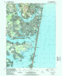 1989 Point Pleasant1989 Print · USGSCoastal New Jersey comes into sharp focus during the late eighties, documenting the dense development along the Barnegat Bay and the Atlantic. Traces of local life are everywhere, from the National Guard Training Center to landmarks like St Paul Ch and Lake of the Lilies.2 unique versions available
 - 1989 Map of Lakewood
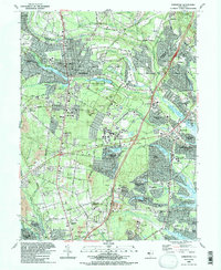 1989 Lakewood1989 Print · USGSCoastal New Jersey suburban life is in full bloom during the late eighties as residential developments spread across Ocean County. Researchers can trace the layout of Leisure Village, locate family plots in Evergreen Cem, or follow the industrial sites near Seven Stars.2 unique versions available
 - 1989 Map of Farmingdale
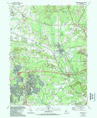 1989 Farmingdale1989 Print · USGSMonmouth County during the late eighties shows a landscape of growing residential hubs and large-scale military and state lands. Trace family roots and local changes through landmarks like Evergreen Cem, the Ardena Ch, and the sprawling U S Naval Weapons Station Earle.
 - 1989 Map of Asbury Park
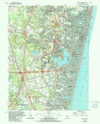 1989 Asbury Park1989 Print · USGSCoastal Monmouth County comes alive in the late eighties, documenting the dense borough grids and expanding inland suburbs. Trace local history through landmark sites like the Jersey Shore Medical Center, Mt Calvary Cem, and the tracks of the New York and Long Branch RR.
End of results
Showing maps 1-10 of 10
Top cities of Monmouth County
- Middletown Township historical maps
- Howell Township historical maps
- Marlboro Township historical maps
- Manalapan Township historical maps
- Freehold Township historical maps
- Long Branch historical maps
See more
Frequently asked questions
- What are the different types of historical maps available for Monmouth County?
- What is the oldest map of Monmouth County?
- Where can I purchase historical maps of Monmouth County for my home or office?
- Where can I download high-res historical maps of Monmouth County?
- Are there historical topographic maps available for Monmouth County?
- Is there historical aerial imagery available for Monmouth County?
- Where are historical maps of Monmouth County sourced from?