2020s Maps of Eagleswood Township, New Jersey
Explore 4 historic maps of Eagleswood Township from the 2020s. These maps offer a rare glimpse into what life looked like during the 2020s — showing old roads, neighborhoods, homes, and landmarks that have changed or disappeared over time.
Whether you're researching your family's past, planning a metal detecting trip, or studying how Eagleswood Township's landscape evolved across the 2020s, these high-resolution maps are a powerful tool for exploring the history of this region.
- Focus on a specific era: All maps on this page are from the 2020s, giving you a focused view of this time period.
- See what’s changed: Compare century-old streets, trails, and buildings to today's modern landscape using overlays and satellite layers.
- Research with precision: Use these maps for genealogy, historical research, land use analysis, or educational projects.
- View, download, or print: Maps are fully viewable online in high resolution, and can be downloaded or printed for your own records.
Start exploring Eagleswood Township's history through authentic maps from the 2020s. This is your window into the past.
Eagleswood Township, NJ maps
(4)- 2023 Map of Beach Haven, 2023 Print
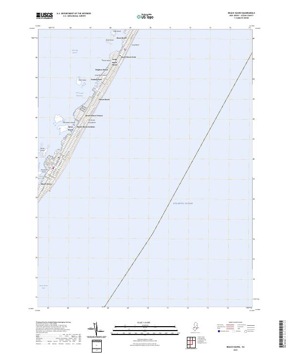 2023 Beach Haven2023 Print · USGSLong Beach Island is shown here as a dense corridor of coastal settlements between the Atlantic and the bay. You can trace the detailed street grids of Beach Haven and Brant Beach or locate smaller bayside features like Mordecai Island and Harris Harbor.
 - 2023 Map of Ship Bottom, 2023 Print
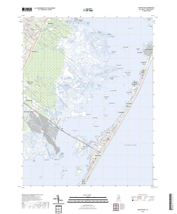 2023 Ship Bottom2023 Print · USGSLong Beach Island and the mainland marshlands are captured in detail during the early 2020s. Genealogists and local historians can trace family-named points and shoreline developments from Ship Bottom and Surf City to the reaches of Loveladies and Manahawkin.
 - 2023 Map of West Creek, 2023 Print
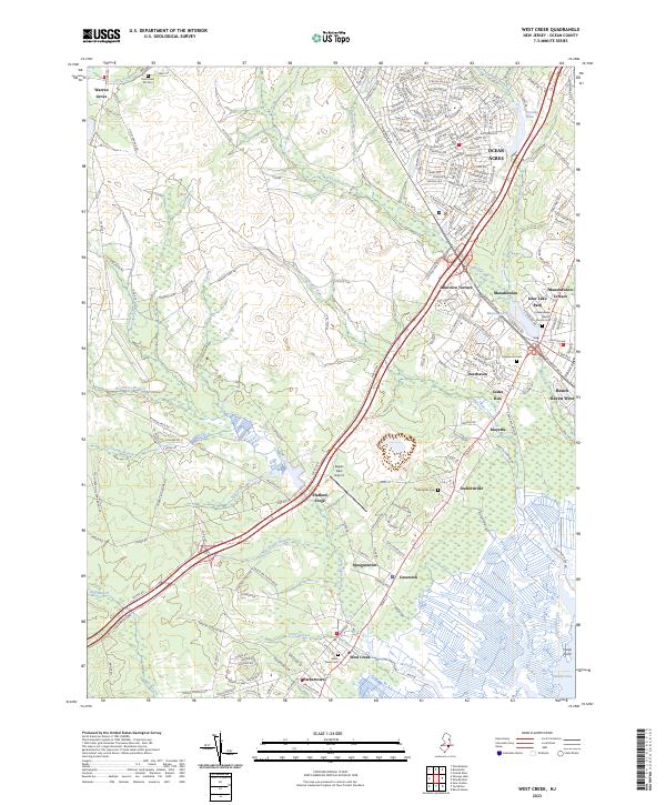 2023 West Creek2023 Print · USGSCoastal Ocean County in the 2020s reveals a landscape where modern residential growth meets the heritage of the Pine Barrens. Researchers can trace historic sites like Stafford Forge and Spraguetown while locating family roots at West Creek Cem and Staffordville Cem.
 - 2023 Map of Tuckerton, 2023 Print
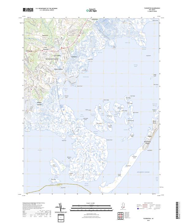 2023 Tuckerton2023 Print · USGSThe Jersey Shore's intricate tidal marshes and barrier islands are captured in this contemporary survey of the Tuckerton area. Researchers can trace historical mainland neighborhoods like Giffordtown and Nugentown or explore the marsh geography of Johnny Sedge and Mordecai Island.
End of results
Showing maps 1-4 of 4
Top cities near Eagleswood Township
- Egg Harbor Township historical maps
- Manchester Township historical maps
- Berkeley Township historical maps
- Galloway Township historical maps
- Stafford Township historical maps
- Lacey Township historical maps
See more
Top neighborhoods of Eagleswood Township
- Staffordville historical maps
- West Creek historical maps
- Coxstown historical maps
- Spraguetown historical maps
- Stafford Forge historical maps
- Eagleswood Village historical maps
See more
Frequently asked questions
- What are the different types of historical maps available for Eagleswood Township?
- What is the oldest map of Eagleswood Township?
- Where can I purchase historical maps of Eagleswood Township for my home or office?
- Where can I download high-res historical maps of Eagleswood Township?
- Are there historical topographic maps available for Eagleswood Township?
- Is there historical aerial imagery available for Eagleswood Township?
- Where are historical maps of Eagleswood Township sourced from?