2020s Maps of Totowa, New Jersey
Explore 2 historic maps of Totowa from the 2020s. These maps offer a rare glimpse into what life looked like during the 2020s — showing old roads, neighborhoods, homes, and landmarks that have changed or disappeared over time.
Whether you're researching your family's past, planning a metal detecting trip, or studying how Totowa's landscape evolved across the 2020s, these high-resolution maps are a powerful tool for exploring the history of this region.
- Focus on a specific era: All maps on this page are from the 2020s, giving you a focused view of this time period.
- See what’s changed: Compare century-old streets, trails, and buildings to today's modern landscape using overlays and satellite layers.
- Research with precision: Use these maps for genealogy, historical research, land use analysis, or educational projects.
- View, download, or print: Maps are fully viewable online in high resolution, and can be downloaded or printed for your own records.
Start exploring Totowa's history through authentic maps from the 2020s. This is your window into the past.
Totowa, NJ maps
(2)- 2023 Map of Pompton Plains, 2023 Print
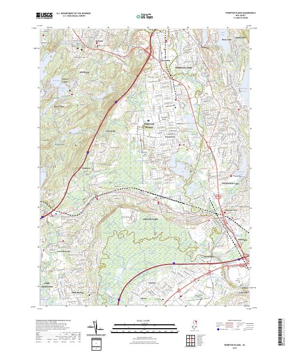 2023 Pompton Plains2023 Print · USGSThe confluence of the Pequannock, Ramapo, and Wanaque rivers defines this North Jersey landscape as it appears in the early twenty-first century. Genealogists and local historians can trace the path of the Morris Canal or locate family markers at Mount Rest Cem and Brown Cem.
 - 2023 Map of Paterson, 2023 Print
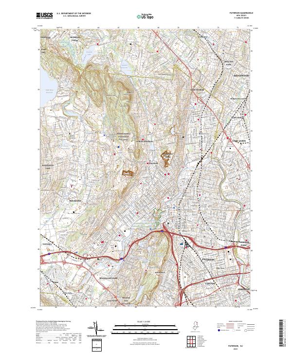 2023 Paterson2023 Print · USGSThe industrial heart of Passaic County meets the ridges of the Watchung Mountains in this contemporary survey of the North Jersey urban corridor. Trace local history through numerous burial grounds like Laurel Grove Cem or follow the Passaic River past the landmark Paterson Great Falls.
End of results
Showing maps 1-2 of 2
Top cities near Totowa
- New York historical maps
- Newark historical maps
- Jersey City historical maps
- Ramapo historical maps
- Paterson historical maps
- Elizabeth historical maps
See more
Frequently asked questions
- What are the different types of historical maps available for Totowa?
- What is the oldest map of Totowa?
- Where can I purchase historical maps of Totowa for my home or office?
- Where can I download high-res historical maps of Totowa?
- Are there historical topographic maps available for Totowa?
- Is there historical aerial imagery available for Totowa?
- Where are historical maps of Totowa sourced from?