1900s (20th Century) Maps of Warren Township, New Jersey
Explore 27 historic maps of Warren Township from the 1900s (20th Century). These maps offer a rare glimpse into what life looked like during the 1900s — showing old roads, neighborhoods, homes, and landmarks that have changed or disappeared over time.
Whether you're researching your family's past, planning a metal detecting trip, or studying how Warren Township's landscape evolved across the 1900s, these high-resolution maps are a powerful tool for exploring the history of this region.
- Focus on a specific era: All maps on this page are from the 1900s, giving you a focused view of this time period.
- See what’s changed: Compare century-old streets, trails, and buildings to today's modern landscape using overlays and satellite layers.
- Research with precision: Use these maps for genealogy, historical research, land use analysis, or educational projects.
- View, download, or print: Maps are fully viewable online in high resolution, and can be downloaded or printed for your own records.
Start exploring Warren Township's history through authentic maps from the 1900s. This is your window into the past.
Warren Township, NJ maps
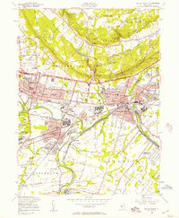
(27)- 1900 Map of Passaic
 1900 Passaic1900 Print · USGSNorthern New Jersey and the New York Harbor are captured here at the close of the nineteenth century, showing a landscape defined by rail, river, and coastal defense. Researchers can trace the original path of the Morris Canal, locate Seton Hall College, and explore the batteries at Fort Wadsworth.
 - 1900 Map of Raritan
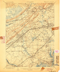
 1900 Raritan1900 Print · USGSNorth Jersey in the late nineteenth century was a complex web of mountain ridges and vital rail corridors. Researchers can trace ancestral routes through old junctions like High Bridge, industrial sites at Mine Hill, and the shores of Lake Hopatcong.
 - 1905 Map of Plainfield
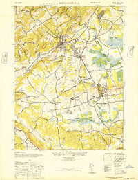
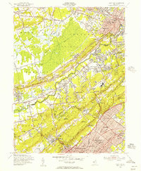
 1905 Plainfield1905 Print · USGSNorth-central New Jersey at the turn of the century shows a landscape transitioning from rural townships to a bustling suburban and industrial network. Researchers can trace early property patterns and rail expansion through Great Swamp, Washington Rock, and Baltusrol.6 unique versions available
 - 1905 Map of Raritan
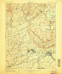
 1905 Raritan1905 Print · USGSNorthern New Jersey's ridges and valleys are meticulously detailed here at the turn of the century. You can trace the complex rail networks of the Lehigh Valley R.R. and locate family landmarks from Swayze Mills to the Powder Depot near Picatinny Peak.2 unique versions available
 - 1905 Map of Somerville
 1905 Somerville1905 Print · USGSCentral New Jersey at the start of the twentieth century shows a landscape shaped by the Raritan River and early rail expansion. Researchers can trace the Delaware and Raritan Canal, locate landmarks like Chimney Rock, and find old centers like Pluckemin and Bernardsville.3 unique versions available
 - 1905 Map of Passaic
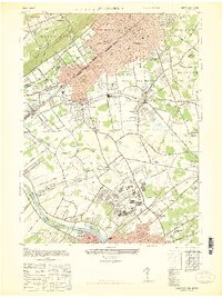
 1905 Passaic1905 Print · USGSNorthern New Jersey and Staten Island appear here at a pivotal moment of early 20th-century growth and industrialization. Researchers can trace the development of transit hubs like Convent Sta. or locate legacy landmarks including Hillside Cemetery and the Moravian Cemetery.4 unique versions available
 - 1921 Map of Plainfield
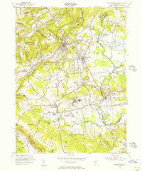
 1921 Plainfield1921 Print · USGSNew Jersey's industrial corridor meets the ridges of the First and Second Mountains in the early twenties. Genealogists can trace family names and small settlements like Raritan Landing, Smalleytown, and the grounds of the New Jersey Reformatory.
 - 1942 Map of Passaic
 1942 Passaic1942 Print · USGSNorthern New Jersey and New York harbor appear in detail at the start of the war, showing a landscape of burgeoning suburbs and vital industry. Trace family roots and local history across the Passaic River valley, from Paterson to the Watchung Mountains.
 - 1944 Map of Newark, 1971 Print
 1944 Newark1971 Print · USGSThe industrial corridor from Philadelphia to New York was in a period of massive transition during the mid-forties. Genealogists and researchers can trace the rail lines of the Lehigh Valley RR, locate military installations like Picatinny Arsenal, and explore the early sprawl near Levittown.5 unique versions available
 - 1947 Map of Bound Brook
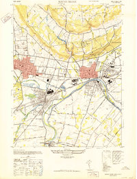 1947 Bound Brook1947 Print · USGSSomerset County is shown at its post-war industrial peak when the confluence of the Raritan and Millstone rivers was a bustling rail hub. Genealogists and historians can trace the foundations of Manville, identify the expansive Duke Estate, or locate family sites near Serca Pana Jezusa Cem.
 - 1947 Map of Chatham
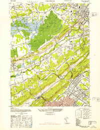 1947 Chatham1947 Print · USGSThe Morris and Union County borderlands appear here in the late 1940s as a mix of preserved marshland and rapid suburban growth. Researchers can trace the rail-side development of Stirling and Gillette or locate historic sites like the Bonnie Burn Sanatorium and Murray Hill Sta.2 unique versions available
 - 1947 Map of Bernardsville
 1947 Bernardsville1947 Print · USGSSomerset County saw significant development following the war as the rail network linked historic villages with new institutional centers. Genealogists can locate family landmarks like Osborn Mills, the Stone House, and the Greenlawn Memory Park Cem.
 - 1947 Map of Plainfield
 1947 Plainfield1947 Print · USGSNorth-central New Jersey is shown here at a post-war peak of rail and military activity. Researchers can trace the sprawling footprint of Camp Kilmer, find the early runways of Hadley Airport, or locate family sites near New Market and Stelton.2 unique versions available
 - 1949 Map of Newark
 1949 Newark1949 Print · USGSThe industrial corridor between Philadelphia and New York comes alive in this post-war survey. Genealogists and historians can trace the massive rail networks of the Reading Railroad and locate major installations like Fort Dix or Picatinny Arsenal.2 unique versions available
 - 1954 Map of Bernardsville, 1956 Print
 1954 Bernardsville1956 Print · USGSThe Somerset and Morris County borderlands come into focus in the mid-1950s, showing a landscape of established estates and growing townships. Genealogists and historians can trace local landmarks like Somerset Hills Cemetery, the U S Veterans Hospital, and Osborn Mills.6 unique versions available
 - 1955 Map of Plainfield, 1957 Print
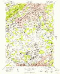 1955 Plainfield1957 Print · USGSMid-century New Jersey comes to life as industrial rail corridors and the sprawling US Military Reservation Camp Kilmer meet expanding suburbs. Trace early flight at Hadley Airport and local roots at Sacred Heart Sch or Pumptown.5 unique versions available
 - 1955 Map of Bound Brook, 1957 Print
 1955 Bound Brook1957 Print · USGSSomerset County undergoes rapid post-war growth in the mid-fifties as industry and infrastructure converge along the Raritan. Researchers can trace the path of the Delaware and Raritan Canal or locate local landmarks like Alma White College and the Van Nest Burying Ground.5 unique versions available
 - 1955 Map of Chatham, 1957 Print
 1955 Chatham1957 Print · USGSMid-century Morris, Somerset, and Union Counties are defined here by the intersection of the Great Swamp and the rising Watchung Mountains. Researchers can trace the development of suburban rail corridors and find local landmarks like St Josephs Shrine, Meyersville Cem, and the Watchung Reservation.7 unique versions available
 - 1956 Map of Newark
 1956 Newark1956 Print · USGSThe industrial heart of the Mid-Atlantic is captured here at the dawn of the highway era, tracing the dense corridors between Newark and Philadelphia. Genealogists and local historians can map the rail networks of the Reading RR or locate mid-century military life at Fort Dix Military Reservation.2 unique versions available
 - 1957 Map of Newark
 1957 Newark1957 Print · USGSThe industrial and military heart of the Mid-Atlantic is mapped during its post-war suburban boom. Genealogists and historians can trace the intricate rail corridors of the Reading Railroad and locate key landmarks from Princeton University to Fort Hancock.
 - 1960 Map of Newark
 1960 Newark1960 Print · USGSThe industrial heart of the Mid-Atlantic is shown at mid-century, stretching from the dense urban centers of Newark and Philadelphia to the Blue Mountain ridges. Researchers can trace historic rail lines, coastal defenses at Fort Hancock, and the riverfront growth of Trenton and Easton.3 unique versions available
 - 1964 Map of Newark
 1964 Newark1964 Print · USGSGreater New Jersey and eastern Pennsylvania appear at the peak of their industrial and rail-centered development in the mid-sixties. Genealogists and historians can trace the paths of the Pennsylvania RR, identify mid-century landmarks like CAMP KILMER, or follow the Schuylkill River through READING.2 unique versions available
 - 1984 Map of Newark, 1985 Print
 1984 Newark1985 Print · USGSNorthern New Jersey's massive industrial and transit network is on full display in the mid-eighties, showing the region just before modern redevelopment. Genealogists and historians can trace the dense urban grids of Newark, find historic landmarks like Ellis Island, and locate the sprawling Picatinny Arsenal in the western hills.
 - 1986 Map of Newark, 1987 Print
 1986 Newark1987 Print · USGSNorthern New Jersey during the mid-eighties shows an incredible transition from the industrial harbor to the wooded Highlands. Researchers can trace the massive footprints of Picatinny Arsenal and Newark International Airport or explore protected lands like the Great Swamp National Wildlife Refuge.
 - 1995 Map of Bound Brook, 1998 Print
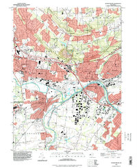 1995 Bound Brook1998 Print · USGSMid-century New Jersey comes into focus here, centered on the busy industrial and rail corridors where the Raritan River meets the historic Delaware and Raritan Canal. Researchers can trace old neighborhoods and cultural sites like Zarephath, the Ukrainian Village, and Alma White College.
Showing maps 1-25 of 27
Top cities near Warren Township
- Edison historical maps
- Woodbridge Township historical maps
- Franklin Township historical maps
- Old Bridge Township historical maps
- Union historical maps
- Parsippany-Troy Hills historical maps
See more
Top neighborhoods of Warren Township
- Warrenville historical maps
- Round Top historical maps
- Smalleytown historical maps
- Coontown historical maps
- Mount Horeb historical maps
- Mount Bethel historical maps
See more
Frequently asked questions
- What are the different types of historical maps available for Warren Township?
- What is the oldest map of Warren Township?
- Where can I purchase historical maps of Warren Township for my home or office?
- Where can I download high-res historical maps of Warren Township?
- Are there historical topographic maps available for Warren Township?
- Is there historical aerial imagery available for Warren Township?
- Where are historical maps of Warren Township sourced from?