Old Maps of Linden, New Jersey for Hiking & Exploration
Hike through history with 52 historic maps of Linden. Explore old trails, ghost towns, and forgotten backroads — perfect for outdoor adventurers and local explorers.
- Rediscover forgotten places: Map out old mining camps, roads, and footpaths that no longer exist on modern maps.
- Layer with modern tools: Combine with LiDAR or satellite views to plan hikes through historical terrain.
- Made for exploration: Popular among hikers, overlanders, and local history lovers.
Use these maps to find adventure and explore the hidden past of Linden.
Linden, NJ maps
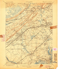
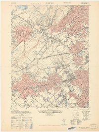
(52)- 1888 Map of Plainfield
 1888 Plainfield1888 Print · USGSNorth-central New Jersey is captured in the late nineteenth century as the rail network rapidly transformed small villages into vital industrial hubs. Genealogists and local researchers can trace the early footprints of Perth Amboy, Metuchen, and Dunellen alongside vanished local place names like Samptown.
 - 1893 Map of Plainfield
 1893 Plainfield1893 Print · USGSIn the late nineteenth century, the corridor between the Orange Mountains and the Raritan River was rapidly transforming into a dense rail-and-commuter network. Trace the early footprints of settlements like Feltville and Chatham, or locate vanished industries near Branch Mills and Ash Swamp.2 unique versions available
 - 1898 Map of Plainfield
 1898 Plainfield1898 Print · USGSNorth-central New Jersey at the close of the nineteenth century shows a landscape defined by the ridges of the Watchung Mountains and a rapidly expanding rail network. Genealogists and local historians can trace early property patterns and settlements like Feltville, Connecticut Farms, and the estates near Baltusrol.2 unique versions available
 - 1898 Map of Staten Island
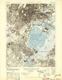
 1898 Staten Island1898 Print · USGSGreater Staten Island and the industrial shores of New Jersey are captured during the peak of the Victorian maritime era. Genealogists can trace early neighborhood boundaries and landmarks like Moravian Cemetery, the Morris Canal, and the vanished industry of Linoleumville.
 - 1900 Map of Passaic
 1900 Passaic1900 Print · USGSNorthern New Jersey and the New York Harbor are captured here at the close of the nineteenth century, showing a landscape defined by rail, river, and coastal defense. Researchers can trace the original path of the Morris Canal, locate Seton Hall College, and explore the batteries at Fort Wadsworth.
 - 1900 Map of Staten Island
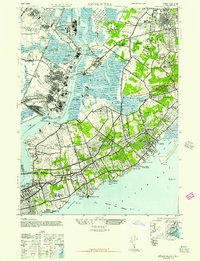
 1900 Staten Island1900 Print · USGSThe New York and New Jersey harbor comes alive in the late Victorian era, showing Staten Island when small villages and defensive forts still defined the coastline. Trace family roots and vanished landmarks through Fort Wadsworth, the Morris Canal, and historic settlements like Rossville or Tottenville.10 unique versions available
 - 1905 Map of Plainfield
 1905 Plainfield1905 Print · USGSNorth-central New Jersey at the turn of the century shows a landscape transitioning from rural townships to a bustling suburban and industrial network. Researchers can trace early property patterns and rail expansion through Great Swamp, Washington Rock, and Baltusrol.6 unique versions available
 - 1905 Map of Passaic
 1905 Passaic1905 Print · USGSNorthern New Jersey and Staten Island appear here at a pivotal moment of early 20th-century growth and industrialization. Researchers can trace the development of transit hubs like Convent Sta. or locate legacy landmarks including Hillside Cemetery and the Moravian Cemetery.4 unique versions available
 - 1921 Map of Plainfield
 1921 Plainfield1921 Print · USGSNew Jersey's industrial corridor meets the ridges of the First and Second Mountains in the early twenties. Genealogists can trace family names and small settlements like Raritan Landing, Smalleytown, and the grounds of the New Jersey Reformatory.
 - 1942 Map of Passaic
 1942 Passaic1942 Print · USGSNorthern New Jersey and New York harbor appear in detail at the start of the war, showing a landscape of burgeoning suburbs and vital industry. Trace family roots and local history across the Passaic River valley, from Paterson to the Watchung Mountains.
 - 1943 Map of Roselle, 1947 Print
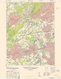 1943 Roselle1947 Print · USGSUnion County's industrial and commuter corridors are shown here at the height of the war years. Genealogists and rail historians can trace the complex junctions at Cranford Junction and locate family plots in Hazelwood Cem or Graceland Mem Park Cem.
 - 1944 Map of Newark, 1971 Print
 1944 Newark1971 Print · USGSThe industrial corridor from Philadelphia to New York was in a period of massive transition during the mid-forties. Genealogists and researchers can trace the rail lines of the Lehigh Valley RR, locate military installations like Picatinny Arsenal, and explore the early sprawl near Levittown.5 unique versions available
 - 1947 Map of Elizabeth
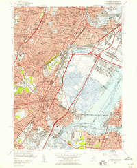
 1947 Elizabeth1947 Print · USGSIn the late 1940s, the industrial corridor between Newark and Staten Island reached its peak of rail and maritime activity. Researchers can trace the development of Newark Airport, identify local parish sites like St James, and locate vanished rail stops such as Bay Way Sta.2 unique versions available
 - 1947 Map of Perth Amboy
 1947 Perth Amboy1947 Print · USGSPerth Amboy and its surrounding townships thrived as a powerhouse of New Jersey industry just after the war. You can trace the complex rail yards and waterfront works like the Raritan Copper Works, locate the Edison Mem Beacon, or find family names at Beth Israel Cemetery.
 - 1947 Map of Roselle
 1947 Roselle1947 Print · USGSThe northern Union County suburbs were rapidly expanding in the late 1940s as rail networks and park systems matured. Genealogists and local historians can trace the development of Summit, Kenilworth, and Linden alongside landmarks like Cranford Junction and Fairview Cem.2 unique versions available
 - 1947 Map of Arthur Kill
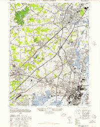
 1947 Arthur Kill1947 Print · USGSPost-war Staten Island and the New Jersey shoreline are revealed here as a landscape of heavy industry and large-scale social institutions. Researchers can trace the roots of local communities through the NY State School Mental Defectives, St Michaels Foundling Home, and the sprawling Standard Oil Co of New Jersey complex.
 - 1949 Map of Newark
 1949 Newark1949 Print · USGSThe industrial corridor between Philadelphia and New York comes alive in this post-war survey. Genealogists and historians can trace the massive rail networks of the Reading Railroad and locate major installations like Fort Dix or Picatinny Arsenal.2 unique versions available
 - 1955 Map of Arthur Kill, 1957 Print
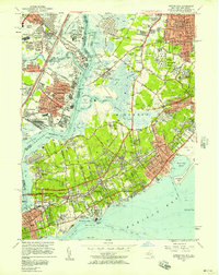 1955 Arthur Kill1957 Print · USGSStaten Island and the industrial New Jersey shore are captured here in the mid-fifties, just as suburban expansion began to accelerate. Researchers can trace historic institutions and neighborhoods from Sea View Hospital to the Staten Island Rapid Transit line and the Linden Airport.2 unique versions available
 - 1955 Map of Elizabeth, 1958 Print
 1955 Elizabeth1958 Print · USGSGreater Newark and Elizabeth are shown here at a peak of industrial and transit development during the mid-fifties. Genealogists and urban historians can trace local parish schools like St Marys Sch, the vast Evergreen Cemetery, and the early layout of Newark Airport.2 unique versions available
 - 1955 Map of Roselle, 1958 Print
 1955 Roselle1958 Print · USGSNorth-central New Jersey thrived during the mid-fifties as the suburban landscape densified around historic rail hubs and new parkways. Genealogists can trace family roots through numerous local landmarks like Fairview Cemetery, Holy Trinity High Sch, and the Lackawanna RR corridor.4 unique versions available
 - 1956 Map of Newark
 1956 Newark1956 Print · USGSThe industrial heart of the Mid-Atlantic is captured here at the dawn of the highway era, tracing the dense corridors between Newark and Philadelphia. Genealogists and local historians can map the rail networks of the Reading RR or locate mid-century military life at Fort Dix Military Reservation.2 unique versions available
 - 1956 Map of Perth Amboy, 1958 Print
 1956 Perth Amboy1958 Print · USGSMiddlesex County emerges as a suburban and industrial powerhouse in the mid-fifties as major highways reshape the landscape. Local researchers can trace family roots through numerous numbered schools and parish sites like St Cecilias Sch or the Edison Memorial Tower.6 unique versions available
 - 1957 Map of Newark
 1957 Newark1957 Print · USGSThe industrial and military heart of the Mid-Atlantic is mapped during its post-war suburban boom. Genealogists and historians can trace the intricate rail corridors of the Reading Railroad and locate key landmarks from Princeton University to Fort Hancock.
 - 1960 Map of Newark
 1960 Newark1960 Print · USGSThe industrial heart of the Mid-Atlantic is shown at mid-century, stretching from the dense urban centers of Newark and Philadelphia to the Blue Mountain ridges. Researchers can trace historic rail lines, coastal defenses at Fort Hancock, and the riverfront growth of Trenton and Easton.3 unique versions available
 - 1964 Map of Newark
 1964 Newark1964 Print · USGSGreater New Jersey and eastern Pennsylvania appear at the peak of their industrial and rail-centered development in the mid-sixties. Genealogists and historians can trace the paths of the Pennsylvania RR, identify mid-century landmarks like CAMP KILMER, or follow the Schuylkill River through READING.2 unique versions available
Showing maps 1-25 of 52
Top cities near Linden
- New York historical maps
- Newark historical maps
- Jersey City historical maps
- Elizabeth historical maps
- Edison historical maps
- Woodbridge Township historical maps
See more
Top neighborhoods of Linden
Frequently asked questions
- What are the different types of historical maps available for Linden?
- What is the oldest map of Linden?
- Where can I purchase historical maps of Linden for my home or office?
- Where can I download high-res historical maps of Linden?
- Are there historical topographic maps available for Linden?
- Is there historical aerial imagery available for Linden?
- Where are historical maps of Linden sourced from?